Nahunta, Georgia facts for kids
Quick facts for kids
Nahunta, Georgia
|
||
|---|---|---|

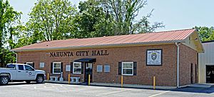
Nahunta City Hall
|
||
|
||

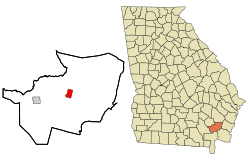
Location in Brantley County and the state of Georgia
|
||
| Country | United States | |
| State | Georgia | |
| County | Brantley | |
| Area | ||
| • Total | 2.83 sq mi (7.34 km2) | |
| • Land | 2.82 sq mi (7.30 km2) | |
| • Water | 0.01 sq mi (0.04 km2) | |
| Elevation | 66 ft (20 m) | |
| Population
(2020)
|
||
| • Total | 1,013 | |
| • Density | 359.35/sq mi (138.75/km2) | |
| Time zone | UTC-5 (Eastern (EST)) | |
| • Summer (DST) | UTC-4 (EDT) | |
| ZIP code |
31553
|
|
| Area code(s) | 912 | |
| FIPS code | 13-54124 | |
| GNIS feature ID | 0319189 | |
Nahunta is a small city in the state of Georgia, located in Brantley County. It's known as the county seat, which means it's where the main government offices for the county are. In 2020, about 1,013 people lived there. Nahunta is an important spot because two major roads, U.S. Route 82 and U.S. Route 301, meet right in its downtown area. It is also part of the larger Brunswick, Georgia metropolitan area.
Contents
History of Nahunta
Nahunta was first settled around 1870 and was originally called Victoria. People believe the town was renamed in 1899 after a timber executive named N.A. Hunter, but this hasn't been officially confirmed.
In 1923, Nahunta became even more important when it was chosen as the new county seat for Brantley County. Before that, the county seat was in a town called Hoboken. The Georgia General Assembly, which is like Georgia's state parliament, officially made Nahunta a city in 1925.
In the late 1970s and early 1980s, Nahunta became famous for its fun armadillo festival. This festival happened during the first weekend in May. It included exciting events like the "Brantley County Armadillo Olympics" and a big cookout where armadillo was a special dish.
Geography and Climate
Nahunta is located at 31°12′16″N 81°58′56″W / 31.20444°N 81.98222°W. The city covers a total area of about 7.3 square kilometers (about 2.8 square miles). Only a very small part of this area, about 0.04 square kilometers (0.01 square miles), is water.
Climate in Nahunta
Nahunta has a humid subtropical climate. This means it has hot, humid summers and mild winters. The weather here is often warm and sunny.
The hottest temperature ever recorded in Nahunta was 104 degrees Fahrenheit (40 degrees Celsius). This happened on July 7, 1990, and again on July 21, 2000. The coldest temperature ever recorded was 3 degrees Fahrenheit (minus 16 degrees Celsius) on January 21, 1985.
| Climate data for Nahunta, Georgia, 1991–2020 normals, extremes 1956–present | |||||||||||||
|---|---|---|---|---|---|---|---|---|---|---|---|---|---|
| Month | Jan | Feb | Mar | Apr | May | Jun | Jul | Aug | Sep | Oct | Nov | Dec | Year |
| Record high °F (°C) | 86 (30) |
88 (31) |
90 (32) |
96 (36) |
99 (37) |
101 (38) |
104 (40) |
102 (39) |
101 (38) |
96 (36) |
89 (32) |
89 (32) |
104 (40) |
| Mean maximum °F (°C) | 77.9 (25.5) |
80.1 (26.7) |
84.3 (29.1) |
88.8 (31.6) |
93.2 (34.0) |
96.3 (35.7) |
97.2 (36.2) |
96.6 (35.9) |
93.2 (34.0) |
88.0 (31.1) |
83.0 (28.3) |
79.4 (26.3) |
98.1 (36.7) |
| Mean daily maximum °F (°C) | 62.6 (17.0) |
65.9 (18.8) |
71.7 (22.1) |
78.1 (25.6) |
84.6 (29.2) |
88.6 (31.4) |
90.9 (32.7) |
90.0 (32.2) |
85.8 (29.9) |
78.8 (26.0) |
71.9 (22.2) |
64.0 (17.8) |
77.7 (25.4) |
| Daily mean °F (°C) | 49.6 (9.8) |
52.5 (11.4) |
57.7 (14.3) |
64.0 (17.8) |
71.4 (21.9) |
77.8 (25.4) |
80.5 (26.9) |
79.9 (26.6) |
75.8 (24.3) |
67.0 (19.4) |
57.8 (14.3) |
51.6 (10.9) |
65.5 (18.6) |
| Mean daily minimum °F (°C) | 36.7 (2.6) |
39.1 (3.9) |
43.8 (6.6) |
49.9 (9.9) |
58.2 (14.6) |
67.0 (19.4) |
70.1 (21.2) |
69.8 (21.0) |
65.7 (18.7) |
55.3 (12.9) |
44.6 (7.0) |
39.2 (4.0) |
53.3 (11.8) |
| Mean minimum °F (°C) | 20.6 (−6.3) |
23.3 (−4.8) |
28.0 (−2.2) |
35.0 (1.7) |
45.1 (7.3) |
58.4 (14.7) |
64.1 (17.8) |
63.7 (17.6) |
55.0 (12.8) |
38.3 (3.5) |
27.9 (−2.3) |
24.0 (−4.4) |
18.9 (−7.3) |
| Record low °F (°C) | 3 (−16) |
14 (−10) |
18 (−8) |
24 (−4) |
35 (2) |
40 (4) |
56 (13) |
55 (13) |
37 (3) |
28 (−2) |
18 (−8) |
8 (−13) |
3 (−16) |
| Average precipitation inches (mm) | 4.62 (117) |
4.08 (104) |
4.10 (104) |
3.30 (84) |
3.86 (98) |
7.48 (190) |
6.46 (164) |
7.64 (194) |
5.32 (135) |
3.97 (101) |
2.21 (56) |
3.71 (94) |
56.75 (1,441) |
| Average precipitation days (≥ 0.01 in) | 5.7 | 6.1 | 6.6 | 5.0 | 6.2 | 10.8 | 9.8 | 10.4 | 7.2 | 5.1 | 3.7 | 5.7 | 82.3 |
| Source 1: NOAA | |||||||||||||
| Source 2: National Weather Service | |||||||||||||
People of Nahunta: Demographics
| Historical population | |||
|---|---|---|---|
| Census | Pop. | %± | |
| 1930 | 352 | — | |
| 1940 | 561 | 59.4% | |
| 1950 | 739 | 31.7% | |
| 1960 | 952 | 28.8% | |
| 1970 | 974 | 2.3% | |
| 1980 | 951 | −2.4% | |
| 1990 | 1,049 | 10.3% | |
| 2000 | 930 | −11.3% | |
| 2010 | 1,053 | 13.2% | |
| 2020 | 1,013 | −3.8% | |
| U.S. Decennial Census | |||
The population of Nahunta has changed over the years. In 2020, the city had 1,013 residents. This population was made up of 332 households and 189 families.
Here's a look at the different groups of people living in Nahunta as of 2020:
| Race | Num. | Perc. |
|---|---|---|
| White (non-Hispanic) | 734 | 72.46% |
| Black or African American (non-Hispanic) | 208 | 20.53% |
| Native American | 3 | 0.3% |
| Asian | 3 | 0.3% |
| Other/mixed | 33 | 3.26% |
| Hispanic or Latino | 32 | 3.16% |
Education in Nahunta
Students in Brantley County, from kindergarten all the way to twelfth grade, attend schools within the Brantley County School District. This school district has a total of five elementary schools, one middle school, and one high school. There are about 196 full-time teachers who help teach over 3,332 students in the district.
The schools serving the area include:
- Atkinson Elementary School
- Hoboken Elementary School
- Nahunta Elementary School
- Nahunta Primary School
- Waynesville Primary School
- Brantley County Middle School
- Brantley County High School
See also
 In Spanish: Nahunta para niños
 | Emma Amos |
 | Edward Mitchell Bannister |
 | Larry D. Alexander |
 | Ernie Barnes |


