Nash, Texas facts for kids
Quick facts for kids
Nash, Texas
|
|
|---|---|

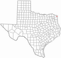
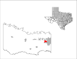
Location of Nash, Texas
|
|
 |
|
| Country | United States |
| State | Texas |
| County | Bowie |
| Government | |
| • Type | Council-Manager |
| Area | |
| • Total | 4.48 sq mi (11.61 km2) |
| • Land | 4.47 sq mi (11.59 km2) |
| • Water | 0.01 sq mi (0.02 km2) |
| Elevation | 361 ft (110 m) |
| Population
(2020)
|
|
| • Total | 3,814 |
| • Density | 855.2/sq mi (330.19/km2) |
| Time zone | UTC-6 (Central (CST)) |
| • Summer (DST) | UTC-5 (CDT) |
| ZIP code |
75569
|
| Area code(s) | 903, 430 |
| FIPS code | 48-50352 |
| GNIS feature ID | 2411213 |
Nash is a city in Bowie County, Texas, United States. It is a suburb of Texarkana and part of the larger Texarkana area. In 2010, about 2,960 people lived there. By 2020, the population grew to 3,814. This shows that Nash is a growing community.
Contents
History of Nash, Texas
Early Days of Nash
The land where Nash is now located was once owned by the State of Texas. In 1849, William Crutcher received the eastern part of the land. Josiah W. Fort received the western part in 1851. These were some of the first official land owners.
How Nash Grew
Nash was first known as "T. C. Junction." People also called it Texarkana Junction. This name came from its location on the Texas and Pacific Railway line. The first railroad tracks were built here in 1873. Nash officially began sometime between 1873 and the late 1880s.
In 1884, the town's name changed to "Park." It was named after Dr. John N. Parker, who was the first postmaster. He chose "Park" because the government thought "Trans-Continental Junction" was too long.
The town changed its name again in 1906 to "Nash." This time, it honored Martin Manny Nash. He was a superintendent for the Texas & Pacific Railroad Company.
Important Events in Nash's History
The first school in Nash opened in 1885. It was a single room taught by Dr. K. M. Kelley. By 1890, Nash had a store, a pharmacy, two mills, and a cotton gin. About 100 people lived there.
In 1894, a strong cyclone hit Nash. It destroyed one-third of the town. The first school, two churches, and many homes were ruined. Two people also lost their lives.
Nash has two old cemeteries. The Handley or Blocker Cemetery dates back to 1876. It is the burial place for two soldiers from the Confederate army. The Nash Cemetery is the second oldest. Several other Confederate soldiers are buried there.
During the 1950s, Nash became an official city. It started to grow more. By 1980, many people in Nash worked in Texarkana. Others worked at nearby military bases. These included Red River Army Depot and Lone Star Army Ammunition Plant. In 2000, the population was 2,169.
Geography of Nash
Nash is in eastern Bowie County, Texas. It is located where Kings Highway (Farm to Market Road 989) and U.S. Route 82 meet. The city of Texarkana borders Nash to the north and east. Wake Village is to the south. Interstate 30 forms the northern edge of Nash. You can get to Nash from Exit 218 on Interstate 30.
The United States Census Bureau says Nash covers about 8.8 square kilometers (3.4 square miles). Only a very small part, about 0.03 square kilometers (0.01 square miles), is water.
Climate in Nash
Nash has a warm climate. The warmest months are usually July or August. The highest temperature ever recorded was 108°F (42°C) in September 2000. January is typically the coolest month. The lowest temperature recorded was -6°F (-21°C) in 1989. Nash usually gets the most rain in November.
| Climate data for Nash, Texas | |||||||||||||
|---|---|---|---|---|---|---|---|---|---|---|---|---|---|
| Month | Jan | Feb | Mar | Apr | May | Jun | Jul | Aug | Sep | Oct | Nov | Dec | Year |
| Record high °C (°F) | 27 (81) |
32 (90) |
32 (89) |
35 (95) |
37 (98) |
38 (101) |
41 (105) |
41 (106) |
42 (108) |
35 (95) |
30 (86) |
27 (80) |
42 (108) |
| Mean daily maximum °C (°F) | 12 (53) |
14 (58) |
19 (67) |
24 (75) |
28 (82) |
32 (89) |
34 (93) |
34 (93) |
30 (86) |
25 (77) |
18 (64) |
13 (55) |
24 (74) |
| Daily mean °C (°F) | 6 (42) |
8 (46) |
12 (54) |
17 (62) |
22 (71) |
26 (79) |
28 (83) |
28 (82) |
24 (75) |
18 (64) |
12 (53) |
7 (44) |
17 (63) |
| Mean daily minimum °C (°F) | −1 (31) |
1 (34) |
6 (42) |
10 (50) |
16 (60) |
20 (68) |
22 (72) |
22 (71) |
18 (64) |
11 (52) |
5 (41) |
1 (33) |
11 (52) |
| Record low °C (°F) | −16 (3) |
−13 (8) |
−9 (15) |
−2 (28) |
4 (40) |
11 (52) |
14 (57) |
13 (55) |
3 (38) |
−3 (27) |
−9 (16) |
−21 (−6) |
−21 (−6) |
| Average precipitation mm (inches) | 99.3 (3.91) |
96.5 (3.80) |
113.3 (4.46) |
107.4 (4.23) |
126.2 (4.97) |
122.4 (4.82) |
91.9 (3.62) |
61.2 (2.41) |
95.8 (3.77) |
117.1 (4.61) |
144.5 (5.69) |
125.7 (4.95) |
1,301.3 (51.24) |
| Source: The Weather Channel | |||||||||||||
People of Nash: Demographics
| Historical population | |||
|---|---|---|---|
| Census | Pop. | %± | |
| 1960 | 1,124 | — | |
| 1970 | 1,961 | 74.5% | |
| 1980 | 2,022 | 3.1% | |
| 1990 | 2,162 | 6.9% | |
| 2000 | 2,169 | 0.3% | |
| 2010 | 2,960 | 36.5% | |
| 2020 | 3,814 | 28.9% | |
| U.S. Decennial Census | |||
| Race | Number | Percentage |
|---|---|---|
| White (NH) | 1,807 | 47.38% |
| Black or African American (NH) | 1,120 | 29.37% |
| Native American or Alaska Native (NH) | 17 | 0.45% |
| Asian (NH) | 37 | 0.97% |
| Pacific Islander (NH) | 4 | 0.1% |
| Some Other Race (NH) | 24 | 0.63% |
| Mixed/Multi-Racial (NH) | 186 | 4.88% |
| Hispanic or Latino | 619 | 16.23% |
| Total | 3,814 |
In 2000, about 2,169 people lived in Nash. There were 891 households and 603 families. The population density was about 768 people per square mile. Most people were White (77.87%) or African American (17.57%). A small number were Native American, Asian, or from other backgrounds. About 3.83% of the population was Hispanic or Latino.
By 2020, the population grew to 3,814 people. White and African American people were still the largest groups. The median household income in 2020 was about $37,750. This means half of the households earned more than this, and half earned less. The average household income was higher, at $67,654.
Education in Nash
Students in Nash attend schools that are part of the Texarkana Independent School District.
Notable Person
- Rick Minter, a football coach, is from Nash.
See also
 In Spanish: Nash (Texas) para niños
 | Lonnie Johnson |
 | Granville Woods |
 | Lewis Howard Latimer |
 | James West |

