
Bowie County, Texas facts for kids
Quick facts for kids
Bowie County
|
|
|---|---|

The Bowie County Courthouse
|
|

Location within the U.S. state of Texas
|
|
 Texas's location within the U.S. |
|
| Country | |
| State | |
| Founded | 1840 |
| Named for | James Bowie |
| Seat | Boston (legal); New Boston (courthouse) |
| Largest city | Texarkana |
| Area | |
| • Total | 923 sq mi (2,390 km2) |
| • Land | 885 sq mi (2,290 km2) |
| • Water | 38 sq mi (100 km2) 4.1% |
| Population
(2020)
|
|
| • Total | 92,893 |
| • Density | 100.64/sq mi (38.858/km2) |
| Time zone | UTC−6 (Central) |
| • Summer (DST) | UTC−5 (CDT) |
| Congressional districts | 1st, 4th |
Bowie County (pronounced BOO-ee) is a county in the state of Texas, USA. Its main office, called the county seat, is in Boston. However, the county's courthouse is located in New Boston. In 2020, about 92,893 people lived in Bowie County. It is part of the larger Texarkana area. The county is named after James Bowie, a famous Texan who fought and died at the Battle of the Alamo.
Contents
History of Bowie County
Early People and Explorers
Long ago, around 1500 BCE, the Caddoan Mississippian culture lived and farmed in Bowie County. When European explorers like Hernando de Soto arrived in 1541, there were some conflicts. Sadly, European diseases like smallpox and measles spread, and the Caddo people weren't immune, which caused many problems. Because of these challenges and issues with other groups like the Osage, the Caddo eventually had to leave their lands. Later, settlers had peaceful relationships with the Shawnee, Delaware, and Kickapoo tribes who lived there.
In 1719, French explorer Jean-Baptiste Bénard de la Harpe built a military fort called Le Poste des Cadodaquious. This fort was used until 1770. An important trip called the Red River Expedition passed through Bowie County in 1806. This trip was important for President Thomas Jefferson and for trade.
Forming the County
Bowie County was officially created in December 1840. It was named after James Bowie. The county's size was set to what it is today in 1846. DeKalb was the temporary county seat at first, but Boston became the permanent county seat in 1841.
Before the American Civil War, many settlers in Bowie County came from the Southern states. They brought enslaved people to work on cotton farms. By 1860, there were more enslaved people (2,651) than white settlers (2,401) in the county. The county voted strongly (208 to 15) to leave the Union. Even though no battles happened in Bowie County during the war, it was occupied during the time after the war, known as Reconstruction. Between 1860 and 1870, the number of people living in the county went down.
When the Texas and Pacific Railway built tracks through the county, a new town called Texarkana was started.
Bowie County, like many places, faced tough times during the Great Depression. Things started to get better when the Lone Star Army Ammunition Plant was built in 1942. This base was active until 2009. The Red River Army Depot, which opened in 1941, is still active today. These two places covered a huge area (almost 40,000 acres) and created thousands of jobs for people.
Geography
Bowie County covers a total area of 923 square miles. Most of this (885 square miles) is land, and 38 square miles (about 4.1%) is water.
Main Roads
Many important highways run through Bowie County, connecting it to other parts of Texas and nearby states. These include:
- I-30
- I-49
- I-369
- US 59
- US 67
- US 71
- US 82
- US 259
- TX 14
- FM 44
- TX 93
- TX 151
- FM 558
- FM 559
- FM 989
- FM 1397
- FM 2148
Neighboring Counties
Bowie County shares borders with several other counties:
- McCurtain County, Oklahoma (to the northwest)
- Little River County, Arkansas (to the north)
- Miller County, Arkansas (to the east)
- Cass County (to the south)
- Morris County (to the southwest)
- Red River County (to the west)
Population Information
| Historical population | |||
|---|---|---|---|
| Census | Pop. | %± | |
| 1850 | 2,912 | — | |
| 1860 | 5,052 | 73.5% | |
| 1870 | 4,684 | −7.3% | |
| 1880 | 10,965 | 134.1% | |
| 1890 | 20,267 | 84.8% | |
| 1900 | 26,676 | 31.6% | |
| 1910 | 34,827 | 30.6% | |
| 1920 | 39,472 | 13.3% | |
| 1930 | 48,563 | 23.0% | |
| 1940 | 50,208 | 3.4% | |
| 1950 | 61,966 | 23.4% | |
| 1960 | 59,971 | −3.2% | |
| 1970 | 67,813 | 13.1% | |
| 1980 | 75,301 | 11.0% | |
| 1990 | 81,665 | 8.5% | |
| 2000 | 89,306 | 9.4% | |
| 2010 | 92,565 | 3.6% | |
| 2020 | 92,893 | 0.4% | |
| U.S. Decennial Census 1850–2010 2010–2020 |
|||
In 2000, there were 89,306 people living in Bowie County. The population density was about 101 people per square mile. By 2020, the population grew to 92,893 people.
| Race / Ethnicity (NH = Non-Hispanic) | Pop 2000 | Pop 2010 | Pop 2020 | % 2000 | % 2010 | % 2020 |
|---|---|---|---|---|---|---|
| White alone (NH) | 62,712 | 61,343 | 55,855 | 70.22% | 66.27% | 60.13% |
| Black or African American alone (NH) | 20,787 | 22,230 | 23,084 | 23.28% | 24.02% | 24.85% |
| Native American or Alaska Native alone (NH) | 487 | 572 | 554 | 0.55% | 0.62% | 0.60% |
| Asian alone (NH) | 372 | 721 | 1,082 | 0.42% | 0.78% | 1.16% |
| Pacific Islander alone (NH) | 33 | 45 | 69 | 0.04% | 0.05% | 0.07% |
| Other race (NH) | 50 | 88 | 332 | 0.06% | 0.10% | 0.36% |
| Mixed race or Multiracial (NH) | 873 | 1,504 | 4,315 | 0.98% | 1.62% | 4.65% |
| Hispanic or Latino (any race) | 3,992 | 6,062 | 7,602 | 4.47% | 6.55% | 8.18% |
| Total | 89,306 | 92,565 | 92,893 | 100.00% | 100.00% | 100.00% |
Education
Bowie County has many school districts that serve its students. These include:
- De Kalb ISD
- Hooks ISD
- Hubbard ISD
- Leary ISD
- Liberty-Eylau ISD
- Malta ISD
- Maud ISD
- New Boston ISD
- Pleasant Grove ISD
- Red Lick ISD
- Redwater ISD
- Simms ISD
- Texarkana ISD
Also, all of Bowie County is served by Texarkana College, which is a local college.
Notable People
- Jean Baptiste Brevelle (1698-1754) was an early explorer, trader, and soldier. He was involved with Fort Saint Jean Baptiste des Natchitoches and Le Poste des Cadodaquious, which was the first European settlement in the county. A nearby lake, Brevelle Lake, is named after him.
Images for kids
-
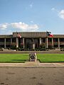
The Bowie County Courthouse
See also
 In Spanish: Condado de Bowie para niños
