National Register of Historic Places listings in Allegan County, Michigan
Allegan County, Michigan, is home to many special places that are listed on the National Register of Historic Places. This is a list of buildings, areas, and even a shipwreck that are important to history. They are protected so people can learn about them for many years to come.
These places are like treasures that tell us stories about the past. They show us how people lived, worked, and built things a long time ago. Exploring these sites helps us understand the history of Allegan County and the whole state of Michigan.
Contents
- Historic Buildings and Homes
- All Saints' Episcopal Church
- Edward D. Born House
- Engelbert B. Born House
- William H. Brown House
- Cherry DeLefebvre House
- Dorr E. Felt Mansion
- Henry Franks House
- Augustus Lilly House
- William C. Messenger House
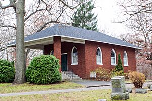
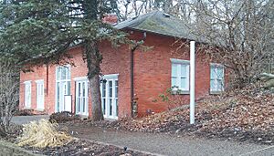
- Oakwood Cemetery Chapel
- Old Wing Mission
- Sarah Lowe Stedman House
- Warner P. Sutton House
- James Noble Sherwood House
- Historic Districts and Areas
- Bridges and Other Structures
- Archaeological Sites and Shipwrecks
- Images for kids
Historic Buildings and Homes
Many of the historic places in Allegan County are old houses and churches. These buildings often have unique designs and tell us about the people who lived in them.
All Saints' Episcopal Church
Located in Saugatuck, this beautiful church was built a long time ago. It's a special place for the community and has been around since 1984.
Edward D. Born House
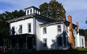
This house in Allegan was added to the list in 1987. It's an example of the kind of homes people built in the past.
Engelbert B. Born House
Also in Allegan, this house is another historic home from 1987. It shows us how families lived in the area many years ago.
William H. Brown House
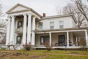
The William H. Brown House, located on Ely Street in Allegan, became a historic place in 1987. It's a great example of older homes in the city.
Cherry DeLefebvre House
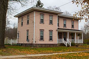
You can find the Cherry DeLefebvre House in Plainwell. This home was recognized as historic in 1991, showing the history of Plainwell's early residents.
Dorr E. Felt Mansion
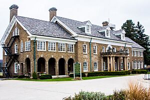
The Dorr E. Felt Mansion is a large, impressive house near Holland. It was built by Dorr E. Felt, who was an inventor. This mansion became a historic site in 1996.
Henry Franks House
The Henry Franks House in Allegan was added to the list in 1987. It's another important old home that helps tell the story of the city.
Augustus Lilly House
This house, located on Cora Street in Allegan, was recognized in 1987. It's one of many historic homes that make Allegan special.
William C. Messenger House
The William C. Messenger House in Allegan also joined the list in 1987. It's a reminder of the people who shaped the community.
Oakwood Cemetery Chapel
This chapel is found in Oakwood Cemetery in Allegan. It's a historic building from 1987, showing the architectural styles of the past.
Old Wing Mission
The Old Wing Mission near Holland is a very old and important site. It was added to the list in 1986 and has a deep history related to early settlements.
Sarah Lowe Stedman House
The Sarah Lowe Stedman House is another historic home in Allegan, recognized in 1987. It adds to the rich history of the city's architecture.
Warner P. Sutton House
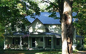
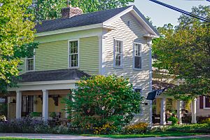
This house in Saugatuck became a historic place in 1992. It's a beautiful old home that shows the style of buildings from its time.
James Noble Sherwood House
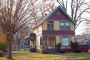
The James Noble Sherwood House is located in Plainwell. It was added to the historic register in 1984, preserving its unique character.
Historic Districts and Areas
Some historic places are not just single buildings, but whole areas! These "historic districts" include many buildings that together tell a story about a neighborhood or town.
Downtown Allegan Historic District
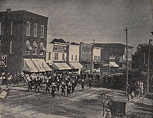
This district covers a large part of downtown Allegan. It includes many buildings that show what the town looked like in the past. It became historic in 1987.
Griswold Civic Center Historic District
Also in Allegan, this district is important for its public buildings and spaces. It was recognized in 1987.
Island Historic District
The Island Historic District in Plainwell is a special area. It includes parts of the town near the Kalamazoo River and was added to the list in 1991.
Marshall Street Historic District
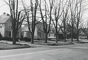
This district on Marshall Street in Allegan has many historic homes. It was recognized in 1987 for its collection of old buildings.
Michigan Paper Company Mill Historic District
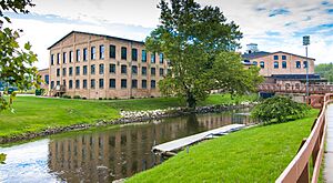
This district in Plainwell includes the old paper mill. It tells the story of industry and work in the area and became historic in 2011.
Pritchard's Outlook Historic District
This district in Allegan offers great views and has several historic buildings. It was added to the list in 1987.
Wayland Downtown Historic District
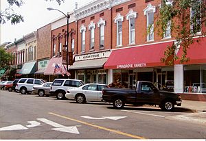
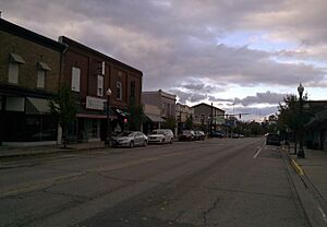
The downtown area of Wayland is a historic district. It includes Main Street and Superior Street, showing the town's growth over time. It was recognized in 2021.
West Bridge Street Historic District
This district in Plainwell includes a section of West Bridge Street. It was added to the list in 1991, preserving the look of this historic road.
Bridges and Other Structures
Not all historic places are buildings. Some are bridges, lighthouses, or even shipwrecks!
Douglas Union School
The Douglas Union School in Douglas is a historic school building. It was added to the list in 1995 and is a great example of old school architecture.
J. F. Eesley Milling Co. Flour Mill–Elevator
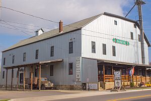
This old flour mill and elevator in Plainwell was important for making food in the past. It became a historic site in 1991.
Fifty-Seventh Street Bridge
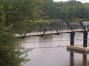
This bridge, also known as the New Richmond Swing Bridge, crosses the Kalamazoo River in Manlius Township. It's a special type of bridge that can swing open for boats. It was recognized in 1998.
Francis Metallic Surfboat
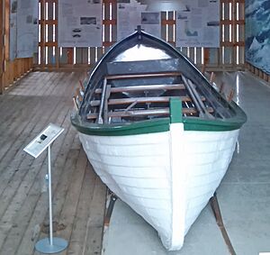
This unique surfboat is located in Douglas. It's a very old boat made of metal, which was unusual for its time. It became a historic item in 2015.
Lake Shore Chapel
The Lake Shore Chapel is a small, charming chapel near Douglas. It was added to the list in 1997 and is a peaceful historic spot.
Leiendecker's Inn-Coral Gables
This building in Saugatuck is known as Coral Gables. It was once an inn and is a well-known landmark. It became historic in 2009.
These structures are at the mouth of the Kalamazoo River in Saugatuck. They help boats navigate the harbor and were recognized in 2001.
Saugatuck Pump House
The Saugatuck Pump House in Saugatuck was once used to pump water. Now, it's the Saugatuck Douglas Historical Museum! It became a historic site in 2015.
Second Street Bridge
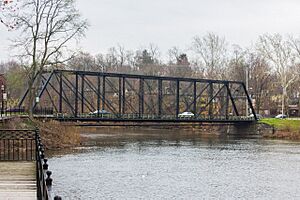
This bridge in Allegan crosses the Kalamazoo River. It's an important part of the city's transportation history and was added to the list in 1980.
Archaeological Sites and Shipwrecks
Some historic places are not visible buildings, but sites where archaeologists find clues about the past, or even shipwrecks hidden underwater!
Hacklander Site
The Hacklander Site is an archaeological site located on the south shore of the Kalamazoo River near Douglas. This means it's a place where scientists study old human activity. It was recognized in 1973.
HENNEPIN Self-unloading Steamship (Shipwreck)
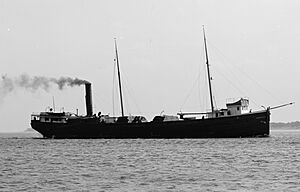
The HENNEPIN was a self-unloading steamship that sank in Lake Michigan. This shipwreck near South Haven is a historic site underwater. It was added to the list in 2008.
Images for kids


