National Register of Historic Places listings in Cambria County, Pennsylvania facts for kids
Welcome to Cambria County, Pennsylvania! This area is home to many special places listed on the National Register of Historic Places. Think of this register as a national list of buildings, sites, and districts that are important to American history, architecture, archaeology, engineering, or culture. When a place is on this list, it means it's worth protecting and remembering for future generations.
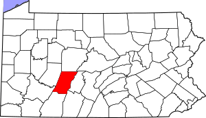
Cambria County has 31 amazing spots on this list. Two of these are even more special: they are called National Historic Landmarks. One other site is a National Memorial, which is a place that honors a significant event or person. Let's explore some of these cool historic places!
Cool Historic Places to Visit
Cambria County has some truly unique spots that tell important stories about the past. These places are great for learning and exploring.
Allegheny Portage Railroad National Historic Site
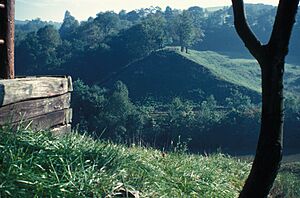
Imagine a time before modern trains could climb steep mountains! The Allegheny Portage Railroad National Historic Site was an incredible engineering marvel. It was the first railroad to cross the Allegheny Mountains. This special railroad used a series of inclined planes, like giant ramps, to pull canal boats and cargo over the mountains. It helped connect the eastern and western parts of Pennsylvania, making trade much easier. It's a fantastic place to visit and see how people solved big problems long ago.
Johnstown Flood National Memorial
The Johnstown Flood National Memorial remembers a terrible disaster that happened in 1889. A huge dam broke, causing a massive flood that destroyed the city of Johnstown and took many lives. This memorial helps us remember the people who were lost and learn about the importance of safety and preparedness. It's a powerful place that reminds us of nature's force and human resilience.
Buildings and Districts with a Story
Many other places in Cambria County are important because of their history or unique design. Some are single buildings, while others are entire neighborhoods called "historic districts."
Cambria Iron Company
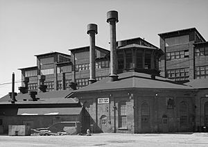
The Cambria Iron Company was a giant steel-making factory in Johnstown. It was one of the biggest and most important iron and steel producers in the United States. This company played a huge role in America's industrial growth, making materials for railroads, bridges, and buildings. It's a National Historic Landmark because of its importance to the country's industrial history.
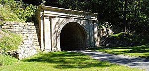
Staple Bend Tunnel
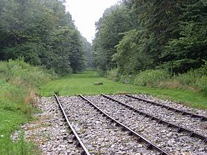
The Staple Bend Tunnel is another amazing engineering feat connected to the Allegheny Portage Railroad. It was the first railroad tunnel built in the United States! Imagine digging a tunnel through a mountain using only hand tools and gunpowder. This tunnel was a huge step forward in transportation and is also a National Historic Landmark.
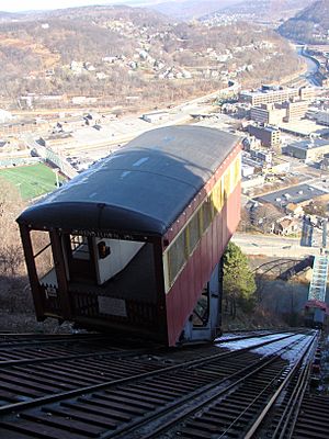
Johnstown Inclined Plane
The Johnstown Inclined Plane is a fun and historic way to travel! It's one of the steepest and longest funiculars (a type of cable railway) in the world. It was built after the 1889 flood to help people get between the city of Johnstown and the higher ground of Westmont. It's still used today and offers amazing views of the city.
Historic Districts: Neighborhoods of the Past
Many areas in Cambria County are listed as "historic districts." This means that a whole neighborhood or part of a town has many old buildings that together tell a story about how people lived and worked.
Cambria City Historic District
Cambria City Historic District in Johnstown is one such area. It was once home to many immigrant families who came to work in the steel mills. The district has many churches and homes that show the diverse cultures and strong community spirit of the time.
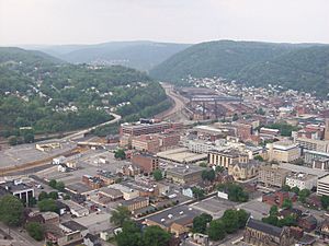
Downtown Johnstown Historic District
The Downtown Johnstown Historic District includes many of the city's important older buildings, like shops, offices, and public buildings. These buildings show the history of Johnstown as a busy commercial center.
Minersville Historic District
The Minersville Historic District is another area in Johnstown that tells the story of the coal mining industry. Many people who worked in the mines lived in this area, and the buildings reflect that history.
Colver Historic District
The Colver Historic District is a great example of a "company town." This means the town was built by a coal company to house its workers. You can see the houses, stores, and other buildings that were part of this community.
Other Notable Buildings
Many individual buildings in Cambria County are also on the National Register. These include important public buildings and unique homes.
Cambria County Courthouse
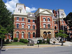
The Cambria County Courthouse in Ebensburg is where many important government decisions for the county are made. It's an impressive building that has been a center of community life for a long time.
Cambria County Jail
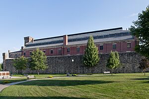
Right near the courthouse is the historic Cambria County Jail. This old jail building has a long history and is a reminder of the county's past justice system.
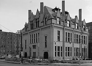
Cambria Public Library Building
The Cambria Public Library Building in Johnstown was one of the first "Carnegie Libraries." These libraries were built with money from famous businessman Andrew Carnegie, who believed everyone should have access to books and learning.
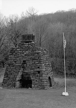
Eliza Furnace
The Eliza Furnace is an old iron furnace located near Vintondale. It's a great example of early industrial technology used to make iron. It stands as a monument to the region's rich history of iron production.
South Fork Fishing and Hunting Club Historic District
The South Fork Fishing and Hunting Club Historic District was once a fancy resort for wealthy people. It's famous because the club's dam was the one that broke and caused the devastating Johnstown Flood. The district now helps tell the story of that tragic event.
These are just some of the many fascinating places in Cambria County that are recognized for their historical importance. Each one offers a glimpse into the past and helps us understand the rich story of this part of Pennsylvania.


