
National Register of Historic Places listings in Clearwater County, Idaho facts for kids

Hey there! Did you know that some places are so special and important that they get listed on a national register? This page is all about the cool historic spots in Clearwater County, Idaho, that are part of the National Register of Historic Places. It's like a special list of buildings, sites, and objects that are important to American history, architecture, archaeology, engineering, or culture.
There are 8 amazing places in Clearwater County on this list. Two of them are even more special and are called National Historic Landmarks! These are places that have played a really big part in the history of the whole country. New places are added to the Register all the time, so this list might grow!
Contents
What is the National Register of Historic Places?
The National Register of Historic Places is the official list of the nation's historic places worth saving. It's managed by the National Park Service. When a place is listed, it means it's recognized for its importance to local, state, or national history. It helps people learn about and protect these special sites.
Why are places listed?
Places get listed for many reasons. Maybe a famous person lived there, or an important event happened there. Sometimes, a building is a great example of a certain style of architecture. Listing a place helps to make sure it's remembered and cared for.
What is a National Historic Landmark?
A National Historic Landmark is like a superstar on the National Register. These places are considered to be of exceptional national importance. They tell a story that is significant to all of America. Clearwater County is lucky to have two of these!
Cool Historic Places in Clearwater County
Here are some of the interesting places in Clearwater County that are on the National Register of Historic Places:
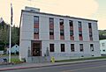
Brown's Creek CCC Camp Barracks
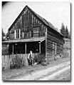
This building is located near Weippe, Idaho. It was part of a camp for the Civilian Conservation Corps, often called the CCC. The CCC was a program during the 1930s that helped young men find work during the Great Depression. They built parks, roads, and helped with conservation projects. This barracks building reminds us of their important work.
- Location: Weippe
- Listed: 1984
Lolo Trail

The Lolo Trail is a very old and important trail that runs through the Bitterroot Mountains. It was used for thousands of years by Native American tribes, especially the Nez Perce. Later, the famous explorers Lewis and Clark used this trail during their journey to the Pacific Ocean in 1805. It's a National Historic Landmark because of its huge role in both Native American history and the exploration of the American West.
- Location: Parallel to U.S. Route 12, from Lolo Pass to Weippe
- Listed: 1966
- Special Status: National Historic Landmark
Moore Gulch Chinese Mining Site
This site near Pierce, Idaho, is a reminder of the Chinese miners who came to Idaho during the gold rush. They played a big part in the history of mining in the area. This site helps us understand their lives and contributions.
- Location: Pierce (address restricted for protection)
- Listed: 1983
Nez Perce National Historical Park

This park is not just one place, but several important sites that tell the story of the Nez Perce people. The part in Clearwater County is located along U.S. Route 12 near Kamiah, Idaho. It helps preserve and share the history, culture, and traditions of the Nez Perce Nation.
- Location: Along U.S. Route 12 southeast of Kamiah
- Listed: 1966
Orofino Historic District
This district includes several streets in downtown Orofino, Idaho, like 2nd, Dewey, Main, Johnson, and 6th Streets. A historic district means that a group of buildings together are important because of their history or architecture. This area shows what Orofino was like in earlier times.
- Location: Orofino
- Listed: 1982
Pierce Courthouse

The Pierce Courthouse, located on Idaho State Highway 11 in Pierce, Idaho, is a very old and important building. It was built in 1862 and is the oldest courthouse in Idaho! It's a great example of early Idaho architecture and played a role in the legal history of the region.
- Location: Pierce
- Listed: 1972
U.S. Post Office – Orofino Main

This building, located at 320 Michigan Avenue in Orofino, Idaho, is the main post office for the town. Post offices are often important community buildings, and this one is recognized for its design and its role in the town's history.
- Location: Orofino
- Listed: 1989
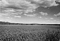
Weippe Prairie

Weippe Prairie, south of Weippe, Idaho, is another National Historic Landmark. This beautiful prairie was a very important place for the Nez Perce people. It's also where the Lewis and Clark Expedition first met the Nez Perce in 1805. This meeting was a key moment in American history.
- Location: South of Weippe and Idaho State Highway 11
- Listed: 1966
- Special Status: National Historic Landmark
Images for kids
-
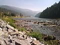
The Lochsa River, near the Lolo Trail.
-
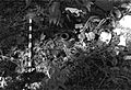
A view of the Moore Gulch Chinese Mining Site.
-
A sign for the Nez Perce National Historical Park.
-
The historic Pierce Courthouse.
-
The U.S. Post Office in Orofino.
-
A view of Weippe Prairie.

