Clearwater County, Idaho facts for kids
Quick facts for kids
Clearwater County
|
||
|---|---|---|

|
||
|
||

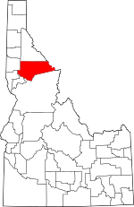
Location within the U.S. state of Idaho
|
||
 Idaho's location within the U.S. |
||
| Country | ||
| State | ||
| Founded | February 27, 1911 | |
| Named for | Clearwater River | |
| Seat | Orofino | |
| Largest city | Orofino | |
| Area | ||
| • Total | 2,488 sq mi (6,440 km2) | |
| • Land | 2,457 sq mi (6,360 km2) | |
| • Water | 31 sq mi (80 km2) 1.2% | |
| Population
(2020)
|
||
| • Total | 8,734 | |
| • Estimate
(2023)
|
9,214 |
|
| • Density | 3.5105/sq mi (1.3554/km2) | |
| Time zone | UTC−8 (Pacific) | |
| • Summer (DST) | UTC−7 (PDT) | |
| Congressional district | 1st | |
Clearwater County is a county located in the state of Idaho. It's a beautiful area known for its rivers and forests. In 2020, about 8,734 people lived here. The main town and county seat is Orofino.
The county was created in 1911. It was named after the Clearwater River. This river is very important to the area. You can find the North Fork of the Clearwater River here. There's also the amazing Dworshak Reservoir and Dworshak Dam. This dam is the third highest in the U.S. If you like to ski, there's a small ski area called Bald Mountain between Orofino and Pierce.
Contents
History of Clearwater County
Early Explorers and Native Americans
The Clearwater River and Lolo Pass are famous. They were explored by Lewis and Clark in the early 1800s. After a very tough journey through the Bitterroot Mountains, they met the Nez Perce tribe. This meeting happened on the Weippe Prairie in 1805.
The Nez Perce people helped the explorers. They rested and built canoes. Then, they paddled down the Clearwater, Snake, and Columbia rivers. A month later, they reached the Pacific Ocean.
Gold Rush and County Changes
The first gold in Idaho was found in 1860. It was discovered by Elias D. Pierce and Wilbur F. Bassett. They found it on Orofino Creek, near where Pierce is today. This started Idaho's gold rush!
Clearwater County wasn't always a separate county. For a long time, it was part of Shoshone County. Then, it joined Nez Perce County for a few years. Finally, in 1911, Clearwater County was officially created.
The town of Pierce was once the first county seat for a huge Shoshone County. This was back in 1861, even before Idaho became a territory. Later, as more people moved to the Silver Valley, the county seat moved. It was too far for people in the Clearwater River area to travel. This is why the southern part of the area became part of Nez Perce County. Eventually, Clearwater County was formed to better serve its growing population.
Geography of Clearwater County
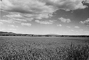
Clearwater County covers a total area of about 2,488 square miles. Most of this is land, with a small part being water. The county is part of the Palouse region. This area has wide, rolling hills, like a prairie.
Neighboring Counties
Clearwater County shares borders with several other counties:
- Shoshone County – to the north
- Mineral County, Montana – to the northeast
- Missoula County, Montana – to the east
- Idaho County – to the south
- Lewis County – to the southwest
- Nez Perce County – to the southwest
- Latah County – to the west
Main Roads
You can travel through Clearwater County using these major highways:
Protected Natural Areas
A large part of Clearwater County is protected land. These areas are great for nature and outdoor activities:
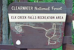
- Clearwater National Forest (part)
- Mallard-Larkins Pioneer Area
- Lolo Trail National Historic Landmark (part)
- Nez Perce National Historical Park (part)
- Canoe Camp
- Musselshell Meadows
- Pierce Courthouse
- Weippe Prairie
- St. Joe National Forest (part)
Ski Area
People of Clearwater County
| Historical population | |||
|---|---|---|---|
| Census | Pop. | %± | |
| 1920 | 4,993 | — | |
| 1930 | 6,599 | 32.2% | |
| 1940 | 8,243 | 24.9% | |
| 1950 | 8,217 | −0.3% | |
| 1960 | 8,548 | 4.0% | |
| 1970 | 10,871 | 27.2% | |
| 1980 | 10,390 | −4.4% | |
| 1990 | 8,505 | −18.1% | |
| 2000 | 8,930 | 5.0% | |
| 2010 | 8,761 | −1.9% | |
| 2020 | 8,734 | −0.3% | |
| 2023 (est.) | 9,214 | 5.2% | |
| U.S. Decennial Census 1790–1960 1900–1990 1990–2000 2010–2020 2020 |
|||
Population Information
In 2010, there were 8,761 people living in Clearwater County. There were about 3,660 households. The county had about 3.6 people per square mile. Most of the people were White (93.9%). There were also American Indian, Asian, Black, and Pacific Islander residents. About 3.1% of the people were of Hispanic or Latino background.
Many families lived in the county. About 22.8% of households had children under 18. Most households (54.7%) were married couples. The average age of people in the county was 49 years old.
By 2020, the population was 8,734 people. There were 3,474 households. The racial makeup was similar to 2010. About 93% of residents were White. There were also Native American, Black, Asian, and Pacific Islander residents. About 4.5% of the population was of Hispanic or Latino origin.
Communities in Clearwater County
Clearwater County has several towns and smaller communities.
Cities
Smaller Communities
- Ahsahka
- Cardiff
- Cavendish
- Dent
- Grangemont
- Greer
- Headquarters
- Hollywood
- Judge Town
- Konkolville
- Moose City
- Teakean
Ghost Town
- Fraser is a former town, now a ghost town.
City Populations (2010)
Here's how the cities in Clearwater County ranked by population in 2010:
| Rank | City/Town/etc. | Type | Population (2010 Census) |
|---|---|---|---|
| 1 | † Orofino | City | 3,142 |
| 2 | Pierce | City | 508 |
| 3 | Weippe | City | 441 |
| 4 | Elk River | City | 125 |
† county seat
See also
 In Spanish: Condado de Clearwater (Idaho) para niños
 | Stephanie Wilson |
 | Charles Bolden |
 | Ronald McNair |
 | Frederick D. Gregory |


