
Lolo Pass (Idaho–Montana) facts for kids
Quick facts for kids Lolo Pass |
|
|---|---|

Historical marker sign in Idaho in 2011
|
|
| Elevation | 5,233 ft (1,595 m) |
| Traversed by | |
| Location | Idaho Co., Idaho, & Missoula Co., Montana, United States |
| Range | Bitterroot Range, Rocky Mountains |
| Coordinates | 46°38′06″N 114°34′48″W / 46.635°N 114.580°W |

|
Lolo Trail
|
|

Location in Idaho
|
|
| Location | Bitterroot Mountains, Idaho-Montana |
|---|---|
| Built | 1805 |
| NRHP reference No. | 66000309 |
| Added to NRHP | October 15, 1966 |
Lolo Pass is a mountain pass located in the western United States. It sits high up in the Bitterroot Range, which is part of the larger Rocky Mountains. This pass is right on the border between the states of Montana and Idaho. It reaches an elevation of 5,233 feet (about 1,595 meters) above sea level. The pass is about 40 miles (64 km) west-southwest of Missoula, Montana.
Contents
The Historic Lolo Trail
Lolo Pass is the highest point of the historic Lolo Trail. This trail connects the Bitterroot Valley in Montana to the Weippe Prairie in Idaho. The Nez Perce people called this trail naptnišaqs, which means "Nez Perce Trail." They used it for many years before European explorers arrived.
Lewis and Clark Expedition
In September 1805, the famous Lewis and Clark Expedition used the Lolo Trail. They were guided by a Shoshone man named Old Toby. The explorers faced deep snow as they traveled westward. After spending the winter at Fort Clatsop in what is now Oregon, they returned across the Lolo Trail the following June.
The Nez Perce War
The Lolo Trail is also important because of the Nez Perce War in 1877. During this time, some of the Nez Perce people, led by Chief Joseph, tried to escape the United States Army. They used the Lolo Trail to cross the mountains. Soon after crossing the pass, the Nez Perce and the U.S. Army fought at the Battle of the Big Hole in Montana.
Because of its importance to the Lewis and Clark Expedition and the Nez Perce War, the Lolo Trail is now a National Historic Landmark.
What's in a Name?
The name "Lolo" for the pass is thought to come from a French nickname. Some say it might be a Salish version of the French name Laurence or Laurent. However, Lewis and Clark did not use the name Lolo. The first known mention of the name was in 1810. An explorer named David Thompson wrote about three fur trappers named Michael, Lolo, and Gregoire. They were probably of French descent.
Modern Day Travel
Today, U.S. Highway 12 crosses Lolo Pass. This highway was finished in 1962. A special ceremony was held at the pass to celebrate its completion. Thousands of people attended, including the governors of Idaho and Montana. They used a large two-man saw to cut through a cedar log, marking the opening of the highway.
Nearby Places
- Lolo Hot Springs is about 7 miles (11 km) east of the pass in Montana. It's a popular spot for relaxing in natural hot springs.
- To the west, in Idaho, the first services are in Powell, about 13 miles (21 km) from the pass.
- Further west, about 65 miles (105 km) from the pass, is Lowell. This town is where the Lochsa River and Selway River meet to form the Middle Fork of the Clearwater River.
- The main city in Idaho served by U.S. 12 is Lewiston. It is about 170 miles (274 km) west of the pass, near the border with Washington. In Lewiston, the Clearwater River flows into the Snake River.
Images for kids
-

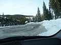
Lolo Pass, Montana side, approaching summit, westbound
-
Entering Montana from Lolo Pass
-
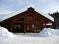
Lolo Pass visitor center
-
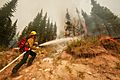
Forest fire near Lolo Pass, 2003
-
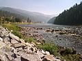
Idaho's Lochsa River, west of Lolo Pass
-
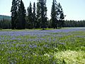
Camas blooming at Packer Meadows, near Lolo Pass, Idaho


