
National Register of Historic Places listings in Lorain County, Ohio facts for kids

This article is about the cool and historic places in Lorain County, Ohio, United States, that are listed on the National Register of Historic Places. These are special spots that the government wants to protect because they tell important stories about our past.
You can find 124 amazing places and areas in Lorain County on this list. Three of them are even more special, called National Historic Landmarks! A few other places used to be on the list but have been removed.
Contents
What is the National Register of Historic Places?
The National Register of Historic Places is like a special list of buildings, sites, and objects that are important in American history, architecture, archaeology, engineering, or culture. When a place is added to this list, it means it's recognized for its value and gets some protection. It helps people learn about and save these important parts of our history.
Cool Historic Places in Lorain County
Lorain County has many different types of historic places. Let's look at some examples of what you might find on the list:
Homes with History
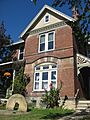
Many old houses are on the list because they show us how people lived long ago or because famous people once lived there.
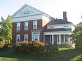
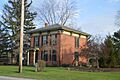
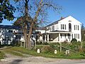
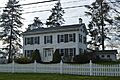
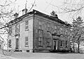
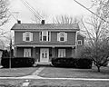
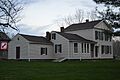
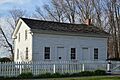
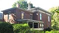
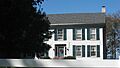
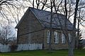
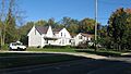
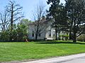
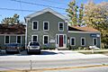
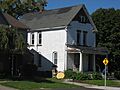
- The Darlon Allen House and O.T. Baker House in Huntington Township are examples of old homes that tell us about the area's early settlers.
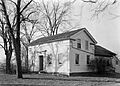
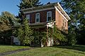
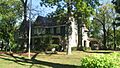
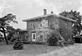
- The Carlos Avery House and Henry Bradford Farm also show us what farm life was like in the past.
- The Wilson Bruce Evans House in Oberlin is a National Historic Landmark. It belonged to a very important person who helped people escape slavery before the Civil War.
- The John Mercer Langston House, also in Oberlin, is another National Historic Landmark. John Mercer Langston was a very important leader, lawyer, and educator who fought for civil rights.
Important Buildings and Structures
Beyond homes, many other buildings are on the list because of their design or what happened inside them.
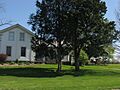
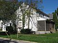
- The Amherst Town Hall and Columbia Town Hall are examples of places where local government and community events happened for many years.
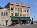
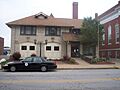
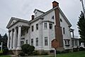
- The Antlers Hotel in Lorain was once a grand place where travelers stayed.
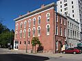
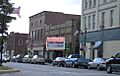
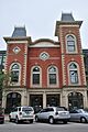
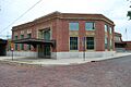
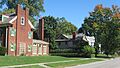
- The Broadway Building and Duane Block in Lorain are parts of the city's old downtown, showing how businesses used to look.
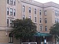
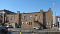
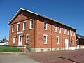
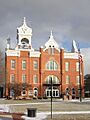
- The Lorain County Courthouse in Elyria is where important legal decisions have been made for a long time.
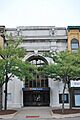
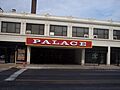
- The Palace Theatre Building in Lorain is a beautiful old movie theater where people enjoyed shows and films.
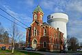
- The Old Elyria Water Tower is a unique structure that helped provide water to the city.
Churches and Schools
Churches and schools often play a big role in a community's history.
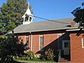
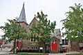
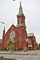
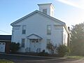
- The Christ Episcopal Church in Oberlin and the Columbia Baptist Church are historic places of worship.
- The Immaculate Conception Church in Grafton is another beautiful old church.
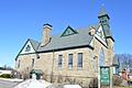
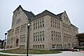
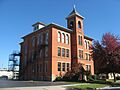
- The Central School in Amherst and the Elyria High School - Washington Building were places where many generations of students learned.
- The Grafton School also served as an important learning center.
Historic Districts
Sometimes, a whole area or neighborhood is historic, not just one building. These are called historic districts.
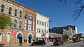
- The Broadway Historic District in Lorain includes many old buildings that together show the history of the city's main street.
- The Brownhelm Historic District and Downtown Oberlin Historic District are other areas where many historic buildings are grouped together, giving a sense of what the towns were like long ago.
- The Elyria Downtown-West Avenue Historic District and Washington Avenue Historic District in Elyria also preserve the look and feel of older parts of the city.
- The Wellington Center Historic District and Wellington Historic District highlight the history of that town.
Unique and Special Sites
Some places are unique, like old forts or lighthouses.
- The 103rd Ohio Volunteer Infantry Association Barracks in Sheffield Lake is a place connected to soldiers from the Civil War.
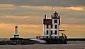
- The Lorain Lighthouse is a famous landmark in Lorain Harbor, guiding ships for many years.
- The Burrell Fort and Burrell Orchard Site in Sheffield are important archaeological sites that tell us about even older times in the area.
- The Eiden Prehistoric District is another very old site that helps us understand the people who lived here thousands of years ago.
Former Historic Listings
Sometimes, a building that was once on the National Register is removed. This can happen if the building is changed too much or if it is no longer standing.
- The George Bryant House, Old District Nine Schoolhouse, and Old St. John's Church in Elyria were once on the list but have since been removed.
Images for kids
-
The 103rd Ohio Volunteer Infantry Association Barracks.
-
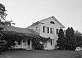
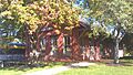
The Darlon Allen House.
-
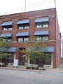
The American Felsol Company Building.
-
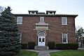
The Amherst Town Hall.
-
The Antlers Hotel in Lorain.
-
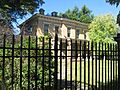
The Carlos Avery House.
-

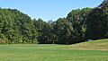
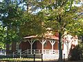
Avon Isle.
-

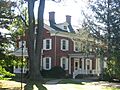
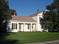
The O.T. Baker House.
-
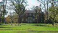
The Henry Bradford Farm.
-
The Justin Breckenridge House.
-

The Broadway Building in Lorain.
-
A building in the Brownhelm Historic District.
-
The Burrell Fort site.
-

The Burrell Orchard Site.
-
The Jabez and Robbins Burrell House.
-
The Burrell-King House.
-
The Samuel C. Cahoon House.
-
The Wilbur Cahoon House.
-

The Patrick Carlin House.
-
The Central School in Amherst.
-

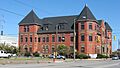
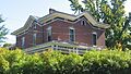
The Century Block in Elyria.
-
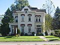
The John A. Chapman House.
-

Christ Episcopal Church in Oberlin.
-
The Ansel Clark House.
-
The Whitney Clark House.
-
The Columbia Baptist Church.
-

The Columbia Town Hall.
-
A Commercial Building in Elyria.
-

The Congregational Church of Christ.
-

The Dean Road Bridge.
-
The Apollo Theatre in the Downtown Oberlin Historic District.
-
The Duane Block in Lorain.
-

The Eagles Building in Lorain.
-

The Eiden Prehistoric District.
-

The Ely Block in Elyria.
-
A street in the Elyria Downtown-West Avenue Historic District.
-
The Elyria Elks Club.
-
The Elyria High School - Washington Building.
-
The Wilson Bruce Evans House.
-

The First Church of Christ, Scientist in Elyria.
-
The First National Bank Building in Elyria.
-

The First United Methodist Church in Elyria.
-
The Halsey Garfield House.
-
The Milton Garfield House.
-
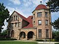
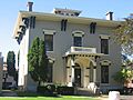
The Arthur L. Garford House.
-

The Gould Block in Lorain.
-

The Grafton School.
-
The Gregg House.
-
The Gunn House.
-

The Huntington Grange.
-

The Huntington Public School.
-

The Huntington Township Hall.
-
The William E. Hurst House.
-

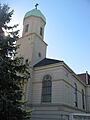
The Immaculate Conception Church in Grafton.
-
The Frank Jewett House.
-
The Johnson Steel Street Railway Company General Offices Building.
-
The E.J. Johnson House.
-
The John Mercer Langston House.
-
The Thomas W. Laundon House.
-
The John Lersch House.
-

The Lorain Carnegie Public Library.
-
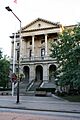
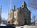
The Lorain County Courthouse.
-
The Lorain Fire Station No. 1.
-
The Lorain Lighthouse.
-

The Lorain YMCA Building.
-
The Addison Lord House.
-
The Mill Hollow House.
-
The Peter Miller House.
-
Monteith Hall in Elyria.
-

The Leonard M. Moore House.
-

The Morris-Franks Site.
-
The Mosher House.
-
The New York Central Freight House.
-
The Walter Nichols House.
-
The Nimocks House.
-
The William Nooney House.
-
The North Ridgeville Town Hall.
-
Oberlin College.
-
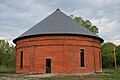
The Oberlin Gas Lighting Company Gasholder House.
-
The Oberlin Lake Shore and Michigan Southern Station.
-
The Old Amherst Freight Depot.
-

The Old Baptist Parsonage.
-
The Old City Hall in Elyria.
-

The Old Elyria Water Tower.
-

The Old Huntington Inn.
-

The Old Methodist Parsonage.
-
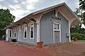
The Old Railroad Station in Elyria.
-
Old St. Patrick's Church.
-
The Palace Theatre Building in Lorain.
-

The Reamer Barn.
-

The Redington Block.
-

The Frederick Reefy House.
-
The William H. Root House.
-
The Sage House.
-
St. Andrew's Episcopal Church in Elyria.
-
St. Ladislaus Roman Catholic Church.
-
St. Mary's Catholic School.
-
St. Mary's Roman Catholic Church.
-

The William Seher House.
-

The Sheffield Village Hall.
-
The John J. Shipherd House.
-
The Charles William and Anna Smith House.
-

The Soldiers and Sailors Monument in Elyria.
-
The South Ridge Schoolhouse.
-

The Sprague House.
-
The Horace C. Starr House and Carriage Barns.
-

The U.S. Post Office in Elyria.
-

The U.S. Post Office in Lorain.
-

The Union Church in Kipton.
-
The United Church of Huntington.
-

The Benjamin Wadsworth House.
-
A street in the Washington Avenue Historic District.
-

The Washington Terrace Apartments.
-

The A.R. Webber House.
-
The Wellington Center Historic District.
-
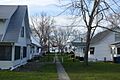
Houses in the Wellington Historic District.
-
The West House.
-

Westervelt Hall.
-
The J.B. Wilber House.
-
The Henry Harrison Williams House.
-
The Wilson-Falkner-Baldauf House.
-

The Wooster Block.
-
The former George Bryant House.
-
The former Old District Nine Schoolhouse.
-
The former Old St. John's Church.


.jpg)


_P2160036.JPG)


See also
- List of National Historic Landmarks in Ohio
- Listings in nearby counties: Ashland, Cuyahoga, Erie, Huron, Medina
- National Register of Historic Places listings in Ohio
