National Register of Historic Places listings in Methuen, Massachusetts facts for kids
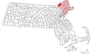
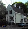
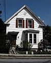
Welcome to Methuen, Massachusetts! This page lists all the special places and areas in Methuen that are part of the National Register of Historic Places. Think of this as a list of important buildings, homes, and districts that are officially recognized for their history and unique architecture. You can even see where these places are on an online map if you know their exact location!
Methuen is in Essex County, Massachusetts, which has many historic spots. Out of 471 historic places in Essex County, 45 of them are right here in Methuen!
Historic Places in Methuen
| Name on the Register | Image | Date listed | Location | City or town | Description | |
|---|---|---|---|---|---|---|
| 1 | Arlington Mills Historic District |
(#85000023) |
Broadway between Manchester, Stafford and Chase Sts. 42°42′56″N 71°10′52″W / 42.715556°N 71.181111°W |
This historic area stretches into the nearby city of Lawrence. It was once a big center for making textiles. | ||
| 2 | Stephen Barker House |
(#84002307) |
165 Haverhill St. 42°42′24″N 71°11′57″W / 42.706667°N 71.199167°W |
This house looks like the grand mansions you might see in the Southern United States. It's a well-kept "country home" from the mid-1800s. | ||
| 3 | Bellevue Cemetery |
(#03000993) |
170 May St. 42°42′38″N 71°11′10″W / 42.7106°N 71.1861°W |
Most of this cemetery is actually located in Lawrence. | ||
| 4 | J.E. Buswell House |
(#84002317) |
535-537 Prospect St. 42°43′52″N 71°09′43″W / 42.731111°N 71.161944°W |
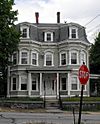
This house is a great example of the Second Empire style of architecture. It was a typical home for a businessman back in the day. | ||
| 5 | Daddy Frye's Hill Cemetery |
(#84002320) |
East and Arlington Sts. 42°43′31″N 71°09′58″W / 42.725278°N 71.166111°W |
This cemetery is also known as Meeting House Hill. It's where the first two meeting houses (churches) in Methuen stood from 1728 to 1832. | ||
| 6 | Terence Dolan House |
(#84002323) |
478 Prospect St. 42°43′30″N 71°09′29″W / 42.725°N 71.158056°W |
A large home built in the Georgian Revival style. It shows what many houses in this area looked like in the early 1900s. | ||
| 7 | Double-arch Sandstone Bridge |
(#84002326) |
Hampshire Rd. 42°44′33″N 71°12′29″W / 42.7425°N 71.208056°W |
This bridge is a "dry stone arch bridge," meaning it was built without any mortar! Some parts of it are from as far back as 1735. It crosses the Spicket River. | ||
| 8 | Emerson House |
(#84002351) |
58 Ayers Village Rd. 42°42′27″N 71°10′19″W / 42.7075°N 71.171944°W |
This colonial farmhouse was built in 1750. It's very well-preserved and still shows what the rural landscape looked like back then. | ||
| 9 | Capt. Oliver Emerson Homestead |
(#84002347) |
133 North St. 42°46′38″N 71°10′50″W / 42.777222°N 71.180556°W |
|||
| 10 | G.B. Emmons House |
(#84002353) |
283 Broadway 42°43′44″N 71°11′18″W / 42.728889°N 71.188333°W |
|||
| 11 | First Baptist Church |
(#84002365) |
253 Lawrence St. 42°43′41″N 71°11′06″W / 42.728056°N 71.185°W |
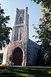
Built in 1869, this church is a huge example of the Carpenter Gothic style of architecture. | ||
| 12 | First Church Congregational |
(#78000461) |
Pleasant and Stevens Sts. 42°43′46″N 71°11′08″W / 42.729444°N 71.185556°W |
|||
| 13 | Urias Hardy House |
(#84002367) |
50 Brown St. 42°43′23″N 71°10′48″W / 42.723056°N 71.18°W |
|||
| 14 | House at 15-19 Park Street |
(#84002388) |
15-19 Park St. 42°43′38″N 71°11′05″W / 42.727222°N 71.184722°W |
|||
| 15 | House at 10 Park Street |
(#84002385) |
10 Park St. 42°43′34″N 71°11′09″W / 42.726111°N 71.185833°W |
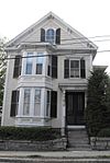
This house, called the E.M. Clark House, was built around 1880. It's a great example of an Italianate-style home. | ||
| 16 | House at 113-115 Center Street |
(#84002381) |
113-115 Center St. 42°43′12″N 71°10′49″W / 42.72°N 71.180278°W |
This is one of the few remaining examples of an early duplex house (a house with two separate living units) in the Arlington Mills Historic District. | ||
| 17 | House at 13 Annis Street |
(#84002387) |
13 Annis St. 42°43′11″N 71°10′44″W / 42.719722°N 71.178889°W |
This house is a good example of the simple, affordable homes built for workers at the woolen mills in the Arlington Mills Historic District. | ||
| 18 | House at 136 Hampstead Street |
(#84002377) |
136 Hampstead St. 42°46′35″N 71°10′29″W / 42.776389°N 71.174722°W |
|||
| 19 | House at 23 East Street |
(#84002382) |
23 East St. 42°43′34″N 71°10′39″W / 42.726111°N 71.1775°W |
|||
| 20 | House at 262-264 Pelham Street |
(#84002390) |
262-264 Pelham St. 42°43′38″N 71°13′31″W / 42.727222°N 71.225278°W |
|||
| 21 | House at 306 Broadway |
(#84002379) |
306 Broadway 42°43′44″N 71°11′22″W / 42.728889°N 71.189444°W |
|||
| 22 | House at 4 Birch Avenue |
(#84002374) |
4 Birch Ave. 42°43′40″N 71°08′58″W / 42.727778°N 71.149444°W |
|||
| 23 | House at 491 Prospect Street |
(#84002396) |
491 Prospect St. 42°43′39″N 71°09′33″W / 42.7275°N 71.159167°W |
|||
| 24 | House at 50 Pelham Street |
(#84002392) |
50 Pelham St. 42°43′32″N 71°11′34″W / 42.725556°N 71.192778°W |
|||
| 25 | House at 526 Prospect Street |
(#84002394) |
526 Prospect St. 42°43′45″N 71°09′40″W / 42.729188°N 71.161000°W |
|||
| 26 | House at 9 Park Street |
(#84002384) |
9 Park St. 42°43′35″N 71°11′06″W / 42.726389°N 71.185°W |
|||
| 27 | Johnson House |
(#84002398) |
8 Ditson Pl. 42°43′38″N 71°11′13″W / 42.727222°N 71.186944°W |
|||
| 28 | Lawrence Street Cemetery |
(#84002399) |
Lawrence St. 42°43′39″N 71°10′57″W / 42.7275°N 71.1825°W |
|||
| 29 | Methuen Memorial Music Hall |
(#78000462) |
192 Broadway 42°43′30″N 71°11′08″W / 42.725°N 71.185556°W |
|||
| 30 | Methuen Water Works |
(#84002403) |
Cross St. 42°44′23″N 71°12′53″W / 42.739722°N 71.214722°W |
|||
| 31 | Moses Morse House |
(#84002404) |
311 Pelham St. 42°43′40″N 71°14′01″W / 42.727778°N 71.233611°W |
|||
| 32 | Nevins Memorial Library |
(#84002407) |
305 Broadway 42°43′52″N 71°11′25″W / 42.731111°N 71.190278°W |
|||
| 33 | Henry C. Nevins Home for Aged and Incurables |
(#84002406) |
110 Broadway 42°43′16″N 71°10′58″W / 42.721111°N 71.182778°W |
This building is still used today as The Nevins Nursing & Rehabilitation Centre. | ||
| 34 | Old Town Farm |
(#84002413) |
430 Pelham St. 42°44′17″N 71°14′33″W / 42.738056°N 71.2425°W |
|||
| 35 | Park Lodge |
(#84002414) |
257 Lawrence St. 42°43′40″N 71°11′08″W / 42.727778°N 71.185556°W |
|||
| 36 | Joseph Perkins House |
(#84002416) |
297 Howe St. 42°45′40″N 71°10′08″W / 42.761111°N 71.168889°W |
|||
| 37 | Pleasant-High Historic District |
(#84002417) |
Roughly bounded by Broadway, High, Vine, Charles, and Pleasant Sts. 42°43′47″N 71°11′09″W / 42.729722°N 71.185833°W |
|||
| 38 | Searles High School |
(#84002431) |
41 Pleasant St. 42°43′48″N 71°11′02″W / 42.73°N 71.183889°W |
|||
| 39 | James E. Simpson House |
(#84002432) |
606 Prospect St. 42°44′17″N 71°09′59″W / 42.738056°N 71.166389°W |
This house is a type of American Craftsman Style bungalow. | ||
| 40 | Spicket Falls Historic District |
(#84002435) |
Roughly bounded by the Spicket River, Railroad, Pelham, Hampshire, Broadway and Osgood Sts. 42°43′36″N 71°11′21″W / 42.726667°N 71.189167°W |
|||
| 41 | Asie Swan House |
(#84002437) |
669 Prospect St. 42°44′26″N 71°10′01″W / 42.740556°N 71.166944°W |
|||
| 42 | Tenney Castle Gatehouse |
(#84002438) |
37 Pleasant St. 42°43′46″N 71°11′04″W / 42.729444°N 71.184444°W |
|||
| 43 | Turnpike House |
(#84002439) |
314 Broadway 42°43′47″N 71°11′24″W / 42.729722°N 71.19°W |
The original building for this entry no longer exists. It was left empty and later torn down. | ||
| 44 | George A. Waldo House |
(#84002441) |
233 Lawrence St. 42°43′39″N 71°11′00″W / 42.7275°N 71.183333°W |
|||
| 45 | Walnut Grove Cemetery |
(#84002444) |
Grove and Railroads Sts. 42°43′23″N 71°11′27″W / 42.723056°N 71.190833°W |

All content from Kiddle encyclopedia articles (including the article images and facts) can be freely used under Attribution-ShareAlike license, unless stated otherwise. Cite this article:
National Register of Historic Places listings in Methuen, Massachusetts Facts for Kids. Kiddle Encyclopedia.

