National Register of Historic Places listings in Miami County, Kansas facts for kids
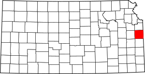
Have you ever wondered about the old buildings and special places in your community? Many of these places have amazing stories to tell about the past! In Miami County, Kansas, there are 16 such places that are so important, they've been added to a special list called the National Register of Historic Places. This list helps protect these sites and reminds us of their history.
What is the National Register of Historic Places?
The National Register of Historic Places is like a hall of fame for historic buildings, sites, and objects across the United States. It's managed by the National Park Service. When a place is added to this list, it means it's important to American history, architecture, archaeology, engineering, or culture.
Being on the National Register doesn't stop people from changing a property, but it does encourage its preservation. It also makes these places eligible for certain benefits, like grants or tax breaks, to help keep them in good shape. It's a way to celebrate and remember the stories of our country.
Historic Places in Miami County
Miami County is home to several fascinating historic sites. Let's explore some of them!
Asylum Bridge
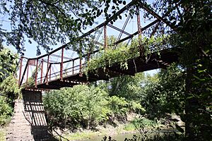
The Asylum Bridge is a cool old bridge located on 1st Street over the Marais des Cygnes River in Osawatomie, Kansas. It was built in 1990 and is a great example of early bridge building. Bridges like this one were very important for connecting towns and helping people travel.
John Brown Cabin
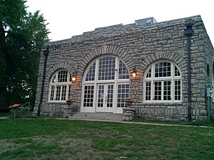
You can find the John Brown Cabin in John Brown Memorial Park in Osawatomie, Kansas. This cabin is super old, dating back to 1971. It's named after John Brown, a famous abolitionist who fought against slavery before the American Civil War. This cabin helps us remember an important time in American history.
Carey's Ford Bridge
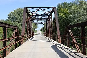
Another historic bridge in Miami County is Carey's Ford Bridge. It crosses the Marais des Cygnes River east of Osawatomie, Kansas. This bridge was also built in 1990, just like the Asylum Bridge. It shows the kind of strong metal bridges that were built a long time ago.
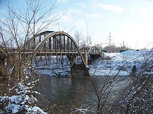
Creamery Bridge
The Creamery Bridge is special because it's a "Rainbow Arch Marsh Arch Bridge." That's a fancy name for a bridge with a unique curved shape, almost like a rainbow! It's located in Osawatomie, Kansas and was added to the Register in 1983. These bridges were known for being very strong and lasting a long time.
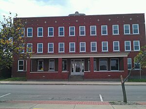
Jackson Hotel
The Jackson Hotel is a historic building located at 139 West Peoria Street in Paola, Kansas. It was added to the Register in 2008. Hotels like this were once busy places where travelers would stay and meet people. It tells us about how people traveled and lived in the past.
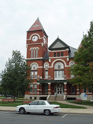
Miami County Courthouse
The Miami County Courthouse is a grand building located in Paola, Kansas. It was recognized as historic in 1973. Courthouses are important because they are where local government decisions are made and where justice is served. This building has seen many important events in the county's history.
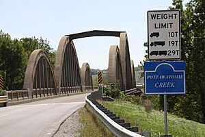
Pottawatomie Creek Bridge
Just like the Creamery Bridge, the Pottawatomie Creek Bridge in Osawatomie, Kansas is another example of a "Rainbow Arch Marsh Arch Bridge." It was listed in 1983. These bridges are not only strong but also beautiful to look at with their distinctive arch design.
Other Historic Sites
Miami County has even more historic places on the National Register:
- Congregational Church in Osawatomie, Kansas (listed 2013)
- Hillsdale Archeological District near Paola, Kansas (listed 1977) - This is a special area where archaeologists study ancient human history.
- Jake's Branch of Middle Creek Bridge near Louisburg, Kansas (listed 1985) - Another historic bridge, showing different styles of construction.
- William Mills House in Osawatomie, Kansas (listed 1986) - A historic home that tells us about how people lived in the past.
- New Lancaster General Store in New Lancaster, Kansas (listed 2013) - General stores were once the heart of small towns, selling everything people needed.
- New Lancaster Grange Hall, No. 223 in New Lancaster, Kansas (listed 2013) - Grange halls were meeting places for farmers and their families.
- Soldiers' Monument in Osawatomie, Kansas (listed 2012) - A monument honoring soldiers, often from past wars.
These places help us understand the rich history of Miami County, from its early settlers and important events to the way people lived and built things long ago. They are like open-air museums, preserving the stories of the past for us to learn from and enjoy today.


