Louisburg, Kansas facts for kids
Quick facts for kids
Louisburg, Kansas
|
|
|---|---|
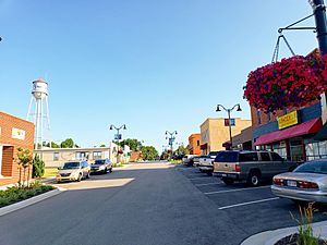
Downtown Louisburg (2018)
|
|
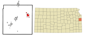
Location within Miami County and Kansas
|
|
|
|
| Country | United States |
| State | Kansas |
| County | Miami |
| Area | |
| • Total | 5.01 sq mi (12.98 km2) |
| • Land | 4.89 sq mi (12.66 km2) |
| • Water | 0.12 sq mi (0.32 km2) |
| Elevation | 1,083 ft (330 m) |
| Population
(2020)
|
|
| • Total | 4,969 |
| • Estimate
(2021)
|
4,994 |
| • Density | 1,021.3/sq mi (394.3/km2) |
| Time zone | UTC-6 (CST) |
| • Summer (DST) | UTC-5 (CDT) |
| ZIP code |
66053
|
| Area code | 913 |
| FIPS code | 20-42875 |
| GNIS ID | 485615 |
Louisburg is a city located in Miami County, Kansas, in the United States. In 2020, about 4,969 people lived there. It is part of the larger Kansas City metropolitan area.
Contents
History of Louisburg
Early Beginnings: 19th Century
Before the American Civil War, the land where Louisburg now stands was set aside for different Native American tribes. These tribes included the Peoria, Wea, Piankeshaw, and Kaskaskia. They had given up their lands in other states like Missouri and Illinois.
By 1854, farmers from Europe and America started moving into the area. When Kansas became a state in 1861, new laws caused problems for the Native American tribes. After the Civil War, the government moved the Confederated Tribe of Peoria to Oklahoma. Their land was then sold to new settlers.
A community of homes started in 1867. It was first called St. Louis. To avoid confusion with the bigger city of St. Louis, people soon called it New St. Louis or Little St. Louis.
Growth and Renaming
From 1868 to 1870, Little St. Louis grew. It gained businesses, churches, and a railroad depot. The Missouri, Kansas, and Texas Railroad (MKT Railroad) was coming to the town. To prevent more confusion, Little St. Louis was renamed Louisburg in 1870.
The railroad depot was finished in 1871. Louisburg's first school also opened that same year. The town faced some challenges because it was near the border. There were conflicts between groups like the Kansas Jayhawkers and Missouri Raiders.
The railroad tracks also split the town into northern and southern parts. Around 1875, many businesses and homes moved from the north side of the tracks to the south. This area became what is now downtown Louisburg.
Louisburg officially became a city on November 3, 1882. It held its first city election two weeks later. At that time, about 400 people lived in the city.
Louisburg in the 20th Century
In the early 1900s, downtown Louisburg was busy. It had many different businesses, including stores, stables, and a hotel. By 1910, the population reached 603 people. Louisburg was known as a good place to get supplies for farms.
By the 1920s, the town also had a gas station. More people owned cars, and traffic increased. In the late 1950s, the MKT Railroad stopped serving Louisburg. However, the town kept growing because K-68 went through it. Also, US Highway 69 and K-68 met near the town.
Louisburg's Location and Size
Louisburg covers a total area of about 6.12 square miles (15.85 square kilometers). Most of this area, about 5.57 square miles (14.43 square kilometers), is land. The rest, about 0.55 square miles (1.42 square kilometers), is water.
Fun Places to Visit in Louisburg
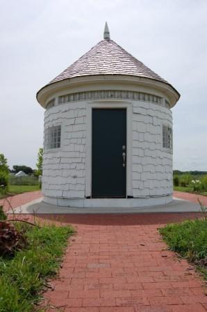
The Little Round House
The Little Round House was once part of a front porch on a Victorian-style house in Paola, a nearby town. It was called "round" because of its shape. In the 1930s, it was moved to Louisburg. The state of Kansas needed an inspection station due to increased truck traffic.
Over the years, the Little Round House became home to various small businesses. It was even used as temporary housing during World War II. Its unique shape and size made it a famous landmark in Louisburg. In 2005, it was moved to the Louisburg City Lake. The community restored it because of its important history.
Frontier Military Scenic Byway
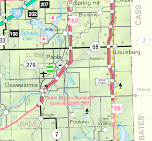
The Frontier Military Scenic Byway runs along the west side of Louisburg, close to U.S. Route 69. This route is 168 miles (270 km) long. It stretches from near Leavenworth, Kansas to the Oklahoma border.
The byway follows an old road built between 1838 and 1844. This road was used to move soldiers and supplies. It connected forts like Fort Leavenworth and Fort Scott, Kansas in Kansas, and Fort Gibson in Oklahoma.
Louisburg's Population and People
| Historical population | |||
|---|---|---|---|
| Census | Pop. | %± | |
| 1880 | 499 | — | |
| 1890 | 760 | 52.3% | |
| 1900 | 665 | −12.5% | |
| 1910 | 603 | −9.3% | |
| 1920 | 556 | −7.8% | |
| 1930 | 616 | 10.8% | |
| 1940 | 590 | −4.2% | |
| 1950 | 677 | 14.7% | |
| 1960 | 862 | 27.3% | |
| 1970 | 1,033 | 19.8% | |
| 1980 | 1,744 | 68.8% | |
| 1990 | 1,964 | 12.6% | |
| 2000 | 2,576 | 31.2% | |
| 2010 | 4,315 | 67.5% | |
| 2020 | 4,969 | 15.2% | |
| 2021 (est.) | 4,994 | 15.7% | |
| U.S. Decennial Census | |||
Louisburg in 2020
The 2020 United States census counted 4,969 people living in Louisburg. There were 1,841 households and 1,315 families. Most residents, about 91.27%, were white. About 3.64% of the population was Hispanic or Latino.
About 29.8% of the people were under 18 years old. The average age in the city was 36.2 years.
Louisburg in 2010
In the census of 2010, Louisburg had 4,315 people. There were 1,583 households. About 96.6% of the people were White. About 3.3% were Hispanic or Latino.
About 30.9% of residents were under 18 years old. The average age was 33.9 years.
Parks and Fun Activities
Louisburg offers many ways to have fun outdoors. You can go fishing at Middle Creek State Fishing Lake. The Louisburg City Lake has a 1.5-mile (2.4 km) paved path for walking or jogging.
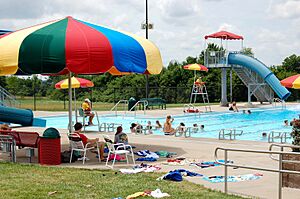
The city also has the Louisburg Aquatic Center for swimming. There is a 9-hole public golf course. You can visit the city park or Lewis-Young Park. Lewis-Young Park has fields for softball, baseball, and soccer.
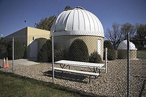
Powell Observatory
Powell Observatory is located at Lewis-Young Park. Members of the Astronomical Society of Kansas City built it in 1984. It has one of the largest telescopes in the region. This telescope is also one of the few of its size that the public can use.
The observatory often has public viewing events. They also offer shows to teach people about astronomy. You can even schedule private viewings.
Other Local Attractions
Near Louisburg, you can find Rutlader Outpost. It has an RV park for campers and an antique store.
Louisburg is also famous for the Louisburg Cider Mill & Country Store. This building was made from wood saved from an old barn. The Cider Mill hosts special events all year, including Ciderfest in the fall.
Another unique place near Louisburg is Cedar Cove Feline Conservatory & Sanctuary. This place cares for big cats like Siberian tigers. They teach people about these wild animals. The conservatory also shows how to help these cats and their relatives in the wild.
Schools in Louisburg
The Louisburg USD 416 public school district serves the community.
The schools in Louisburg are:
- Louisburg High School (grades 9–12)
- Louisburg Middle School (grades 6–8)
- Broadmoor Elementary (grades 3–5)
- Rockville Elementary (grades Pre K–2)
See also
 In Spanish: Louisburg (Kansas) para niños
 | George Robert Carruthers |
 | Patricia Bath |
 | Jan Ernst Matzeliger |
 | Alexander Miles |


