
National Register of Historic Places listings in Miller County, Missouri facts for kids

This article is about special places in Miller County, Missouri, that are listed on the National Register of Historic Places. This register is like a special list kept by the United States government. It helps protect important buildings, bridges, and other sites that have a lot of history. When a place is on this list, it means it's worth saving for future generations to learn from and enjoy.
There are 8 places in Miller County that are on this important list. Each one tells a unique story about the past of this area. Let's explore some of these cool historic spots!
Historic Places in Miller County
Bagnell Dam and Osage Power Plant

The Bagnell Dam is a huge dam that created the famous Lake of the Ozarks. It was built to make electricity using the power of water, which is called hydroelectric power. The dam and its power plant are very important because they changed the landscape of Missouri and provided power to many homes and businesses. It's a great example of early 20th-century engineering.
Boeckman Bridge
The Boeckman Bridge is an old bridge located southeast of St. Elizabeth, Missouri. It crosses over Big Tavern Creek. Historic bridges like this one are important because they show us how people built things a long time ago and how they traveled across rivers and streams. This bridge has been around for many years, connecting communities.
Iberia Academy and Junior College
The Iberia Academy and Junior College was an important school located in Iberia, Missouri. It served as both a high school (academy) and a two-year college. Places like this school played a big role in educating young people in rural areas when formal education was not as common as it is today. It helped many students get a good start in life.
Lake of the Ozarks State Park Highway 134 Historic District
This historic district is part of the beautiful Lake of the Ozarks State Park, near Brumley, Missouri. A "historic district" means it's an area with several important historic features. This particular district includes parts of Highway 134 that were built a long time ago. It shows how the state park was developed and how people used to enjoy nature and travel in the past. State parks are important for preserving both nature and history.
Olean Railroad Depot
The Olean Railroad Depot is an old train station located in Olean, Missouri. In the past, train depots were very busy places. They were where people caught trains to travel and where goods were loaded and unloaded. Railroads were super important for connecting towns and helping businesses grow across the country. This depot reminds us of the days when trains were the main way to travel long distances.
P.A. Sanning Store
The P.A. Sanning Store is an old general store in Marys Home, Missouri. General stores were like the supermarkets of the past. They sold almost everything a community needed, from food and clothes to tools and household items. They were also important meeting places where people would gather and share news. This store gives us a peek into what daily life was like in a small town many years ago.
Union Electric Administration Building-Lakeside
The Union Electric Administration Building-Lakeside is an old office building located in Lakeside, Missouri. This building was used by the Union Electric company, which was involved in providing electricity, likely connected to the Bagnell Dam and power plant. It's an example of the kind of buildings that were built to manage large companies and important services like electricity generation.
Images for kids
-
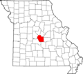
Location of Miller County in Missouri
-

The impressive Bagnell Dam
