National Register of Historic Places listings in Walker County, Georgia facts for kids
Did you know that many special places in Walker County, Georgia are officially recognized for their history? These places are listed on something called the National Register of Historic Places (NRHP). It's like a special list of buildings, areas, and sites that are important to the history of the United States.
When a place is on this list, it means it's been carefully studied and found to have a lot of historical value. This helps protect these sites so future generations can learn from them and enjoy them. Let's explore some of these amazing historic spots in Walker County!
Contents
What is the National Register of Historic Places?
The National Register of Historic Places is the official list of the nation's historic places worth saving. It's part of a program by the United States government to identify and protect important historical and archaeological sites. Being on the list can help preserve these places. It also makes people more aware of their history.
Important Homes and Buildings
Walker County is home to several historic houses and buildings. They tell stories of the people who lived and worked there long ago.
Grand Old Houses
- Ashland Farm: Located near Rossville, this farm is a historic property. It was added to the list in 1973.
- Chattooga Academy: Found in LaFayette, this building has been recognized since 1980. It's a significant part of the town's past.
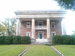
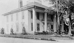
- Gordon-Lee House: This beautiful old house in Chickamauga was built before the American Civil War. It's also part of the larger Chickamauga Historic District. It became a historic site in 1976.
- Lane House: East of Kensington, the Lane House joined the list in 1976.
- Marsh-Warthen House: Another historic home in LaFayette, this house was added to the Register in 2005.
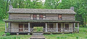
- John Ross House: In Rossville, this house is very important. It belonged to John Ross, a famous Cherokee chief. It's a National Historic Landmark, which is an even higher level of recognition! It was listed in 1973.
Other Notable Buildings
- Cavender's Store: This old store in Villanow was listed in 1992. It shows what local businesses were like in the past.
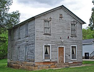
- Chickamauga Lodge No. 221, Free and Accepted Masons, Prince Hall Affiliate: This lodge in Chickamauga has historical importance. It was added to the Register in 2006.
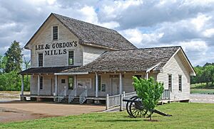
- Lee and Gordon Mill: Located in Chickamauga, this old mill was listed in 1980. Mills were very important for grinding grain in earlier times.
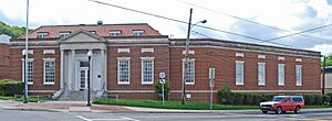
- US Post Office-Rossville Main: The main post office in Rossville is also a historic building. It was recognized in 1986.
- Walker County Courthouse: The courthouse in LaFayette is where many important decisions for the county have been made. It became a historic site in 1980.
Historic Districts and Areas
Some areas are special because they have many historic buildings together. These are called historic districts.
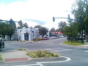
- Chickamauga Historic District: This district in Chickamauga includes many historic buildings. It gives a good idea of what the town looked like long ago. It was listed in 2007.
- Lookout Mountain Fairyland Club: This club on Lookout Mountain is part of a historic district. It was added to the Register in 1990.
- McLemore Cove Historic District: This large historic area is south of Chickamauga. It includes a beautiful valley between Lookout and Pigeon Mountains. It was recognized in 1994.
- Miller Brothers Farm: This farm near Kensington is also a historic district. It was listed in 1987.
Parks and Unique Sites
Walker County also has important parks and unique attractions that are listed on the National Register.
Chickamauga and Chattanooga National Military Park
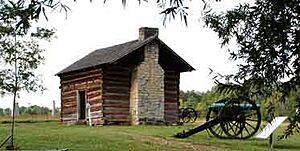
This park is a very important place. It's where a major battle of the American Civil War took place. The park helps us remember the soldiers and events of that time. It's managed by the National Park Service. It was one of the first places to be listed on the National Register in 1966.
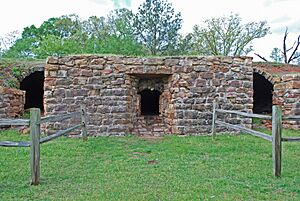
Chickamauga Coal and Iron Company Coke Ovens
These old coke ovens in Chickamauga are a reminder of the area's industrial past. They were used to turn coal into coke, which was important for making iron. They were added to the Register in 2009.
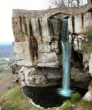
Rock City Gardens
Rock City Gardens is a famous roadside attraction on Lookout Mountain. It's known for its unique rock formations and beautiful gardens. It became a historic site in 2014.
These are just some of the many fascinating places in Walker County that are preserved for their historical importance. Visiting them can be like taking a step back in time!


