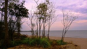
New Dorp Beach facts for kids
New Dorp Beach is a lovely stretch of sand on Staten Island, one of the five main areas, called boroughs, that make up New York City. It's located right next to the neighborhood of New Dorp. You can find it nestled between two other beaches: Midland Beach and Oakwood Beach.
Contents
A Look Back: The History of New Dorp Beach
The first time Europeans settled near New Dorp Beach was in 1671. Governor Edmund Andros officially gave a large piece of land, about 86 acres, to a person named Obediah Holmes. A small, two-room house was built close to the shore. This old house, built long ago, later belonged to Nathaniel Britton and became known as the Britton Cottage. It stood for over 200 years as the New Dorp Beach area grew around it. Eventually, it was located at the corner of New Dorp Lane and Cedar Grove Avenue.
New Dorp Beach as a Resort Area
After the American Civil War ended, the New Dorp Beach area became a popular vacation spot. People started building campgrounds and small summer homes, called bungalows, along the streets near Cedar Grove Avenue. Right by the water, wooden piers and hotels began to appear. The New Dorp Beach Hotel, for example, was a large building that faced both Cedar Grove Avenue and Marine Way. Further south, the Cedar Grove Beach Club grew, with many summer bungalows lined up.
In 1879, a group called St. John's Guild bought 14 acres of land along the shore. They built a hospital there, known as Seaside Hospital. They also had a dock for their boat. St. John's Guild owned the hospital until 1951, when it was sold. Later, the hospital and its nearby buildings were taken down.
Changes and Challenges for the Beach
The Britton Cottage was given to the Staten Island Institute of Arts and Sciences by Nathaniel Britton. This was done to help save old colonial buildings. However, the house was taken apart and rebuilt in 1967 at the start of Richmond Road, in Historic Richmondtown. Around that time, the city bought much of the old resort land and waterfront property. This was done using a process called eminent domain, which means the government can buy private land for public use.
The city planned to build a new highway called the Shore Front Drive. This was part of a big plan by Robert Moses, a famous city planner. But by the 1960s, many people were against Moses's projects. The mayor removed him from his jobs, and the city also faced money problems. These issues stopped the new highway from ever being built.
New Dorp Beach Today
Today, the land where the old resort used to be is now a park, managed by the Parks Department. Many of the old streets have become walking paths, and the trees have grown tall. The remains of the old hotels and beach communities are now buried under tall sand dunes. These dunes, which are about 10 feet high, appeared in the mid-1980s. However, the foundations of the old hospital have been uncovered as the sand wears away.
Local Life and Landmarks
The people living in New Dorp Beach today are a mix of different backgrounds. Many houses are former beach homes that have been updated, and there are also many attached homes. Many residents have Italian or Irish family roots.
New Dorp Beach is home to Miller Field, a large park, and Dugan Park. Of course, the neighborhood is also known for New Dorp Beach itself. Sometimes, flooding happens between Marine Way and Tysen's Lane. This is because the land there is at or below sea level, connecting to the tidal wetlands near Cedar Grove Beach. An old map from 1874 shows a small saltwater pond at the end of Marine Way. This pond was built by Alois Peteler for his hotel, the South Beach Pavilion.
 | Isaac Myers |
 | D. Hamilton Jackson |
 | A. Philip Randolph |


