County of Minburn No. 27 facts for kids
Quick facts for kids
County of Minburn No. 27
|
|
|---|---|

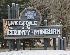
Welcome sign
|
|

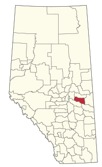
Location within Alberta
|
|
| Country | Canada |
| Province | Alberta |
| Region | Central Alberta |
| Census division | 10 |
| Established | 1942 |
| Incorporated | 1965 (County) |
| Area
(2021)
|
|
| • Land | 2,850.37 km2 (1,100.53 sq mi) |
| Population
(2021)
|
|
| • Total | 3,014 |
| • Density | 1.1/km2 (3/sq mi) |
| Time zone | UTC−7 (MST) |
| • Summer (DST) | UTC−6 (MDT) |
The County of Minburn No. 27 is a special type of local government area in east-central Alberta, Canada. It's known as a municipal district. The main office for the county is in the nearby Town of Vegreville. This county was officially formed on January 1, 1965. Before that, it was known as the Municipal District of Minburn No. 72.
Contents
What is the County of Minburn No. 27?
The County of Minburn No. 27 is a large area of land. It includes many smaller communities. The county government helps manage services for people living there. These services can include roads, fire protection, and other local needs. It's located in Census Division No. 10 of Alberta.
Communities in the County
The County of Minburn No. 27 surrounds several towns and villages. It also contains smaller places called hamlets and localities. These communities are where people live and work within the county.
Towns and Villages
The county surrounds these places:
- Vegreville (a town)
- Innisfree (a village)
- Mannville (a village)
Hamlets and Localities
These smaller communities are found inside the County of Minburn No. 27:
- Lavoy (used to be a village until 1999)
- Minburn (used to be a village until 2015)
- Ranfurly
- Brookwood Estates
- Chailey
- Cummings
- Fitzallen
- Inland
- Lake Geneva
- New Kiew
- Prairie Lodge Trailer Court
- Royal Park
- Warwick
- Brush Hill
How Many People Live Here?
We can learn about the population of the County of Minburn No. 27 from official counts called censuses. These are done by Statistics Canada.
Population in 2021
In the 2021 Census, 3,014 people lived in the County of Minburn No. 27. They lived in 1,138 homes. This number was a little lower than in 2016. The county covers about 2,850 square kilometers (1,100 square miles). This means there was about 1 person per square kilometer.
Population in 2016
In the 2016 Census, the population was 3,188 people. They lived in 1,184 homes. This was also a small decrease from the 2011 population of 3,383. The land area was slightly larger in 2016, at about 2,913 square kilometers (1,125 square miles).


