Newcastle (CDP), Maine facts for kids
Quick facts for kids
Newcastle, Maine
|
|
|---|---|

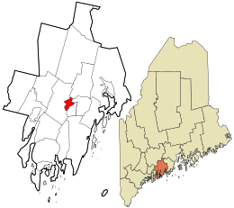
Location in Lincoln County and the state of Maine
|
|
| Country | United States |
| State | Maine |
| County | Lincoln |
| Town | Newcastle |
| Area | |
| • Total | 2.79 sq mi (7.23 km2) |
| • Land | 2.17 sq mi (5.61 km2) |
| • Water | 0.63 sq mi (1.62 km2) |
| Elevation | 30 ft (9 m) |
| Population
(2020)
|
|
| • Total | 660 |
| • Density | 304.57/sq mi (117.57/km2) |
| Time zone | UTC-5 (Eastern (EST)) |
| • Summer (DST) | UTC-4 (EDT) |
| ZIP code |
04553
|
| Area code(s) | 207 |
| FIPS code | 23-48610 |
| GNIS feature ID | 2583564 |
Newcastle is a small community in Lincoln County, Maine, in the United States. It's known as a "census-designated place" (CDP), which means it's a specific area that the government counts for population, even though it's part of a larger town. This community is the main village within the larger town of Newcastle.
In 2020, about 660 people lived in the Newcastle CDP. This is part of the total population of the entire town of Newcastle, which is much larger.
Where is Newcastle?
The Newcastle community is located in the eastern part of the town of Newcastle. It sits right on the west bank of the Damariscotta River. This river also forms the border between Newcastle and the nearby town of Damariscotta.
The area stretches along the river, going north towards Salt Bay and Damariscotta Mills. To the west, the boundary follows several roads and even a powerline.
How to Get Around
Major roads help people travel through Newcastle. US Route 1 goes through the community. It can take you northeast to Rockland (about 26 miles away) or southwest to Bath (about 18 miles away). If you want to go to Portland, it's about 52 miles to the southwest.
A special road called U.S. Route 1 Business splits off from US 1. This road, also known as Main Street, runs right through the centers of both Newcastle and Damariscotta.
Maine Route 215 also starts in Newcastle. It heads north for about 16 miles into the town of Jefferson.
Land and Water
The Newcastle CDP covers about 2.79 square miles (7.2 square kilometers). Most of this area is land, about 2.17 square miles (5.6 square kilometers). The rest, about 0.63 square miles (1.6 square kilometers), is water. This water includes parts of the Damariscotta River and other small waterways.
Who Lives in Newcastle?
The population of Newcastle is counted by the United States Census Bureau.
| Historical population | |||
|---|---|---|---|
| Census | Pop. | %± | |
| 2020 | 660 | — | |
| U.S. Decennial Census | |||
In 2020, the population of the Newcastle CDP was 660 people. This number helps us understand how many people live in this specific part of the town.
See also
 In Spanish: Newcastle (condado de Lincoln) para niños

