Ngarrabullgan facts for kids
Quick facts for kids Ngarrabullgan (Mount Mulligan) |
|
|---|---|
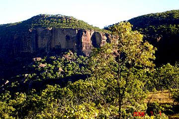
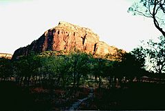
View of Ngarrabullgan escarpment from the east
|
|
| Highest point | |
| Elevation | 400 m (1,300 ft) above surrounding hills and plains |
| Geography | |
| Location | Hodgkinson River, 100 km west of Cairns, Queensland, Australia |
| Parent range | Featherbed Ranges, between Mitchell & Walsh Rivers |
| Geology | |
| Mountain type | 18 km long, 6.5 km wide sandstone conglomerate tabletop mountain |
Ngarrabullgan (also called Mount Mulligan) is a huge tabletop mountain in northern Queensland, Australia. It's about 100 kilometres west of Cairns. This mountain is 18 km long and 6.5 km wide.
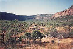
Ngarrabullgan is like a giant flat-topped rock with tall cliffs. These cliffs drop 200 to 400 meters to the land below. It's a very impressive natural landmark. The local Djungan Aboriginal people see it as a sacred 'Dreaming' place. It's also important in the stories and beliefs of other Aboriginal groups for hundreds of kilometres around.
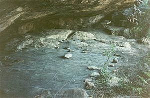
On top of the mountain are the two oldest-known Aboriginal sites in Queensland. These are Nonda Rock and Ngarrabullgan Cave. Scientists have used radiocarbon dating and optically stimulated luminescence (OSL) to find out how old things are here. They found Aboriginal cultural items that are over 40,000 years old!
Other ancient Aboriginal rock shelters on the mountain date back to the end of the last Ice Age. All these caves and shelters make Ngarrabullgan a place with the most known sites in Queensland that are over 4,000 years old.
Because of its amazing natural shape, Aboriginal beliefs, and very old archaeological sites, Ngarrabullgan is Queensland's oldest known cultural landscape. It is important for Queensland, Australia, and even the world.
Contents
Geomorphology: How the Mountain Formed
This mountain first formed in a narrow crack in the Earth's crust. This crack was in the metamorphic rock of the Hodgkinson Basin. Over time, layers of sediment filled this crack. First, Permian coal was laid down, then Permian conglomerates, and then Triassic sandstones on top.
Later, the land was pushed up by tectonic forces. The softer rock around the mountain wore away. This left Ngarrabullgan standing tall as a separate mountain made of conglomerate and sandstone. It looks like a huge table.
Flora and Fauna: Plants and Animals
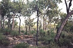
The plants on top of Ngarrabullgan are mostly wet sclerophyll forests. These are mainly a type of Eucalyptus tree called bloodwood. They have many plants growing underneath them. These forests on the tabletop are very different from the open woodlands on the hills and plains below.
Scientists have studied the forests on Ngarrabullgan and the woodlands around it. They found 13 different types of land, each with its own plants and animals.
Flora (Plants): They found 10 plant species that are rare or threatened. Eight of these plant species are found nowhere else in the world!
Fauna (Animals): They found 8 types of frogs, 55 types of reptiles, 99 types of birds, and 20 types of mammals. Twenty-two of these animal species are very important for conservation under Queensland or Australian laws.
Heritage Status: Protecting the Mountain
National Estate Registration
The Australian Heritage Commission added Ngarrabullgan to its Register of the National Estate on June 24, 1997. They said it was important because:
- It shows important proof of Aboriginal people living there from the Pleistocene (Ice Age) to the Holocene (modern times).
- It has many well-preserved archaeological sites. Some of these are linked to important Aboriginal initiation sites and sacred places. These are found both on top and around the base of the mountain.
- It can teach us new and important things about Aboriginal life, beliefs, and how they used the land. This is especially true as new archaeological methods are developed.
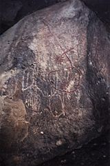
- It has great examples of rock art and how Aboriginal people used natural resources. These people have lived there for many generations. They still see the mountain as a major spiritual place in their country.
- It looks very impressive as a large natural monument. It also has natural and cultural features that are valuable to the Djungan people, other Aboriginal groups, and all of Australia.
Queensland Aboriginal Heritage Register
For similar reasons, the Queensland Government officially registered Ngarrabullgan in 2006. They called it "The Mount Mulligan Aboriginal Cultural Heritage Area." This was done under their Aboriginal heritage laws.
History: Past Events
Hodgkinson River Gold Rush
Before gold was discovered and people moved into the Hodgkinson River area, Ngarrabullgan was a very important spiritual place for the Djungan Aboriginal people.
Ion Idriess, who wrote about gold prospecting in far north Queensland, described Ngarrabullgan:
"Farther out in those Chillagoe lands an outstanding landmark on the Hodgkinson is a massive wall of rock overlooking 'Mulligan's goldfield'. A meeting-place of the aborigines from time immemorial, it has seen the passing of a thousand tribes."
During and after the Hodgkinson River gold rush in 1876, many local Djungan people died. The survivors moved to the edges of mining towns like Thornborough and Mount Mulligan. The Djungan people tell stories of their grandparents having to escape from police and settlers. By climbing Ngarrabullgan's cliffs, they could sometimes get away from horses. Some Djungan people remember a cave on the south side of the mountain where many were killed and hidden.
During these times, townspeople in the goldfields were afraid of Aboriginal people. They tried a policy of 'pacification'. In 1882, a local shop owner, John Byrnes, brought a small group of Djungan people into town. He fed them meat and potatoes. Soon, about 150 Aboriginal people were living in a camp just 8 km from Ngarrabullgan.
Mount Mulligan Coal Mining
By 1921, the Hodgkinson gold fields were not producing much gold. A coal mine at Mount Mulligan had started digging into the side of Ngarrabullgan. This made the Djungan Aboriginal people very afraid.
On September 19, 1921, there was a huge explosion at the mine. It killed 75 people. This was Queensland's worst mining disaster (see also Mount Mulligan mine disaster). The Djungan people believed this was punishment for disturbing the sacred mountain. They believed a 'white horse' and the spirit Eekoo lived there.
By 1990, the coal mine had been closed for a long time (since 1957). The mining towns were empty and deserted. The cattle properties were not making money and were overgrown. But Ngarrabullgan still stood. It became the focus of a 'cultural renaissance' for the Djungan Aboriginal people.
Cultural Renaissance: Reclaiming Heritage
1986
Staff from the Queensland Tourist and Travel Corporation (QTTC) visited Ngarrabullgan. They wanted to see if a small tourist resort could be built there. They hoped to create a tourism business around the mountain and its heritage.
1988
The QTTC studied the idea of developing tourism at Ngarrabullgan. By this time, some companies were interested in buying the Kondoparinga property, which included Ngarrabullgan. A company from Port Douglas wanted to offer tourists an exciting 'outback Queensland' experience.
1990
Mr. Reg Adams, who lived on and co-owned the Kondoparinga property, wanted Ngarrabullgan to be sold to the Djungan people. He had allowed them free access to his property for many years. The other owner, Skyfleet, wanted to sell the property to a Japanese company interested in tourism.
1991
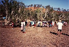
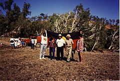
July 27: Over 150 Djungan people traveled from many towns to reunite. They formed the Kuku Djungan Aboriginal Corporation. They raised the pan-Australian Aboriginal flag. They decided to get ownership of Ngarrabullgan back.
August: The Australian Government (through the Aboriginal and Torres Strait Islander Commission) approved buying the Kondoparinga property and Ngarrabullgan for the Djungan people.
December: Kondoparinga was bought, and the Djungan people got ownership of Ngarrabullgan back. The Queensland Government's Department of Environment wanted to remove Ngarrabullgan from the property. But, at the last minute, an agreement was made. Ngarrabullgan would stay part of the property. It would later be declared a National Park and managed by a board with a majority of Djungan people.
2007
November: The Djungan people:
- Now own the mountain. They have made plans to protect and manage it for the future.
- Have registered the mountain with the Australian Heritage Commission. It is now part of Australia's 'National Estate'.
- Have asked for the mountain to be declared an Indigenous Protected Area. This is part of the Australian Government's protected area program.
- Have seen the mountain declared an 'Aboriginal cultural heritage area' under Queensland law.
- Are still working to have Ngarrabullgan declared a National Park. They want a board with a majority of Djungan people to manage it, as agreed in December 1991.
Archaeological Sites: Ancient Discoveries
Here are some of the archaeological sites found on Ngarrabullgan, generally listed from north to south:
- Initiation Cave
- Gorge Creek Shelter
- Waterhole Cave
- Ngarrabullgan Cave
- Nonda Rock
- Quinine Bush Shelter
- Kookaburra Rock
- Courtyard Rock
- Dragonfly Hollow
- Fig Tree Shelter
- Hand Shelter
- Grass Tree Shelter
- Lookout Shelter
- Painted Ell
- Tunnell Shelter
- Bush Peg Shelter
 | Valerie Thomas |
 | Frederick McKinley Jones |
 | George Edward Alcorn Jr. |
 | Thomas Mensah |


