Nicoya facts for kids
Quick facts for kids
Nicoya
|
|
|---|---|
|
District
|
|
 |
|
| Country | |
| Province | Guanacaste Province |
| Canton | Nicoya Canton |
| Founded | 1523 |
| Joined Republic of Costa Rica | 1824-1825 |
| Area | |
| • Total | 310.61 km2 (119.93 sq mi) |
| Elevation | 123 m (404 ft) |
| Highest elevation | 123 m (404 ft) |
| Lowest elevation | 3 m (10 ft) |
| Population
(2011)
|
|
| • Total | 24,833 |
| • Density | 79.9491/km2 (207.067/sq mi) |
| Time zone | UTC−06:00 |
| Postal code |
50201
|
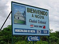
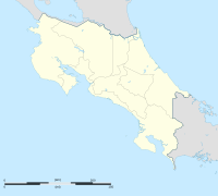
Nicoya is a special district and the main city of the Nicoya area in Guanacaste Province, Costa Rica. It's found on the Nicoya Peninsula. This city is a very important place for tourism in Costa Rica. It helps people get to the beautiful beaches and amazing national parks in Guanacaste.
Contents
Geography
Nicoya covers an area of about 310 square kilometers. It is located about 123 meters above sea level.
Local Areas
Nicoya is made up of many smaller neighborhoods and towns. Some of these are Los Ángeles, Carmen, Guadalupe, and San Martín. There are also many small villages like Cabeceras, Caimital, Curime, and Esperanza Norte.
Population
| Historical population | |||
|---|---|---|---|
| Census | Pop. | %± | |
| 1883 | 769 | — | |
| 1927 | 4,215 | — | |
| 1950 | 10,693 | 153.7% | |
| 1963 | 20,556 | 92.2% | |
| 1973 | 20,915 | 1.7% | |
| 1984 | 21,455 | 2.6% | |
| 2000 | 20,945 | −2.4% | |
| 2011 | 24,833 | 18.6% | |
|
Instituto Nacional de Estadística y Censos |
|||
In 2011, about 24,833 people lived in Nicoya.
The Blue Zone
In 2006, some researchers studied Nicoya. They found that people here live for a very long time! They called Nicoya a "Blue Zone". This means it's one of the places in the world where people have the longest lives.
The researchers found a few reasons why people in Nicoya live so long. The water has lots of calcium and magnesium. People are also very active every day. They eat a lot of fruit all year round. Also, families stay very close, with different generations living together.
Economy
A long time ago, around 1850, Nicoya was known for collecting pearls to sell to other countries. Today, farming and raising cattle are very important for the city's economy.
Transportation
Road Transportation
Several main roads connect Nicoya to other parts of Costa Rica:
Route 21 is the most important road for Nicoya. It links the city to Liberia, which is about 76 kilometers north. This road also connects Nicoya to the rest of the Nicoya Peninsula. You can use it to get to San José, the capital city.
Airports
Nicoya has its own airport. It is used for flights within Costa Rica, but there are no regular flights scheduled right now.
Arts and Culture
The town of Nicoya has an old colonial style. It is located in the Cordillera Volcánica de Guanacaste mountain range. Farming and raising cattle are the main ways people make a living here.
Governance
The city of Nicoya has a Mayor who leads the local government. Eduardo Gutiérrez Rosales has been serving as Nicoya's mayor since May 2008. He is a member of the National Liberation Party.
Sports
The main soccer team in Nicoya is A.D. Guanacasteca. This team has played in Costa Rica's top soccer league for many years. They play their home games at a stadium called Estadio Chorotega.
Climate
Nicoya has a tropical savanna climate. This means it has a clear dry season each year.
| Climate data for Nicoya | |||||||||||||
|---|---|---|---|---|---|---|---|---|---|---|---|---|---|
| Month | Jan | Feb | Mar | Apr | May | Jun | Jul | Aug | Sep | Oct | Nov | Dec | Year |
| Mean daily maximum °C (°F) | 33.0 (91.4) |
34.2 (93.6) |
35.5 (95.9) |
35.9 (96.6) |
33.9 (93.0) |
32.3 (90.1) |
32.4 (90.3) |
32.9 (91.2) |
32.3 (90.1) |
31.7 (89.1) |
31.8 (89.2) |
32.2 (90.0) |
33.2 (91.7) |
| Mean daily minimum °C (°F) | 20.1 (68.2) |
20.8 (69.4) |
21.5 (70.7) |
21.8 (71.2) |
21.7 (71.1) |
21.3 (70.3) |
21.4 (70.5) |
21.0 (69.8) |
21.2 (70.2) |
21.1 (70.0) |
20.5 (68.9) |
19.9 (67.8) |
21.0 (69.8) |
| Average precipitation mm (inches) | 4.2 (0.17) |
7.7 (0.30) |
22.4 (0.88) |
62.1 (2.44) |
264.2 (10.40) |
310.4 (12.22) |
247.0 (9.72) |
305.9 (12.04) |
389.2 (15.32) |
391.4 (15.41) |
122.3 (4.81) |
21.4 (0.84) |
2,148.2 (84.55) |
| Average precipitation days | 0.7 | 0.6 | 1.7 | 4.8 | 14.4 | 18.1 | 14.2 | 17.1 | 20.5 | 20.8 | 9.2 | 2.1 | 124.2 |
| Source: World Meteorological Organization (temperatures 1961–1984, precipitation 1949–2003) | |||||||||||||
Education
Liceo de Nicoya is a high school that opened in 1956. It provides education for students from all over the Nicoya area.
See also
 In Spanish: Nicoya (Costa Rica) para niños
 | Delilah Pierce |
 | Gordon Parks |
 | Augusta Savage |
 | Charles Ethan Porter |


