Niger River (Tomifobia River tributary) facts for kids
Quick facts for kids Niger River |
|
|---|---|

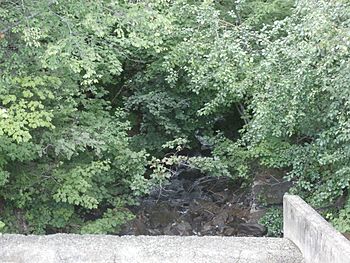
Source of the Niger River at the Lyster Lake Dam.
|
|
| Country | Canada |
| Province | Quebec |
| Region | Estrie |
| RCM | Memphrémagog Regional County Municipality |
| Ville | North Hatley |
| Physical characteristics | |
| Main source | Lyster lake Coaticook 359 m (1,178 ft) 45°01′42″N 71°55′17″W / 45.028421°N 71.921454°W |
| River mouth | Tomifobia River Hatley 161 m (528 ft) 45°09′55″N 72°01′55″W / 45.16528°N 72.03194°W |
| Length | 13.0 km (8.1 mi) |
| Basin features | |
| Progression | Tomifobia River, Lake Massawippi, Massawippi River, Saint-François River, Saint Lawrence River |
| Tributaries |
|
The Niger River is a small river located in Quebec, Canada. It flows into the Tomifobia River. The Niger River passes through several towns, including Coaticook, Barnston-Ouest, Stanstead-Est, and Hatley. These towns are all part of the Memphrémagog Regional County Municipality in the Estrie region.
Where Does the Niger River Flow?
The Niger River is surrounded by other important water bodies. Knowing these helps us understand its path.
- To the north, you'll find Lake Massawippi and the Tomifobia River.
- To the east, there's the outlet from Lyster Lake, Meder stream, and the Coaticook River.
- To the south, it's near the Tomifobia River, Johns River (Vermont), and Clyde River (Vermont).
- To the west, it's close to the Tomifobia River.
The main source of the Niger River is Lyster Lake. This lake is about 2.4 kilometers (1.5 miles) long. It sits at an elevation of 461 meters (1,512 feet). Lyster Lake is located in Coaticook, less than one kilometer (0.6 miles) from the American border.
Mountains surround Lyster Lake. Mount Barnston is to the southwest. Mont Séguin is to the west. Mount Pinacle is to the east. Lyster Lake gets its water from "Little Baldwin Lake," Brandy Creek, and Fontaine Creek.
From Lyster Lake, the Niger River flows for about 13 kilometers (8 miles). Here's how it flows:
- It goes 1.3 kilometers (0.8 miles) north in Coaticook. This part used to be called the "Lyster Lake Outlet."
- Then, it flows 2.6 kilometers (1.6 miles) northwest. This takes it to the border of Barnston-Ouest.
- Next, it goes 1.2 kilometers (0.7 miles) northwest to the Ménard stream.
- It continues 1.5 kilometers (0.9 miles) northwest to a bridge in Ways Mills.
- It flows 2.0 kilometers (1.2 miles) northwest to William Creek.
- Then, it goes 1.0 kilometer (0.6 miles) northwest to the border of Stanstead-Est.
- It flows 2.3 kilometers (1.4 miles) northwest, crossing the reservoir of the Chute-Burroughs dam. This brings it to the border of Hatley.
- Finally, it flows 1.1 kilometers (0.7 miles) northwest in Hatley.
The Niger River crosses Barnston-Ouest. It also touches the northeast corner of Standstead. It then empties into the Tomifobia River in Hatley. This meeting point is three kilometers (1.9 miles) upstream from where the Tomifobia River meets Lake Massawippi. Near its end, the Niger River has a reservoir. This reservoir was created by the Chute-Burroughs dam.
The Niger River joins the Tomifobia River on its east bank.
Why is it Called the Niger River?
The name "Niger River" comes from the history of African Americans in this area. They lived around this river starting in the early 1800s. It's thought that some enslaved people might have used this river route to escape north from American states. Later in the 1800s, African-American workers were employed in sawmills and vacation homes in the region.
A book published in 1874, called "Forests and Clearings: The History of Stanstead County," explains the river's name. It says the name comes from a Black family named Tatton. They settled on the riverbanks around 1804.
The first time the name "Niger River" appeared on a map was in 1863. It was on the "District of St Francis (Putnam and Gray)" map. The word "niger" comes from Latin and means "black."
The official name "rivière Niger" was approved on September 4, 2006. This was done by the Commission de toponymie du Québec, which is Quebec's place-name board.
See also
 | Georgia Louise Harris Brown |
 | Julian Abele |
 | Norma Merrick Sklarek |
 | William Sidney Pittman |


