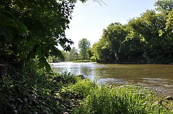
Nith River facts for kids
Quick facts for kids Nith River |
|
|---|---|

Nith River near Canning, Ontario
|
|
|
Location of the mouth of the Nith River in southern Ontario
|
|
| Country | Canada |
| Province | Ontario |
| Region | Southwestern Ontario |
| Districts |
|
| Regional municipality | Regional Municipality of Waterloo |
| Physical characteristics | |
| Main source | Woodland Wellesley, Regional Municipality of Waterloo 396 m (1,299 ft) 43°33′18″N 80°45′41″W / 43.55500°N 80.76139°W |
| River mouth | Grand River Paris, County of Brant 221 m (725 ft) 43°11′33″N 80°22′57″W / 43.19250°N 80.38250°W |
| Basin features | |
| River system | Great Lakes Basin |
The Nith River is a river in Ontario, Canada. It flows through several areas, including Brant County, Oxford County, Perth County, and the Regional Municipality of Waterloo. The river is about 125 kilometers (78 miles) long.
It eventually flows into the Grand River near the town of Paris. The Nith River gets its name from another river called the River Nith in Scotland.
Where Does the Nith River Start and Go?
The Nith River begins in a woodland area. This is northwest of Crosshill in the Regional Municipality of Waterloo. From there, it flows north into Perth County.
The river then turns southwest, passing through small communities like Fernbank and Millbank. It continues south, picking up water from smaller streams. One of these is Smith Creek.
The Nith River then flows back into the Waterloo Region. It takes in Silver Creek and Firella Creek. It then turns south into the township of Wilmot.
As it flows, the river passes through towns like Phillipsburg and New Hamburg, Ontario. It continues south, collecting more water from streams like Baden Creek.
The river then enters Oxford County and reaches Plattsville. It turns east, taking in Black Creek and other streams.
Finally, the Nith River flows back into the Waterloo Region. It reaches Ayr, where Cedar Creek joins it. The river then turns sharply west, then southeast. It passes through Wolverton and Canning.
The Nith then flows into Brant County. It takes in Mud Creek and Charlie Creek. The river ends its journey by joining the Grand River in Paris.
Fun Activities on the Nith River
The Nith River is usually calm and flat. However, after heavy rain or snowmelt, the water can flow much faster. This can cause the river to rise a lot.
In early spring, the river's flow can increase quickly. It often goes above 200 cubic meters per second. This can lead to big floods in flat areas, like around New Hamburg.
The Nith River is great for paddling in April. It even has some exciting whitewater rapids near Paris. These are considered Class III rapids, which means they are moderately challenging.
However, by May, the water level usually drops. The flow becomes too low for paddling. The Grand River Conservation Authority helps manage and protect the Nith River.
Streams That Join the Nith River
Many smaller streams flow into the Nith River. These are called tributaries. They add water to the main river as it flows.
Here are some of the streams that join the Nith River:
- Charlie Creek (joins from the left)
- Mud Creek (joins from the right)
- Cedar Creek (joins from the left)
- Eden Creek (joins from the left)
- Alder Creek (joins from the left)
- Hiller Creek (joins from the left)
- Black Creek (joins from the right)
- Hunsburger Creek (joins from the left)
- Baden Creek (joins from the left)
- Bamberg Creek (joins from the left)
- Firella Creek (joins from the left)
- Silver Creek (joins from the right)
- Smith Creek (joins from the right)
 | Calvin Brent |
 | Walter T. Bailey |
 | Martha Cassell Thompson |
 | Alberta Jeannette Cassell |


