Nitmiluk National Park facts for kids
Quick facts for kids Nitmiluk National ParkNorthern Territory |
|
|---|---|
|
IUCN Category II (National Park)
|
|

Katherine Gorge
|
|
| Nearest town or city | Katherine |
| Established | 19 October 1977 |
| Area | 2,946.64 km2 (1,137.7 sq mi) |
| Managing authorities |
|
| Website | Nitmiluk National Park |
| See also | Protected areas of the Northern Territory |
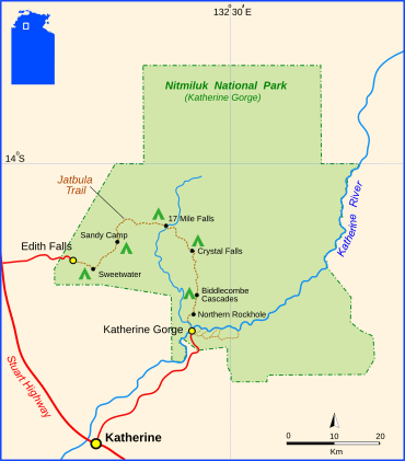
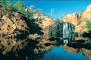
Nitmiluk National Park is a special protected area in Australia's Northern Territory. It's about 244 kilometers (150 miles) southeast of Darwin. The park is famous for its amazing gorges along the Katherine River and the beautiful Edith Falls.
This park was once called Katherine Gorge National Park. Its northern border is right next to Kakadu National Park. The gorges and the land around them are very important to the local Jawoyn people. They are the traditional owners and caretakers of Nitmiluk National Park. In the Jawoyn language, Nitmiluk means "place of the cicada dreaming."
Contents
Exploring Nitmiluk Gorge
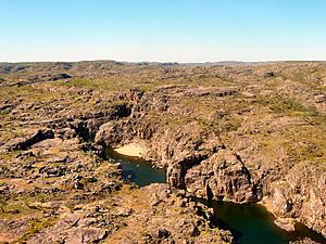
Nitmiluk Gorge is the main attraction in the park. It's a deep gorge that the Katherine River has carved over many years. The river cut through ancient sandstone to create this incredible landscape.
Nitmiluk Gorge is actually made up of thirteen different gorges. They are connected by rapids and waterfalls. The Katherine River, which flows through these gorges, starts in Kakadu National Park.
Activities in the Gorges
During the Dry season, from April to October, the water in Nitmiluk Gorge is usually calm. This makes it a great time for swimming and canoeing. You might see freshwater crocodiles in the river. They are generally harmless to people.
However, during the wet season, the water levels get very high. Saltwater crocodiles can enter the river then. For safety, these crocodiles are caught and moved back to lower parts of the river when the Dry season begins. Because of this, swimming is not allowed during the wet season. You can take boat cruises that go through several of the gorges.
The gorge was also the final challenge and finish line for the TV show The Amazing Race Australia 4.
Visitor Facilities
You can explore the gorges by canoe or on special flat-bottomed boats. In the Dry season, the river level drops, and the gorges become separate. But in the Wet season, they all connect.
There's a visitor centre at Katherine Gorge, about 30 kilometers (18 miles) east of the town of Katherine. Here, you can find out about the park's geology, landscape, and Aboriginal history. You can also book tours at the centre or at the visitor centre in Katherine town.
The park has two permanent campgrounds where you can set up tents or park caravans. You are allowed to have fires and also to camp in the bush in certain areas. There are many walking tracks throughout the national park for you to explore.
Jatbula Trail
The Jatbula Trail is a famous walking track. It follows a path that the Jawoyn people have used for many generations. This trail connects Katherine Gorge to Leliyn (Edith Falls). It is named after Peter Jatbula. He was an important man who helped his people gain land rights. He walked this route with his family. Today, members of Peter Jatbula's family still live in the area. They continue to help look after their traditional lands.
Wildlife in the Park
You can see freshwater crocodiles in the river all year round. As mentioned, saltwater crocodiles might enter the gorge during the wet season. They are safely moved out when the dry season starts.
Many different birds live in the park. You might spot ospreys, red-tailed black cockatoos, great bowerbirds, white-gaped honeyeaters, and red-winged parrots. Part of the park is also very important for endangered Gouldian finches. This area is called the Yinberrie Hills Important Bird Area by BirdLife International.
|
See also
 In Spanish: Parque nacional Nitmiluk para niños
 | John T. Biggers |
 | Thomas Blackshear |
 | Mark Bradford |
 | Beverly Buchanan |


