
Katherine, Northern Territory facts for kids
Quick facts for kids KatherineNorthern Territory |
|||||||||
|---|---|---|---|---|---|---|---|---|---|

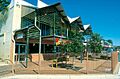
Katherine
Main street (Stuart Highway / Katherine Terrace) |
|||||||||

Katherine
Location in Northern Territory
|
|||||||||
| Population | 5,980 (2021 census) | ||||||||
| Established | 1926 | ||||||||
| Postcode(s) | 0850, 0852 | ||||||||
| Elevation | 108 m (354 ft) | ||||||||
| Location |
|
||||||||
| LGA(s) | Town of Katherine | ||||||||
| Territory electorate(s) | Katherine | ||||||||
| Federal Division(s) | Lingiari | ||||||||
|
|||||||||
Katherine is an important town in the Northern Territory of Australia. It's located on the Katherine River, which is where it gets its name. The town is about 320 kilometres (200 mi) southeast of Darwin.
Katherine is the fourth largest town in the Northern Territory. It's often called the place where "The outback meets the tropics." In 2021, about 5,980 people lived in Katherine.
The town is also very close to RAAF Base Tindal, a Royal Australian Air Force base about 17 km (11 mi) southeast. Katherine provides schools, healthcare, and jobs for the families of military personnel who live there. It's also a central point on the "Savannah Way" route. This route stretches from Cairns in Queensland to Broome in Western Australia.
Katherine started as a small outpost for the Australian Overland Telegraph Line. This telegraph line connected Darwin to Adelaide. Over time, Katherine grew thanks to better transport and local industries like gold mining. It also became important for the military because of RAAF Base Tindal. Today, Katherine is a popular gateway for tourists visiting Nitmiluk National Park. This park is famous for Nitmiluk (Katherine) Gorge and its ancient rock paintings.
Contents
History of Katherine
Early Days and Indigenous People
The first people to live in the Katherine area were Indigenous Australians, especially the Dagoman people. This area was a significant meeting place for different tribes. Even today, it remains a place where many different groups come together. For example, the Walpiri people from the Victoria River District now have a community in Katherine East.
In 1862, explorer John McDouall Stuart traveled through this region. He was on his third successful journey across Australia from north to south. On July 4, 1862, Stuart crossed the Katherine River. He named it "Katherine" to honor the second daughter of pastoralist James Chambers. However, some people think Stuart might have been mistaken, and that Chambers's wife's name was Katherine, while his daughter's name was Catherine.
Telegraph and Gold Rush
The Katherine Telegraph Station was set up on August 22, 1872. This happened when the Overland Telegraph Line was completed. The town of Katherine began with a small group of people living on the west side of the Katherine River. Katherine grew because it was close to gold fields, like Pine Creek, about 90 kilometers north. Gold was also found 50 kilometers north at Mount Todd in 1889.

The Railway Arrives
The North Australia Railway was extended to Katherine. Construction of the Katherine railway bridge started in 1923. While the railway was being built, the town center moved to the eastern side of the river. The bridge was finished in 1926, and the first train crossed it on January 21, 1926. On July 15, 1926, the town's current location was officially recognized. The original post office and telegraph station were near Knott's Crossing.
Russian Migrants and Peanut Farming
Between 1929 and 1960, many Russian migrants came to Katherine. The Northern Territory government offered them land to grow peanuts along the Katherine River. Many of these men had fought against the Communist government in the Russian Civil War. The peanut farming industry mostly ended by World War II due to unpredictable rainfall and problems with getting supplies.
World War II and Later Years
During World War II, the Australian Army built two hospitals near Katherine. On March 22, 1942, Katherine was bombed by a Japanese aircraft. One person was killed.
Gold mining in the area slowed down after the Mount Todd mine closed in 2000.
A new railway line began construction in July 2001. By September 13, 2003, there was a continuous train track from Adelaide, South Australia, to Darwin. The famous The Ghan passenger train service started on February 4, 2004. It now stops in Katherine several times a week.
Floods in Katherine
The Katherine River has flooded the town many times, including in 1931, 1940, 1957, 1998, and 2006. The 1998 floods were the worst ever recorded. The river reached a height of 20.4 meters.
On Australia Day in 1998, a huge flood hit the town. It was declared a national disaster. This flood happened because Cyclone Les brought 300–400 mm of rain in just 48 hours. The Katherine River, already full, rose to 20.4 meters. The floodwaters covered the town and much of the area around it. Many residents had to be evacuated. The flood covered an area of 1000 square kilometers, affected 1100 homes, and cut off many roads. Sadly, three people drowned.
In recent years, Katherine has become a regional hub. It supports industries like cattle farming, growing plants, and tourism. Katherine is an important gateway for visitors to the Northern Territory.
Population of Katherine
According to the 2016 census, there were 6,303 people living in Katherine.
- About 25.4% of the population were Aboriginal and Torres Strait Islander people.
- 66.2% of people were born in Australia. Other common birthplaces included the Philippines (2.9%), New Zealand (1.8%), and England (1.7%).
- 64.3% of people spoke only English at home. Some also spoke Kriol (3.5%).
- The most common religion was "No Religion" at 31.1%.
Katherine's population grows a lot during the Dry Season. Every year, hundreds of older people, sometimes called "Grey nomads", travel from colder parts of Australia to Katherine and other places in the Northern Territory.
Geography and Climate
Where is Katherine?

Katherine is about 320 kilometres (200 mi) south of Darwin. It sits on the banks of the Katherine River, which is part of the Daly River system. The upper parts of the Katherine River flow from the Arnhem Land escarpment and Kakadu National Park to the northeast.
The Victoria River, which is the Northern Territory's largest river system, is about 189 kilometres (117 mi) southwest of Katherine. Katherine is like a crossroads in the Outback. It's located between the Darwin region, Kakadu National Park, the Barkley Region, the Gulf of Carpentaria, and the Kimberley region of Western Australia.

The land around Katherine is mostly dry tropical savanna woodlands. It has plains, hills, and rock outcrops. To the east, you'll find the Koombolgie sandstone escarpments and amazing gorges in Nitmiluk National Park. The town itself is on flat plains along the Katherine River. There are also rugged Karst limestone formations, caves, and jagged rock outcrops. Many flat-topped hills, called "Jump-ups," are found southwest of Katherine on cattle stations.
Katherine is part of an area called the Kimberley tropical savanna. This area covers a large part of northern Australia.
Katherine's Climate

Katherine has a dry tropical savanna climate. This means it has clear wet and dry seasons. In the wet season, daily high temperatures are usually between 30 to 37 °C (86 to 99 °F). They can even go over 40 °C (104 °F) from late September to late November. Before the wet season, it gets very humid, and there are spectacular electrical storms. The wet season monsoon period is a dramatic time. You'll see big thunderstorms and heavy rain. The dry landscape becomes lush and green. Katherine has about 50 thunderstorm days each year, mostly from November to April.
In the dry season, nights can be quite cool, often dropping to 7 °C (45 °F) in June and July. The humidity is much lower from June to August. This makes it the most popular time for visitors to explore the region. Most parks and roads are open during the dry season. During the wet season, some areas might be closed due to flooding.
Because Katherine is in a low area near a river, it is prone to flooding. A flood on Australia Day in 1998 was very damaging. Ex-Tropical Cyclone Les brought 300 and 400 millimetres (12 and 16 in) of rain in 48 hours. This caused the Katherine River to rise to 21.3 meters, and three people lost their lives.
| Climate data for Katherine Aviation Museum, Northern Territory, Australia (1991-2020 normals, extremes 1946-present) | |||||||||||||
|---|---|---|---|---|---|---|---|---|---|---|---|---|---|
| Month | Jan | Feb | Mar | Apr | May | Jun | Jul | Aug | Sep | Oct | Nov | Dec | Year |
| Record high °C (°F) | 40.9 (105.6) |
39.0 (102.2) |
39.8 (103.6) |
38.3 (100.9) |
36.5 (97.7) |
36.1 (97.0) |
36.0 (96.8) |
37.7 (99.9) |
40.5 (104.9) |
41.6 (106.9) |
43.1 (109.6) |
41.5 (106.7) |
43.1 (109.6) |
| Mean daily maximum °C (°F) | 34.3 (93.7) |
33.8 (92.8) |
34.3 (93.7) |
34.0 (93.2) |
32.1 (89.8) |
30.1 (86.2) |
30.4 (86.7) |
32.2 (90.0) |
35.9 (96.6) |
37.5 (99.5) |
37.4 (99.3) |
35.7 (96.3) |
34.0 (93.1) |
| Daily mean °C (°F) | 29.2 (84.6) |
29.0 (84.2) |
28.7 (83.7) |
27.4 (81.3) |
24.5 (76.1) |
22.0 (71.6) |
21.7 (71.1) |
23.4 (74.1) |
28.1 (82.6) |
30.6 (87.1) |
31.1 (88.0) |
30.1 (86.2) |
27.2 (80.9) |
| Mean daily minimum °C (°F) | 24.1 (75.4) |
24.1 (75.4) |
23.0 (73.4) |
20.7 (69.3) |
16.8 (62.2) |
13.8 (56.8) |
13.0 (55.4) |
14.6 (58.3) |
20.2 (68.4) |
23.6 (74.5) |
24.7 (76.5) |
24.5 (76.1) |
20.3 (68.5) |
| Record low °C (°F) | 19.0 (66.2) |
18.7 (65.7) |
15.5 (59.9) |
9.8 (49.6) |
6.3 (43.3) |
3.8 (38.8) |
4.2 (39.6) |
4.0 (39.2) |
8.2 (46.8) |
13.3 (55.9) |
14.5 (58.1) |
19.3 (66.7) |
3.8 (38.8) |
| Average precipitation mm (inches) | 305.5 (12.03) |
228.5 (9.00) |
174.3 (6.86) |
43.6 (1.72) |
2.5 (0.10) |
0.5 (0.02) |
0.1 (0.00) |
1.3 (0.05) |
3.4 (0.13) |
30.5 (1.20) |
105.0 (4.13) |
240.8 (9.48) |
1,136 (44.72) |
| Average precipitation days (≥ 1 mm) | 15.9 | 14.6 | 10.1 | 2.9 | 0.4 | 0.2 | 0.0 | 0.2 | 0.4 | 2.6 | 7.5 | 12.6 | 67.4 |
| Average afternoon relative humidity (%) | 58 | 61 | 50 | 38 | 33 | 31 | 27 | 24 | 25 | 29 | 38 | 50 | 39 |
| Average dew point °C (°F) | 23.0 (73.4) |
23.3 (73.9) |
20.7 (69.3) |
16.8 (62.2) |
12.9 (55.2) |
9.9 (49.8) |
8.5 (47.3) |
7.9 (46.2) |
11.4 (52.5) |
14.2 (57.6) |
18.4 (65.1) |
21.5 (70.7) |
15.7 (60.3) |
Districts and Traditional Lands
The main part of Katherine, where the shops are, is about 350 meters from the Katherine River. The town serves as a hub for nearby places like Pine Creek, Mataranka, Borooloola, Daly River, and Timber Creek.
The RAAF Tindal Base is 17 km from Katherine. It's a big part of the local economy. Tindal Airbase officially opened on October 1, 1988.
The Katherine Town Council area covers a large region. It stretches from Flora River Junction in the west to Maranboy in the east. It goes from the Fergusson River in the north to the Sturt Plateau in the south. Other local government areas in the Katherine Region are the Victoria Daly and Roper Gulf shires.
The land around Katherine belongs to different Indigenous groups. These include the Wardaman, Jawoyn, and Dagoman aboriginal land trusts. The town itself is where these traditional lands meet.
- Wardaman country is to the west of Katherine.
- Jawoyn country is to the east of Katherine, including Nitmiluk National Park.
- Dagoman country is to the south of Katherine.
Historic Buildings and Tourist Spots

Springvale Homestead, built in 1879, is the oldest original homestead in the Northern Territory. It was first managed by Alfred Giles. The Old Katherine Railway Station is another historic place. It was important for transport during World War II.
The O’Keeffe Residence is another historic site. It was built in 1943 as a recreation hut for army officers during World War II. It shows how local materials like Cypress pine and corrugated iron were used.
The Gallon Licence Store is an old shop from the original Katherine settlement. Bernard Murphy built it in 1891 near Knotts Crossing. It's surrounded by large Boab Trees. This store was even featured in the crocodile movie Rogue.
Since Nitmiluk National Park was created, Katherine has become a popular place for tourists. Katherine Gorge in Nitmiluk National Park attracts many visitors each year.
Parks and Gardens
Katherine and its surrounding areas have many parks and gardens. Some parks in town include Dakota Park, Giles Park, and Jukes Park. Tourist attractions include Nitmiluk National Park and Cutta Cutta Caves Nature Park. You can also visit Kintore Caves Nature Park, which has rare cycad plants. Other popular spots are Low Level Nature Park, Springvale Homestead, and Katherine Hot Springs.
Other important parks in the region are Elsey National Park, Gregory National Park, and Giwining/Flora River Nature Park.
Along Riverbank Drive, the Katherine Hot Springs offer swimming, shaded picnic tables, and barbecue areas. These are set among tall paperbark trees and ghost gums, with lots of birds and wildlife. A paved path goes along the Katherine River, and mountain bike trails weave through the area. During the dry season (May to October), you can find a cafe and bike hire at the Hot Springs Carpark.

Fishing for barramundi, tarpon (ox-eye herring), and "Black Bream" is popular along the Katherine River. The river has many different types of fish. The low level nature reserve, hot springs, and Nitmiluk National Park are regularly checked for crocodiles. They are generally considered safe for swimming during the dry season.
Popular fishing spots include Donkey Camp, the Old King River Crossing, Knott's Crossing, and Edith River. The Flora River, 90 minutes southwest of town, also has great barramundi fishing. However, the Flora River has saltwater crocodiles all year, so swimming is not allowed there.
Both freshwater crocodiles (Crocodylus johnstoni) and saltwater crocodiles (Crocodylus porosus) live in the rivers around Katherine.
Economy
The main industries that help Katherine's economy are cattle farming, mining, defense (from RAAF Base Tindal), and tourism. In 2003–04, farming in the Katherine Region was worth about $75 million. Most of this came from cattle, fruits, and vegetables. Mining in the region was worth about $201 million in the same period.
To support farming, the Northern Territory Department of Primary Industry and Fisheries has the Katherine Research Station. This station helps local farmers manage their land, deal with pests, and grow crops that suit the climate.
Mangoes, especially the Kensington Pride type, are a big industry in the Northern Territory. In summer, the Katherine region is one of Australia's main mango-producing areas.
Cotton is a new industry growing around Katherine. Trials of modern cotton have been done at the Katherine Research Station. By 2019-20, 800 hectares of cotton were grown in the Katherine and Top End regions. A large cotton gin (a machine that separates cotton fibers) was built north of Katherine in December 2023.
The main shopping center in Katherine is the Katherine Shopping Centre. It has a Woolworths supermarket, a K Hub store, and other specialty shops.
Transport
Trains
.jpg)
Katherine was once connected to Darwin by the North Australia Railway. This railway closed in 1976. In 2003, a new railway line was built, connecting Alice Springs to Darwin.
The Ghan, a famous passenger train run by Journey Beyond, travels on this new line between Adelaide and Darwin. It stops in Katherine once a week in each direction.
There are plans for a new Katherine Logistics and Agribusiness Hub. This will include a new passenger terminal and rail platform.
| Preceding station | Journey Beyond | Following station | ||
|---|---|---|---|---|
| Darwin
Terminus
|
The Ghan | Alice Springs
towards Adelaide
|
||
Air Travel
Katherine Airport is located inside RAAF Base Tindal, about 15 km south of the town. Airnorth flies to Katherine three times a week from Darwin and Alice Springs. You can also arrange charter flights.
The current airport shares facilities with RAAF Base Tindal. It replaced the original Katherine Airfield, which operated from 1930 to 1978. This old airfield was famous as the base where Dr. Clyde Fenton started the Northern Territory Aerial Medical Service.
Roads
Katherine is at the crossroads of two major routes: the Savannah Way and the Explorer's Way. The Savannah Way goes east–west from Cairns to Broome. The Explorer's Way goes north–south from Darwin to Adelaide through Alice Springs. The town is about a three-hour drive from Darwin.
Facilities
Education in Katherine
As a major regional center, Katherine offers many choices for primary, secondary, and university education. It also helps students with special needs.
There are four public primary schools in town: Katherine South Public School, Clyde Fenton School, Macfarlane Primary School, and Casuarina Street School. Each of these schools also has a pre-school. Kintore Street Special School helps children with special needs from ages 3 to 18.
Katherine High School is the only public secondary school for years 7 to 12. It offers many learning opportunities in academics, sports, and science. The school has a well-stocked library and a large, air-conditioned gymnasium for year-round activities. Many students from remote areas attend Katherine High School. Callistemon House provides accommodation for up to 40 high school students from remote areas so they can attend classes regularly.
Saint Joseph's Catholic College is another option. It teaches students from pre-school to year 12.
Charles Darwin University has a campus in Katherine with two locations. The Rural College is for students studying agriculture. The town offices offer courses in business, computing, childcare, and community services.
Katherine School of the Air was started in 1966. It provides education to students in remote and isolated communities. The school used to teach using HF radio broadcasts. Now, it uses technology like satellite communications and the internet. The school teaches about 250 students up to year 9 across a huge area of 800,000 km2 (310,000 sq mi). It also calls itself the "World's Largest Classroom."
Library
The Katherine Public Library is located in the Randazzo Centre. It's a free community service. The library has books, multimedia, audiobooks, and e-resources. It also has a special collection about the Northern Territory and the Katherine Region.
Fun and Entertainment


Many fun activities in Katherine involve nature. Popular things to do include visiting Katherine Hot Springs and Mataranka Hot Springs. You can also go canoeing in Nitmiluk Gorge on the Katherine River. Other activities are hunting, bushwalking, caving, camping, and fishing on the Victoria, Daly, Roper, or Katherine Rivers.
Even though efforts are made to move saltwater crocodiles away from tourist areas, these crocodiles do live in most of these river systems.
In town, there's a three-screen cinema that opened in 1998. There are also two clubs: The Katherine Club and Katherine Country Club. Several restaurants and hotels offer food.
Sports in Katherine
The Katherine Sports Ground Complex is the main sports facility. It has the Katherine Aquatic Centre with an olympic swimming pool, a tennis club, and four ovals. It also has a BMX track, a basketball court, and fields for rugby league and soccer. The complex also hosts horse sports and the Katherine and District Show. The town has a nine-hole golf course, a baseball diamond, and a softball field.
Australian rules football is very popular. Several local clubs play in the Big Rivers Australian Football League.
More sports facilities are at the Katherine Showgrounds. These include a rodeo arena and a polocrosse playing field. The Jim Jackson Racecourse is home to the Katherine Turf Club and the annual Katherine Cup horse race.
The local rugby league competition is the Katherine Rugby League. It has both junior and senior matches. The season usually runs from March/April to late August.
The YMCA owns the Henry Scott Recreation Centre. It has a roller skating rink and a gym. It hosts activities for young people, like dance classes. The YMCA also offers after-school childcare and Aqua Aerobics classes at the Katherine Aquatic Centre.
Culture
Mimi Aboriginal Art and Craft
Mimi Aboriginal Art and Craft is a nonprofit art center. It is 100% owned by Aboriginal people and was started in 1978. More than half of the money from sales goes to the artists. The rest helps run the art center. Famous artists like Bill Yidumduma Harney are represented there.
The center was renovated in 2021/2022 and reopened in May 2022. It now has better gallery spaces and artist studios.
Music
The Katherine Country Music Muster Association was formed after the 1998 floods. It was created to raise money for the Katherine Historical Society. Over the years, the Muster has featured local and national country music artists, like Kasey Chambers. Unique Indigenous music and dances are also important in the region.
Media
The Katherine Times is the local newspaper, published weekly. There are five TV channels in Katherine: Imparja Television, Southern Cross Central, Ten Central Digital, ABC TV, and SBS TV. Katherine also has local and national radio services. The ABC provides three radio stations: ABC local radio (ABC Radio Darwin), ABC Radio National, and ABC News Radio. Other national services like ABC Classic and Triple J are available through digital TV. The national Christian radio network Vision Radio broadcasts on 87.6 FM. Community radio stations include CAAMA, Mix 104.9, and 8KTR FM.
Notable People from Katherine
Many well-known people are from or have lived in Katherine:
- Jed Anderson, a professional Australian rules footballer.
- Keidean Coleman, a professional Australian rules footballer.
- Mick Dodson, an Indigenous Australian advocate and Australian of the Year.
- Cadel Evans, a famous racing cyclist who won the Tour de France in 2011.
- Clyde Fenton, the first "Flying Doctor" in the Northern Territory.
- Alicia Janz, an Australian rules footballer and netballer.
- Leisel Jones, an Olympic gold medal-winning swimmer.
- Luke Kelly, a professional rugby league footballer.
- Andrew McLeod, a professional Australian rules footballer.
- Malarndirri McCarthy, an Indigenous Australian politician.
- Sam McMahon, an Australian politician and Senator for the Northern Territory.
- James McManus, a professional rugby league footballer.
- Brad Ottens, a professional Australian rules footballer.
- D'Arcy Short, a professional cricketer.
- Mathew Sinclair, a New Zealand Cricketer.
- C. W. Stoneking, an Australian blues musician.
- Stephanie Talbot, an Australian basketball player.
- Jim Zimin, a pioneering farmer and inventor.
Images for kids
-
Katherine
Main street (Stuart Highway / Katherine Terrace)
See also
 In Spanish: Katherine (Territorio del Norte) para niños
