Nivelle (river) facts for kids
Quick facts for kids Nivelle |
|
|---|---|

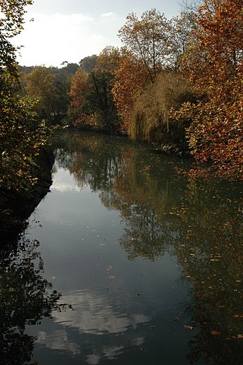
Nivelle at Ascain
|
|
| Countries | Spain and France |
| Physical characteristics | |
| Main source | Western Pyrenees 520 m (1,710 ft) |
| River mouth | Bay of Biscay 43°23′15″N 1°40′9″W / 43.38750°N 1.66917°W |
| Length | 39 km (24 mi) |
| Basin features | |
| Basin size | 233 km2 (90 sq mi) |
The Nivelle is a river that flows through parts of Spain and France. It is about 39 kilometers (24 miles) long. The river starts in the Pyrenees mountains. It then travels mostly from the southeast to the northwest.
Only a small part of the Nivelle, about 7 kilometers (4 miles), can be used by boats. The river begins when several small streams join together in a place called Urdazubi in Navarre, Spain. It then crosses the border into France. Finally, the Nivelle flows into the Bay of Biscay. It reaches the bay near the towns of Saint-Jean-de-Luz and Ciboure. A famous French composer, Maurice Ravel, was born in a house overlooking the river here.
Contents
Understanding the Nivelle's Names
The Nivelle river has many different names in the Basque language. This is even though it is not a very long river. Some of these names include Sarrakaria, Urma, and Uhertsi. The names Ugarana and Urdazuri are also used.
This variety of names shows how the Basque language has been used over time. For a long time, the language was not officially recognized. It was also not taught in schools. Because of this, local people often had their own names for the river. If you ask locals for the river's name in Basque, they might say U(r)handi. This means "big water." This descriptive name has also been used for the nearby Nive River.
Exploring the Nivelle's Climate and Floods
The area around the Nivelle river has a mild climate. The average temperature is about 14 °C (57 °F). This is because humid air from the sea blows over the region. However, when this moist air meets the Pyrenees mountains, it often causes sudden, heavy rain. The area gets a lot of rain each year, about 2,000 mm (79 inches).
Sometimes, the river experiences serious floods. For example, on May 4, 2007, the river banks flooded. This was similar to a flood in 1983. About 170 mm (6.7 inches) of rain fell in just 24 hours near Saint-Pée-sur-Nivelle. Many homes and businesses in the area were damaged. The tourist caves of Urdazubi/Urdax also suffered damage. To help control these floods, the Lurberria dam was built in 2008. This dam helps to hold back the swollen river waters.
Discovering Nivelle's Fish and River Life
The Nivelle river is home to many types of fish. Brown trout are very common, especially in the smaller streams that flow into the river. There are more than 90 of these small brooks. Other fish, like salmon, trout, and shad, live in the lower parts of the Nivelle. These fish are often caught by people who enjoy fishing.
However, there has been a problem with salmon since the 1990s. Fewer salmon are reaching the areas upstream where they lay their eggs. For example, in 1993, about 470 salmon were counted near Saint-Pée-sur-Nivelle. But by 2003, this number dropped to only 88. Many salmon now stay in the river's mouth, or estuary, where they are still fished. Scientists think this change in behavior is due to rising water temperatures and climate change. From 2000 to 2002, the water temperature was above 12 °C (54 °F) for 60% of the days.
See also
 In Spanish: Ugarana para niños
 | Charles R. Drew |
 | Benjamin Banneker |
 | Jane C. Wright |
 | Roger Arliner Young |


