North Cape (Otou) facts for kids
Quick facts for kids North Cape (Otou) |
|
|---|---|

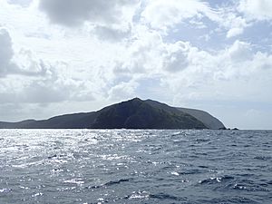
Murimotu Island (foreground) with the Lighthouse just visible on top, Otou just behind the light to the right and Surville Cliffs extending out to the right in the background
|
|
| Coordinates | 34°24′56″S 173°03′04″E / 34.415463°S 173.051111°E |
North Cape is a special place at the very top of the Northland Peninsula in New Zealand's North Island. It's the most northeastern tip of the Aupouri Peninsula. This area is about 30 kilometers east and 3 kilometers north of Cape Reinga, another well-known spot.
The name "North Cape" can mean a few things. Sometimes it refers to the specific cape called Otou in Māori, which looks out over Murimotu Island. It can also mean just the eastern point of Murimotu Island itself. But usually, "North Cape" refers to a larger area. This bigger headland stretches for about five kilometers from Murimotu Island westwards to Kerr Point (Ngatuatata). It also includes the Surville Cliffs. This wider North Cape, especially the Surville Cliffs, is actually the northernmost point of mainland New Zealand. It's about three kilometers further north than Cape Reinga! This article will tell you more about this whole wider North Cape area.
Contents
History of North Cape's Name
North Cape is one of the four main "Cardinal Capes" of New Zealand. These capes were named by James Cook, who was the commander of the ship Endeavour. He named them during his famous voyage between 1769 and 1770. At that time, the other Cardinal Capes were called East Cape, West Cape, and South Cape / Whiore.
How North Cape Was Formed
Long, long ago, North Cape was actually an island. It was created by a volcano that erupted under the sea. Over time, ocean currents carried sand and deposited it. This sand built up and formed a natural land bridge called a tombolo. This particular tombolo is known as Waikuku Flat. It eventually connected the island to the rest of the Aupouri Peninsula. Now, the headland and the flat area together form what we call the North Cape Peninsula.
Protecting Nature at North Cape
A big part of North Cape is protected as the North Cape Scientific Reserve. This reserve was created to keep the unique plants and animals of the area safe. Some of these plants and animals are found nowhere else in the world, especially on the Surville Cliffs.
In 2000, an electric fence was put up around the reserve. This fence helps to create a "mainland island." It keeps out animals like possums, wild pigs, and semi-wild horses that could harm the native wildlife. The Department of Conservation (DoC) manages this reserve, and it is closed to the public to ensure the protection of its special inhabitants.
Much of the Waikuku Flat area is also a DoC reserve, called the Mokaikai Scenic Reserve. This reserve stretches south towards Parengarenga Harbour. Unlike the Scientific Reserve, the Mokaikai reserve is open to visitors. However, to get there by land, you need to cross land owned by Māori tribes. Because of this, you need to get permission from the Māori group in charge before you can cross their land. There's also another strip of Māori land between the Mokaikai reserve and the North Cape reserve. This land includes the southern part of North Cape and the northern edge of Waikuku Flat. It goes from Kerr Point and the north end of Tom Bowling Bay on the north coast all the way to Tokatoka Point on the west coast.
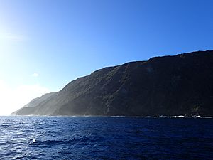
Surville Cliffs: The Northernmost Point
The Hikura / de Surville Cliffs are the northernmost point of mainland New Zealand. They are located right at the tip of North Cape. Sometimes in the past, these cliffs were mistakenly called Kerr Point. However, the real Kerr Point is a short distance away, at the western end of North Cape.
The first European to discover these cliffs was Jean-François-Marie de Surville. He sailed his ship St Jean Baptiste to New Zealand in December 1769. He was looking for a safe place to anchor and care for his sick crew. He found the cliffs just a few days before James Cook saw them.
The cliffs are made of special rocks called serpentinised peridotite. These rocks create a very unique environment. This environment helps many rare and endangered plants to grow. These plants are found only in this small area. Some of these special plants include:
- Pittosporum ellipticum subsp. serpentinum
- Hebe brevifolia
- Hebe ligustrifolia
- Helichrysum aggregatum
- Leucopogon xerampelinus
- Pimelea tomentosa (sand daphne)
- Phyllocladus trichomanoides (tanekaha)
- Pseudopanax lessonii (coastal fivefinger)
- Uncinia perplexa (Surville Cliffs bastard grass)
See also
 In Spanish: Cabo Norte (Nueva Zelanda) para niños
 | Charles R. Drew |
 | Benjamin Banneker |
 | Jane C. Wright |
 | Roger Arliner Young |


