Cape Reinga facts for kids
Quick facts for kids Cape Reinga |
|
|---|---|
| Māori: Te Rerenga Wairua | |
 |
|
| Location | Northland, New Zealand |
| Coordinates | 34°25′44″S 172°40′50″E / 34.4288°S 172.6805°E |
| Offshore water bodies | Tasman Sea |
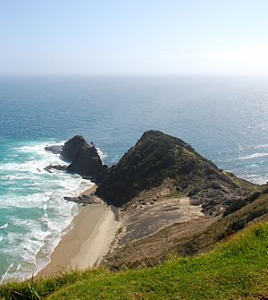
Cape Reinga is a very special place at the top of New Zealand's North Island. It is the northwesternmost tip of the Aupouri Peninsula. The cape is also known by its Māori name, Te Rerenga Wairua. This name means 'the leaping-off place of spirits'. The word 'Reinga' means 'the underworld' in Māori. Both names refer to the Māori belief that this is where spirits go to the afterlife.
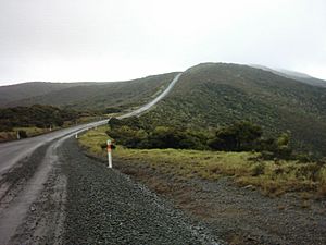
Cape Reinga is over 100 km north of the small town of Kaitaia. You can drive all the way to the cape on State Highway 1. Until 2010, the last part of the road was gravel. Now it is fully sealed, making the trip much easier. You can also reach the cape by driving along Ninety Mile Beach and the Kauaeparaoa Stream bed if you have the right vehicle.
This beautiful cape is a popular spot for tourists. More than 120,000 people visit every year. During busy times, about 1,300 cars arrive each day. The number of visitors keeps growing. Cape Reinga is also on a special list with UNESCO. It is waiting to become a World Heritage Site.
Contents
Where Two Oceans Meet: Tasman Sea and Pacific Ocean
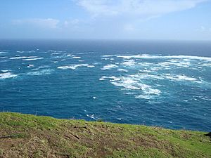
Cape Reinga is famous for being the place where the Tasman Sea and the Pacific Ocean come together. You can see this amazing sight from the lighthouse. The two seas crash into each other, creating rough waters just off the coast.
The Māori people have a special name for this meeting. They call it the coming together of Te Moana-a-Rehua and Te Tai-o-Whitirea. Rehua and Whitirea are like a male and female spirit of the seas.
Many people think Cape Reinga is the northernmost point of New Zealand. But this is not quite right! North Cape is actually further north. Its Surville Cliffs are about 30 km east of Cape Reinga. They are 3 km further north.
Another nearby headland is Cape Maria van Diemen. The Dutch explorer Abel Tasman named it in 1642. He thought it was the northernmost point of the new land he found.
Māori Legends and the Spirit's Journey
Cape Reinga is very important in Māori mythology. It is believed to be the place where the spirits of the dead begin their journey to the afterlife. They travel to the cape and then leap off the headland.
According to the legends, the spirits climb the roots of an 800-year-old pohutukawa tree. From there, they go down to the underworld. They use a path called Te Ara Wairua, which means 'the Spirits' pathway'. This journey takes them back to their traditional homeland of Hawaiki.
After leaving the mainland at Cape Reinga, the spirits make a brief stop. They turn at the Three Kings Islands for one last look back at the land. Then, they continue on their journey.
There was also a special spring on the hillside called Te Waiora-a-Tāne. This means 'the Living waters of Tāne'. It was important in Māori burial ceremonies. The water was used for spiritual cleansing of the spirits. This tradition was practiced all over New Zealand.
Later, when many local people became Christians, the spring was covered. A reservoir was built over it. However, the spring soon disappeared from that spot. It reappeared at the bottom of the cliff, making the reservoir useless.
Protecting a Sacred Place: Restoration Efforts
In 2007, there were concerns from Māori people and a rise in tourists. The Department of Conservation decided to make changes. The public carpark and toilets were on sacred ground. They were moved further away from the cape. The facilities were also made bigger. This project cost NZ$6.5 million.
The road to the cape, State Highway 1, was one of the last parts to be sealed. This work took three years to finish. Over 150,000 plants were planted along the roadside. This helps to stop erosion and protect the land. The new visitor facilities were completed in March 2009.
Lighthouse: A Guiding Light
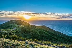
The lighthouse at Cape Reinga was built in 1941. It first shone its light in May of that year. It replaced an older lighthouse on nearby Motuopao Island, which was built in 1879.
In 1987, the Cape Reinga lighthouse became fully automated. This meant that lighthouse keepers were no longer needed there. The old 1000-watt light was replaced with a smaller, 50-watt flashing beacon. It still guides ships safely today.
See also
 In Spanish: Cabo Reinga para niños
 | Madam C. J. Walker |
 | Janet Emerson Bashen |
 | Annie Turnbo Malone |
 | Maggie L. Walker |


