
North Laurel, Maryland facts for kids
Quick facts for kids
North Laurel, Maryland
|
|
|---|---|

North Laurel's All Saints Road and Whiskey Bottom Apartments in August 1998
|
|
 |
|
| Country | |
| State | |
| County | Howard |
| Area | |
| • Total | 6.54 sq mi (16.93 km2) |
| • Land | 6.48 sq mi (16.79 km2) |
| • Water | 0.06 sq mi (0.15 km2) |
| Elevation | 299 ft (91 m) |
| Population
(2020)
|
|
| • Total | 25,379 |
| • Density | 3,915.30/sq mi (1,511.79/km2) |
| Time zone | UTC−5 (Eastern (EST)) |
| • Summer (DST) | UTC−4 (EDT) |
| FIPS code | 24-56725 |
| GNIS feature ID | 1867298 |
North Laurel is a special kind of community called a census-designated place (CDP). It is located in Howard County, Maryland, in the United States. In 2020, about 25,379 people lived there.
North Laurel is right next to the city of Laurel. The Patuxent River separates the two places. This river also forms the border between Howard County and Prince George's County.

Contents
Exploring North Laurel's Location
North Laurel is found in the southern part of Howard County. It is surrounded by several other communities. To the north, you'll find Savage and Columbia. To the west is Scaggsville.
South of North Laurel, across the Patuxent River, is the city of Laurel. To the southeast, in Anne Arundel County, is Maryland City. The Patuxent River creates the southern edge of North Laurel.
North Laurel covers an area of about 16.4 square kilometers (6.3 square miles). Most of this area is land, with a small part being water.
Who Lives in North Laurel?
| Historical population | |||
|---|---|---|---|
| Census | Pop. | %± | |
| 2020 | 25,379 | — | |
| U.S. Decennial Census | |||
North Laurel has grown a lot over the years. In 2010, the population was counted at 20,259 people. By 2020, it had grown to 25,379 residents.
In 2000, there were about 20,468 people living in North Laurel. There were 7,235 households, which are groups of people living in the same home. About 5,281 of these were families.
Many different groups of people live in North Laurel. In 2000, about 33.5% of residents were African American, 32.4% were White, and 17.1% were Asian. About 11.5% of the population was Hispanic or Latino.
Many households in North Laurel had children under 18 living with them. About 57.7% of households were married couples. The average household had about 2.82 people.
The median age in North Laurel in 2000 was 33 years old. This means half the people were younger than 33 and half were older. About 29.9% of the population was under 18.
The median income for a household in 2000 was $66,836. For families, it was $75,068. This shows how much money households and families earned each year.
A Look at North Laurel's Past
Early History and Land Grants
The Patuxent River was first explored and mapped in 1608 by John Smith, a settler from Jamestown. Early English settlers slowly moved north along the river, reaching the area we now call North Laurel.
In the 1620s, the Susquehannock people moved into the area. They were skilled hunters and traded beaver furs with the English. By 1632, Lord Baltimore was giving out land grants in Maryland.
The land in North Laurel was divided into grants in the mid-1700s. These grants had interesting names like Warfield's Range and Wincopion Neck. The oldest building in Howard County, a log cabin from 1696, was once located on Warfield's Range.
A main road connecting Washington and Baltimore was built in 1740. This road, now part of U.S. Route 1, ran along the eastern side of North Laurel. It was used by George Washington and remained important for 200 years.
Farming and Industry
By the 1800s, tobacco farming was very common in North Laurel. However, the farming methods were not good for the soil. This led many farms to change crops or be abandoned.
The opening of the Laurel grist mill in 1811 and the Savage Mill in 1822 brought new jobs to the area. These mills helped create an industrial economy.
Railroad and County Changes
In 1834, workers building the B&O Railroad in North Laurel had conflicts. A group of 60 militia members had to step in to keep the peace. In 1835, the railroad line between Baltimore and Washington was finished.
North Laurel was part of Anne Arundel County until 1860. Then, it became part of the new Howard County.
Developing North Laurel
In 1890, a group tried to create a town called "North Laurel" near the B&O railroad tracks, but it didn't fully happen. The Patuxent Springs became a small place for tourists around that time.
In 1910, a company bought a large farm in North Laurel. They divided it into smaller lots to create a community called Laurel Park. Many of these lots were not developed for a long time. Later, some land was used to build the North Laurel Civic Center and a park.
Also in 1910, Grace "Daisy" Gorman, Senator Arthur Pue Gorman's daughter, built her home called Overlook. This property has been owned by land developer and ambassador Kingdon Gould, Jr. since the 1950s.
By 1963, people expected Howard County to grow a lot. They thought the population would increase from 44,000 to nearly 260,000 by the year 2000.
In 2006, new luxury townhomes were built at Stone Lake. This area used to be a quarry, which is a place where stone is dug out of the ground. The quarry was later filled with water and became a lake.
Images for kids
-
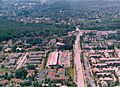
North Laurel's All Saints Road and Whiskey Bottom Apartments in August 1998
See also
 In Spanish: North Laurel (Maryland) para niños
