
Scaggsville, Maryland facts for kids
Quick facts for kids
Scaggsville, Maryland
|
|
|---|---|

Scaggsville, Maryland
Location in Maryland

Scaggsville, Maryland
Location in the United States
|
|
| Country | |
| State | |
| County | Howard |
| Area | |
| • Total | 5.39 sq mi (13.95 km2) |
| • Land | 5.04 sq mi (13.04 km2) |
| • Water | 0.35 sq mi (0.91 km2) |
| Elevation | 367 ft (112 m) |
| Population
(2020)
|
|
| • Total | 9,217 |
| • Density | 1,830.59/sq mi (706.76/km2) |
| Time zone | UTC−5 (EST) |
| • Summer (DST) | UTC−4 (EDT) |
| ZIP code |
20723
|
| Area code(s) | 240, 301 |
| FIPS code | 24-70525 |
| GNIS feature ID | 2583685 |
Scaggsville is a small community in Howard County, Maryland, United States. It is not an official city or town. Instead, it is called an "unincorporated community" and a "census-designated place." This means it's a specific area that the government tracks for population numbers.
Scaggsville is located in the southeastern part of Howard County. It sits between the towns of Laurel and Fulton. Most of Scaggsville is made up of homes, but there are also some businesses. In 2020, about 9,217 people lived there. The area usually uses the ZIP code 20723, which is for Laurel.
Contents
History of Scaggsville
How Scaggsville Got Its Name
Scaggsville is named after the Scaggs family. They moved to the area in the 1830s. They bought about 700 acres (2.8 square kilometers) of farmland. Members of the Scaggs family still live in the region today.
Old Roads and Travel
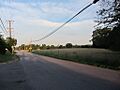
The area was once known as "Hells Corner" during the American Civil War. An old path has run through the town since at least 1795. Today, this path is made up of roads like Lime Kiln Road, Scaggsville Road, and Whiskey Bottom Road.
In the 1800s, Scaggsville was a stop for stagecoaches. These coaches traveled between Washington, D.C. and Baltimore. Travelers would cross the Patuxent River by walking or riding through the water. A wooden bridge was built in 1859, but a flood washed it away in 1868. More bridges were built and washed away by floods. Finally, a strong steel bridge was built.
Scaggsville Today
In 1941, a newspaper reported that Scaggsville had only 15 homes. Today, it has grown a lot. It is now a suburban community with many different neighborhoods.
Where is Scaggsville?
Scaggsville is in the southern part of Howard County. It is next to Fulton on the west and Columbia to the north. To the southeast is North Laurel. To the south, across the Patuxent River, are West Laurel and Burtonsville. The Patuxent River forms the southern border of Scaggsville. It also marks the edge of Howard County.
Major Roads Near Scaggsville
- U.S. Route 29 runs along the western edge of Scaggsville. It goes north about 5 miles (8 kilometers) to Columbia. It also goes south about 19 miles (31 kilometers) to downtown Washington, D.C..
- Interstate 95 is on the eastern side of Scaggsville. It goes northeast about 18 miles (29 kilometers) to downtown Baltimore. It goes southwest about 9 miles (14 kilometers) to Washington's Beltway.
- Maryland Route 216 goes through the middle of Scaggsville. It connects US 29 and I-95. It also leads about 4 miles (6 kilometers) southeast to Laurel.
Population of Scaggsville
| Historical population | |||
|---|---|---|---|
| Census | Pop. | %± | |
| 2020 | 9,217 | — | |
| U.S. Decennial Census | |||
The population of Scaggsville was 9,217 people in 2020.
Why Some People Want to Change the Name
Some people who live in Scaggsville have tried to change its name. They want to call it Rocky Gorge. This is because the community is next to the Rocky Gorge Reservoir. This reservoir is also known as the T. Howard Duckett Reservoir and is part of the Patuxent River. However, these efforts to change the name have not been successful so far.
Images for kids
-
Highridge neighborhood

See also
 In Spanish: Scaggsville para niños
