Northfork, West Virginia facts for kids
Quick facts for kids
Northfork, West Virginia
|
|
|---|---|

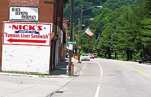
Looking north on Coal Heritage Road in Northfork
|
|
| Nickname(s):
Northfork Blue Demons
|
|

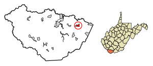
Location of Northfork in McDowell County, West Virginia.
|
|
| Country | United States |
| State | West Virginia |
| County | McDowell |
| Area | |
| • Total | 0.96 sq mi (2.50 km2) |
| • Land | 0.96 sq mi (2.50 km2) |
| • Water | 0.00 sq mi (0.00 km2) |
| Elevation | 1,686 ft (514 m) |
| Population
(2020)
|
|
| • Total | 231 |
| • Density | 348.55/sq mi (134.64/km2) |
| Time zone | UTC-5 (Eastern (EST)) |
| • Summer (DST) | UTC-4 (EDT) |
| ZIP code |
24868
|
| Area code(s) | 304 |
| FIPS code | 54-59428 |
| GNIS feature ID | 1544237 |
Northfork is a small town located in McDowell County, West Virginia, in the United States. You can find it on U.S. Route 52, nestled between the towns of Welch and Bluefield.
The town was officially started in 1901. It got its name because it's situated on the north fork of the Elkhorn Creek, right where it meets the south fork. In 1948, Northfork joined together with the nearby town of Clark. According to the 2020 census, 231 people live in Northfork.
Geography of Northfork
Northfork covers a total area of about 2.50 square kilometers (or 0.96 square miles), and all of it is land. There are no large bodies of water within the town limits.
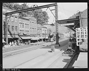
The town is also part of the Norfolk Southern Railway network. This railway was once known as the Norfolk and Western.
Population of Northfork

The number of people living in Northfork has changed quite a bit over the years. Here's a quick look at the population counts from different years:
| Historical population | |||
|---|---|---|---|
| Census | Pop. | %± | |
| 1910 | 425 | — | |
| 1920 | 421 | −0.9% | |
| 1930 | 494 | 17.3% | |
| 1940 | 387 | −21.7% | |
| 1950 | 994 | 156.8% | |
| 1960 | 798 | −19.7% | |
| 1970 | 737 | −7.6% | |
| 1980 | 1,105 | 49.9% | |
| 1990 | 656 | −40.6% | |
| 2000 | 519 | −20.9% | |
| 2010 | 429 | −17.3% | |
| 2020 | 231 | −46.2% | |
| U.S. Decennial Census | |||
In 2010, there were 429 people living in Northfork. About 42% of the residents were White, and about 57% were African American. A very small number of people were Native American or of two or more races.
The average age of people in Northfork in 2010 was about 46 years old. About 23% of the residents were under 18 years old.
Famous People from Northfork
Some well-known people have come from Northfork:
- Charlie Manuel – A famous manager in Major League Baseball (MLB).
- Tom Beasley – A former player for the Washington Redskins football team.
See also
 In Spanish: Northfork (Virginia Occidental) para niños
 | Charles R. Drew |
 | Benjamin Banneker |
 | Jane C. Wright |
 | Roger Arliner Young |


