
McDowell County, West Virginia facts for kids
Quick facts for kids
McDowell County
|
|
|---|---|

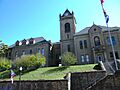
McDowell County Courthouse in Welch
|
|
| Nickname(s):
Free State of McDowell
|
|

Location within the U.S. state of West Virginia
|
|
 West Virginia's location within the U.S. |
|
| Country | |
| State | |
| Founded | February 28, 1858 |
| Named for | James McDowell |
| Seat | Welch |
| Largest city | Welch |
| Area | |
| • Total | 535 sq mi (1,390 km2) |
| • Land | 533 sq mi (1,380 km2) |
| • Water | 1.4 sq mi (4 km2) 0.3%% |
| Population
(2020)
|
|
| • Total | 19,111 |
| • Estimate
(2023)
|
17,439 |
| • Density | 35.72/sq mi (13.792/km2) |
| Demonym(s) | McDowellian (Colloquial) |
| Time zone | UTC−5 (Eastern) |
| • Summer (DST) | UTC−4 (EDT) |
| Congressional district | 1st |

McDowell County is a county in the state of West Virginia, in the United States. As of the 2020 census, about 19,111 people lived there. The main town and county seat is Welch.
McDowell County is the southernmost county in West Virginia. It was created in 1858 by the government of Virginia. It was named after James McDowell, who was a governor of Virginia. In 1863, during the American Civil War, McDowell County became part of the new state of West Virginia. The county is located in the Cumberland Mountains, which are part of the larger Appalachia region.
Over the years, the number of jobs in coal mining has gone down a lot. Because of this, McDowell County's population has also dropped. In 1950, nearly 100,000 people lived there. By 2020, the population was less than 20,000.
Contents
History of McDowell County
How McDowell County Was Formed
McDowell County was created on February 20, 1858. It was formed from the northern part of Tazewell County, Virginia.
In 1861, the country was heading towards the American Civil War. People in McDowell County voted to leave the United States, along with the rest of Virginia. However, many counties in the northwestern part of Virginia wanted to stay with the Union. They decided to form their own state, West Virginia.
McDowell County and seven other southern counties chose not to join the new state right away. The U.S. Supreme Court later decided their status. On June 20, 1863, McDowell County officially became one of the first 50 counties in West Virginia.
Changes to the County Seat
In 1863, the people of McDowell County chose Perryville, which is now called English, as their first county seat. This was the biggest town at the time.
However, the location of the county seat changed a few times. In 1866, the state government moved it to a farm near Mill Creek. It moved back to Perryville in 1874. Finally, in 1892, the county seat was moved to Welch, where it has been ever since.
Local Government Areas
In 1863, West Virginia divided its counties into smaller areas called "civil townships." This was meant to help local governments. But it was hard to do in rural areas with few people. So, in 1872, these townships became "magisterial districts."
McDowell County first had three districts: Big Creek, Elkhorn, and Sandy River. Later, two more were added: Browns Creek and North Fork. In the early 1900s, Adkin District was also created. These districts stayed the same for a long time. In the 1980s, Adkin, Elkhorn, and North Fork were combined into one district called North Elkin.
The "Free State of McDowell"
A local newspaper editor once called McDowell County "the Free State of McDowell." This name became very popular. The exact reason for the name is not fully known.
However, Tom Whittico, who started the first African-American newspaper in West Virginia, said he used the name because African Americans had more voting power and freedoms in McDowell County than in other places in the state. They also faced less segregation there.
McDowell County was also home to the first World War One Memorial built to honor Black soldiers.
Coal Mining and Population Decline
By the early 1900s, coal mining was the main industry in McDowell County. In 1950, it was the top coal-producing county in the United States. About 16% of the county's population worked in coal mining that year.
But over the next few decades, new machines made coal mining easier and fewer workers were needed. By 1960, the number of miners dropped from about 16,000 to 7,000. Many people left the county to find jobs elsewhere. However, some families with strong ties to the area chose to stay.
When John F. Kennedy was running for president, he visited McDowell County. He promised to help the area if he was elected. After he became president, his first executive order created the Food Stamps program. The first people to receive food stamps were in McDowell County.
Geography of McDowell County

McDowell County is the southernmost county in West Virginia. It is located at 37°22′N 81°39′W / 37.37°N 81.65°W. It shares borders with:
- Tazewell County, Virginia (to the south)
- Buchanan County, Virginia (to the west)
- Mingo County (to the northwest)
- Wyoming County (to the north)
- Mercer County (to the east)
The county is part of the Cumberland Mountains, which are a sub-region of the Appalachian Mountains. The highest point in the county is about 1,036 meters (3,399 feet) high. This is on the northwest side of Flat Top Mountain.
The United States Census Bureau says that McDowell County covers a total area of 535 square miles (1,386 square kilometers). Most of this area, 533 square miles (1,380 square kilometers), is land. Only a small part, 1.4 square miles (3.6 square kilometers), is water. The county has a shape like a half-circle, with its borders following the mountains around it.
Population Changes in McDowell County
McDowell County had its largest population in 1950, with almost 99,000 people. However, as jobs were lost in the following decades, the population dropped sharply.
| Historical population | |||
|---|---|---|---|
| Census | Pop. | %± | |
| 1860 | 1,535 | — | |
| 1870 | 1,952 | 27.2% | |
| 1880 | 3,074 | 57.5% | |
| 1890 | 7,300 | 137.5% | |
| 1900 | 18,747 | 156.8% | |
| 1910 | 47,856 | 155.3% | |
| 1920 | 68,571 | 43.3% | |
| 1930 | 90,479 | 31.9% | |
| 1940 | 94,354 | 4.3% | |
| 1950 | 98,887 | 4.8% | |
| 1960 | 71,359 | −27.8% | |
| 1970 | 50,666 | −29.0% | |
| 1980 | 49,899 | −1.5% | |
| 1990 | 35,233 | −29.4% | |
| 2000 | 27,329 | −22.4% | |
| 2010 | 22,113 | −19.1% | |
| 2020 | 19,111 | −13.6% | |
| 2023 (est.) | 17,439 | −21.1% | |
| U.S. Decennial Census 1790–1960 1900–1990 1990–2000 2010–2020 |
|||
Population in 2020
In the 2020 census, there were 19,111 people living in McDowell County. There were 7,483 households and 4,627 families. The population density was about 35.8 people per square mile.
The people living in the county were mostly White (84.7%). About 11.3% were African American. Small percentages were Native American, Asian, or Pacific Islander. About 3.4% of people were of two or more races. People of Hispanic or Latino origin made up 2.0% of the population.
Life Expectancy in McDowell County
In 2013, McDowell County had the lowest life expectancy for both men and women among all 3,142 counties in the United States. Men in McDowell County lived about 63.5 years on average, and women lived about 71.5 years. This is much lower than the national average.
Between 1985 and 2013, life expectancy in McDowell County actually went down. For men, it dropped by 3.2 years, and for women, it dropped by 4.1 years. This is different from the national trend, where life expectancy increased. High rates of smoking and obesity, along with low physical activity, seem to be reasons for this.
In 2020, McDowell County was ranked 55th out of 55 counties in West Virginia for "health outcomes." This ranking looks at how long and how well people live.
Economy of McDowell County

McDowell County has been called a "food desert" by the USDA. This means it's hard for people to find fresh, healthy food. In 2017, there were only two full-sized grocery stores for the entire county, which covers 535 square miles. The county's only Walmart Supercenter, which was the biggest employer, closed in 2016.
There are also not many financial services like banks in the area. In 1999, the only bank in the town of Keystone had to close because of fraud. The bank's managers had lied about its money to make it look like it was making a lot of profit.
Poverty in McDowell County
In 2022, McDowell County was one of the poorest counties in the U.S. It ranked as the 16th poorest out of 3,143 counties. The average yearly income for a household was $28,235. About 37.6% of the people in the county lived in poverty. This is much higher than the average for the U.S. as a whole.
Education in McDowell County
McDowell County Schools manages the public schools in the county. There are 7 elementary schools, 2 middle schools, and 2 public high schools. The high schools are Mount View High School and River View High School. There is also one private school called Twinbranch Pentecostal Christian Academy.
From 2001 to 2013, the state government took control of McDowell County Schools. This happened because the schools needed extra help. Now, some medical services are offered at the schools. This helps students who might not have a car to get to appointments. Also, things like sneakers and backpacks are given to students who need them. In 2022, a new building opened in Welch to help with the shortage of housing for teachers.
Transportation in McDowell County
Main Roads
Several important roads pass through McDowell County:
 U.S. Route 52
 West Virginia Route 16
 West Virginia Route 80
 West Virginia Route 83
 West Virginia Route 103
 West Virginia Route 161
 West Virginia Route 635
The West Virginia Division of Highways is working to build new roads. One example is U.S. Route 121, also known as the Coalfields Expressway.
Airport
McDowell County used to have an airport called Welch Municipal Airport. However, it has been closed for a long time.
Communities in McDowell County
Cities
Towns
Magisterial Districts
- Big Creek
- Browns Creek
- North Elkin
- Sandy River
Census-Designated Places (CDPs)
Unincorporated Communities
- Algoma
- Apple Grove
- Asco
- Ashland
- Atwell
- Avondale
- Beartown
- Big Four
- Bishop (partial)
- Black Wolf
- Bottom Creek
- Canebrake
- Capels
- Caretta
- Carlos
- Carswell
- Coalwood
- Eckman
- Elbert
- Elkhorn
- English
- Ennis
- Erin
- Faraday
- Filbert
- Gilliam
- Havaco
- Hemphill
- Hensley
- Hull
- Isaban (part)
- Jacobs Fork
- Jed
- Jenkinjones
- Johnnycake
- Jolo
- Kyle
- Landgraff
- Leckie
- Lex
- Lila
- Litwar
- Maitland
- Marine
- McDowell
- Mohawk
- Mohegan
- Monson
- Newhall
- Panther
- Paynesville
- Powhatan
- Premier
- Ream
- Rift
- Rockridge
- Rolfe
- Sandy Huff
- Six
- Skygusty
- Squire
- Superior
- Switchback
- Thorpe
- Twin Branch
- Union City
- Upland
- Vallscreek
- Venus
- Warriormine
- Wilcoe
- Worth
- Yerba
- Yukon
Images for kids
-
McDowell County Courthouse in Welch
See also
 In Spanish: Condado de McDowell (Virginia Occidental) para niños
