Nudgee, Queensland facts for kids
Quick facts for kids NudgeeBrisbane, Queensland |
|||||||||||||||
|---|---|---|---|---|---|---|---|---|---|---|---|---|---|---|---|
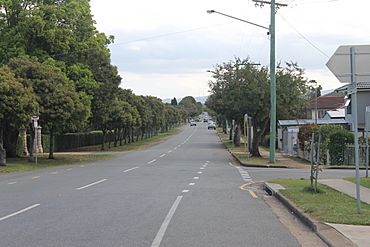
St Vincents Road, outside Nudgee Cemetery
|
|||||||||||||||
| Population | 4,377 (2021 census) | ||||||||||||||
| • Density | 1,122/km2 (2,910/sq mi) | ||||||||||||||
| Postcode(s) | 4014 | ||||||||||||||
| Area | 3.9 km2 (1.5 sq mi) | ||||||||||||||
| Time zone | AEST (UTC+10:00) | ||||||||||||||
| Location | 17.6 km (11 mi) NW of Brisbane CBD | ||||||||||||||
| LGA(s) | City of Brisbane (Northgate Ward) |
||||||||||||||
| State electorate(s) | Nudgee | ||||||||||||||
| Federal Division(s) | Lilley | ||||||||||||||
|
|||||||||||||||
Nudgee is a suburb located in the north-eastern part of Brisbane, Queensland, Australia. It's about 17.6 kilometers (11 miles) north-west of the main city center of Brisbane. In 2021, Nudgee was home to 4,377 people.
Contents
Exploring Nudgee's Location
Nudgee is bordered by the Gateway Motorway to the north-east. This motorway is a major road that helps people travel around Brisbane. To the south-east, the suburb follows Kedron Brook, which is a waterway. Other borders include the Gateway Motorway again, and then it roughly follows Farnshaw Road and Red Hill Road to the south. To the north-west, it's near the Shorncliffe railway line.
A Look Back at Nudgee's History
What's in a Name?
The name Nudgee comes from the Yuggera language, specifically the Yugarabul dialect. It means "place of ducks," with nar meaning "duck" and dha meaning "place."
St Vincent's Orphanage
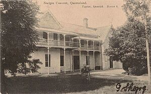
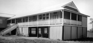
St Vincent's Orphanage, also known as Nudgee Orphanage, opened on Queens Road in 1866. It was a home for children who needed care, run by the Sisters of Mercy. The orphanage even had its own school until the 1950s. Over its time, more than 10,500 children lived there before it closed in 1971. Today, the site is used by Mercy Family Services, which helps children and families. The old orphanage buildings are now listed on the Brisbane Heritage Register because of their historical importance.
Nudgee Cemetery
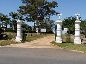
The Nudgee Cemetery was started in 1867 on St Vincents Road. It's a place where people are buried. In 2014, a crematorium was added, which is a facility for cremation.
Nudgee State School
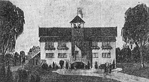
Nudgee State School first opened in 1875. It was located on Nudgee Road. Because of frequent flooding and a growing number of students, new school buildings were built in 1924 on Earnshaw Road. The school eventually closed in 2002 and joined with Banyo State High School to form Earnshaw State College.
St Joseph's College
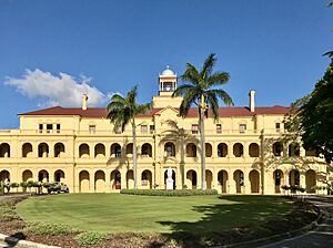
St Joseph's College, also called Nudgee College, started in 1891. It was a boarding school for boys, run by the Congregation of Christian Brothers. Some of its buildings are also listed on the Queensland Heritage Register. While it's known as Nudgee College, the school is actually located in the nearby suburb of Boondall today.
Ancient Bora Rings
Around 1895, a special place called a bora ring was found in Nudgee. Bora rings were important to Indigenous Australians. They were circular areas used for ceremonies, especially for initiating young men into adulthood. The Nudgee bora ring is oval-shaped and is thought to have been used for community gatherings.
Nudgee Golf Club
The Nudgee Golf Club was created in 1930 on land that used to be a grape farm. It started with nine holes, and over time, it grew. In 1985, the Queensland Government needed some of the golf club's land for the Gateway Motorway. After discussions, the club got more land to make up for it, allowing the course to expand to 36 holes.
Local Sports
In 1971, the Banyo Devils Rugby League Club opened on Childs Road in Nudgee. It's a local sports club for rugby league.
Modern Connections
Around 2014, Nudgee was one of the first suburbs in Brisbane to get connected to the National Broadband Network, which provides fast internet.
Who Lives in Nudgee?
In 2021, Nudgee had a population of 4,377 people. Looking back at the 2011 census, about 19.8% of the people were under 15 years old, and 15.4% were 65 or older. Most people (78%) living in Nudgee were born in Australia. Other common birthplaces included New Zealand, England, India, and the Philippines. English was the main language spoken at home by 88.1% of residents.
Places of Historical Importance
Nudgee has several sites that are listed for their historical importance. These "heritage-listed" places are protected because they tell us about the past. Some examples include:
- 10 Hayden Street: Carew Farmhouse
- 15 Hayden Street: Child's Vineyard Residence
- 61 Hayden Street: Nudgee School of Arts & Row of Trees
- 26 Oakmere Street: Glendalough
- 131 Queens Road: former St Vincent's Orphanage
- 18 Railway Street: Fleming Farmhouse
- 40 St Achs Street: Cox's Cottage
- 44 St Achs Street: Emoh
- 491 St Vincents Road: Nudgee Cemetery
Getting Around Nudgee
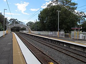
Nudgee has its own train station, Nudgee railway station, which is on the Shorncliffe railway line. This means people can easily travel by train to Brisbane and other places. In 2011, about 18% of people who worked used public transport, while most (60.3%) drove a car to work.
What's in Nudgee?
Nudgee Cemetery
The Nudgee cemetery is on St Vincents Road and is managed by the Roman Catholic Archdiocese of Brisbane. It's the biggest private cemetery in Brisbane. Even though it's run by the Catholic Church, people of all faiths can be buried there.
Nudgee Golf Club
The Nudgee Golf Club is located at 1207 Nudgee Road. It's a popular spot for golf enthusiasts.
Banyo Devils Rugby League Club
Even though it's called the Banyo Devils, this rugby league club is actually located in Nudgee, at 51 Childs Road.
Learning in Nudgee
There are no schools directly within the suburb of Nudgee itself. However, the closest primary and secondary school is Earnshaw State College, which is in the neighboring suburb of Banyo.
Fun Things to Do
You can take tours that explore Indigenous culture in Nudgee, including visits to the ancient bora ring and the Nudgee waterhole. These tours help people learn about the history and traditions of the area's first people.


