Nudgee Beach, Queensland facts for kids
Quick facts for kids Nudgee BeachBrisbane, Queensland |
|||||||||||||||
|---|---|---|---|---|---|---|---|---|---|---|---|---|---|---|---|
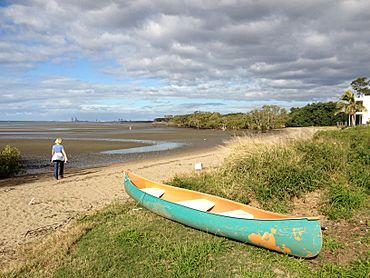
The beach at low tide, 2013
|
|||||||||||||||
| Population | 308 (2021 census) | ||||||||||||||
| • Density | 46.7/km2 (121/sq mi) | ||||||||||||||
| Postcode(s) | 4014 | ||||||||||||||
| Area | 6.6 km2 (2.5 sq mi) | ||||||||||||||
| Time zone | AEST (UTC+10:00) | ||||||||||||||
| Location | 17.9 km (11 mi) NW of Brisbane CBD | ||||||||||||||
| LGA(s) | City of Brisbane (Northgate Ward) |
||||||||||||||
| State electorate(s) | Nudgee | ||||||||||||||
| Federal Division(s) | Lilley | ||||||||||||||
|
|||||||||||||||
Nudgee Beach is a cool suburb and beach area in the city of Brisbane, Queensland, Australia. It's a great spot to visit!
In 2021, about 308 people lived in Nudgee Beach.
Contents
Exploring Nudgee Beach's Geography
Nudgee Beach is located about 17.9 kilometers (11.1 miles) north-west of the main city center. It sits right next to Moreton Bay on its north-east side.
To the south-west, you'll find Kedron Brook, a waterway that flows through the area. The Gateway Motorway also runs along the south-west edge. To the north-west, there's Nundah Creek. Just south of the suburb is the Brisbane Airport.
Waterways and Wetlands
Nudgee Creek starts in the nearby suburb of Nudgee. It winds its way through Nudgee Beach before flowing into Moreton Bay.
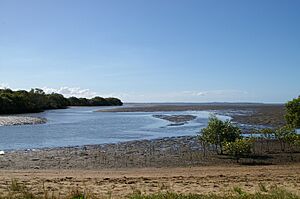
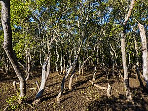
A small residential area is located in the eastern part of the suburb, close to the beach. The rest of Nudgee Beach is mostly mangrove wetlands. The northern part of the suburb is even part of the larger Boondall Wetlands. These wetlands are important natural areas.
You can also find a network of bike tracks here. These tracks connect all the way to the Toombul shopping center.
A Look at Nudgee Beach's History
The name Nudgee comes from the Yuggera language. In the Yugarabul dialect, nardha means place of ducks. This makes sense, as nar means duck and dha means place.
School Days in Nudgee Beach
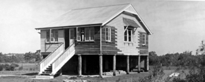
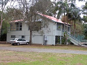
A school called Nudgee Beach Provisional School first opened its doors on April 1, 1926. Later, in 1946, it became Nudgee Beach State School.
The school closed on March 25, 1988. However, it reopened in 1989 as the Nudgee Beach Field Study Centre. In 1992, it was renamed the Nudgee Beach Environmental Education Centre.
Who Lives in Nudgee Beach?
In 2021, the population of Nudgee Beach was 308 people. This is a small and close-knit community.
In 2011, there were 261 people living here. About 48.7% were female and 51.3% were male. The average age was 45 years old. Children under 15 made up 13.8% of the population. People aged 65 and over made up 17.7%.
Most people (77.9%) living in Nudgee Beach were born in Australia. The most common language spoken at home was English (88.8%).
Learning and Education
The Nudgee Beach Environmental Education Centre is located at 1588 Nudgee Road. This center focuses on outdoor and environmental education. It's a great place for students to learn about nature.
There are no regular schools directly in Nudgee Beach. The closest primary and secondary school for students is Earnshaw State College in Banyo.
Fun Things to Do and See
Nudgee Beach offers several amenities for residents and visitors.
Boat and Canoe Access
There is a boat ramp and a floating walkway on Nudgee Beach Road. This allows people to easily launch their boats and access Kedron Brook.
You can also find four canoe ramps in the area:
- One ramp is on Fortitude Street, leading into Moreton Bay.
- Another ramp is on O'Quinn Street, giving access to Nudgee Creek.
- There's also a ramp from the Mangrove boardwalk into Nudgee Creek.
- Finally, a ramp from the Boondal Wetlands leads into Nundah Creek.
These ramps make it easy to explore the waterways by boat or canoe.
 | Shirley Ann Jackson |
 | Garett Morgan |
 | J. Ernest Wilkins Jr. |
 | Elijah McCoy |


