
Oakville, Missouri facts for kids
Quick facts for kids
Oakville, Missouri
|
|
|---|---|

Bee Tree County Park, Oakville, Missouri
|
|

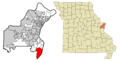
Location of Oakville, Missouri
|
|
| Country | United States |
| State | Missouri |
| County | St. Louis |
| Area | |
| • Total | 17.67 sq mi (45.77 km2) |
| • Land | 15.88 sq mi (41.12 km2) |
| • Water | 1.79 sq mi (4.65 km2) |
| Elevation | 564 ft (172 m) |
| Population
(2020)
|
|
| • Total | 36,301 |
| • Density | 2,286.25/sq mi (882.74/km2) |
| Time zone | UTC-6 (Central (CST)) |
| • Summer (DST) | UTC-5 (CDT) |
| US |
63129
|
| Area code(s) | 314 |
| FIPS code | 29-53876 |
| GNIS feature ID | 2393166 |
| Website | None |
Oakville is a community in south St. Louis County, Missouri, United States. It is known as an unincorporated community, which means it doesn't have its own local government like a city does. It is also a census-designated place (CDP), which is an area the government uses for counting people.
In 2020, about 36,301 people lived in Oakville. It is located about 18 miles south of the city of St. Louis. Oakville is special because it sits near two important rivers: the Mississippi and the Meramec. This area is often called "South County."
Contents
Exploring Oakville's Location and Land
Oakville covers a total area of about 30.93 square miles (79.9 square kilometers). Most of this area is land, about 15.93 square miles (41.2 square kilometers). The rest is water, which includes parts of the nearby rivers.
Who Lives in Oakville?
| Historical population | ||
|---|---|---|
| Year | Pop. | ±% |
| 2000 | 35,309 | — |
| 2010 | 36,143 | +2.4% |
| 2020 | 36,301 | +0.4% |
| Source:
|
||
A Look at the Population
In 2010, there were 36,143 people living in Oakville. These people lived in about 13,788 homes. Many of these homes were families, including married couples and families with children.
The average age of people in Oakville was about 43.7 years old. About 22.8% of the people were under 18 years old. This means many young people and families call Oakville home.
Learning and Education in Oakville
Oakville has many great schools and learning centers for students of all ages.
Local Schools for Students
Oakville is part of the Mehlville School District. This district has two main high schools: Oakville High School and Mehlville High School. Only Oakville High School is actually located within the Oakville area.
Oakville Middle School is also in the Mehlville School District. For younger students, there are three Catholic elementary schools in Oakville: St. Francis of Assisi, Queen of All Saints, and St. Margaret Mary Alacoque.
Community College Options
If you're looking for college courses, St. Louis Community College has a campus nearby. Their South County Education and University Center is located off Meramec Bottom Road.
Public Libraries for Everyone
The St. Louis County Library has a branch in Oakville called the Cliff Cave Branch. It's a great place to find books, study, and learn new things.
Famous People from Oakville
Some well-known people have lived in Oakville, Missouri:
- Pat Maroon – A professional ice hockey player in the National Hockey League.
- Todd Newton – A host for game shows and podcasts.
- Steve Ralston – A professional soccer player for MLS and the U.S. National Team.
- Bridgett Riley – A famous boxer and kickboxer.
Images for kids
-

Bee Tree County Park, Oakville, Missouri
-
Location of Oakville, Missouri
See also
 In Spanish: Oakville (Misuri) para niños
