
Odisha facts for kids
Quick facts for kids
Orissa
ଓଡ଼ିଶା
|
|
|---|---|
|
State of India
|
|

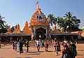
Jagannath Temple, Puri
|
|
.svg)
A map showing us where the location of Orissa is in the Republic of India
|
|

Map of Orissa
|
|
| Country | |
| Region | East India |
| Area | |
| • Total | 155,820 km2 (60,160 sq mi) |
| Population
(2011)
|
|
| • Total | 41,947,358 |
| Time zone | UTC+05:30 (IST) |
| Official languages | Oriya · English |
Odisha, once called Orissa, is a state located on the eastern coast of India. It covers an area of about 155,820 square kilometers. This makes it similar in size to Bangladesh. Odisha is the ninth largest state in India by area. It is also the eleventh most populated state.
The official languages spoken in Odisha are Oriya and English. The capital city of Odisha is Bhubaneswar. The state song is "Bande Utkala Janani."
Odisha is known for its beautiful places. Popular spots for visitors include Puri, Bhubaneswar, and Konark. Konark is even a UNESCO World Heritage Site. Other important cities are Cuttack, Sambalpur, and Raurkela. The state has one main airport, Biju Patnaik International Airport (BBI).
Odisha is surrounded by other states. These include West Bengal, Chhattisgarh, Andhra Pradesh, and Jharkand. The state has also hosted many big sports events. These include the Asian Junior Women's Rugby Tournament and the Men's Hockey World Cup in 2018.


Symbols of Odisha
Every state in India has its own special symbols. These symbols represent the state's unique nature and culture. Odisha also has its own provincial symbols.
State Bird
The state bird of Odisha is the Indian Roller. It is also known as the Blue Jay. This bird is famous for its bright blue feathers. It is often seen in open fields and farmlands.
State Animal
The Sambar deer is the state animal of Odisha. This is a large deer species. It is found in many parts of India. Sambars usually live in forests and woodlands.
State Tree
The state tree of Odisha is the Sacred Fig. This tree is also called the Bodhi tree. It is very important in many religions. It is known for its long lifespan.
State Flower
The provincial flower of Odisha is the Sita-Ashok. This beautiful flower is often used in religious ceremonies. It has a lovely fragrance and bright colors.
-
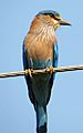
Provincial bird of Odisha
-
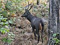
Provincial animal of Odisha
-
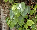
Provincial tree of Odisha
-
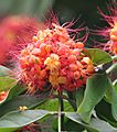
Provincial flower of Odisha


_flowers_in_Kolkata_W_IMG_4146.jpg)
Images for kids
-
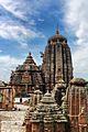
Lingaraja Temple built by King Jajati Keshari
-
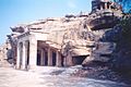
Hathigumpha on the Udayagiri Hills from around 150 BCE
-
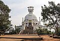
Shanti Stupa at Dhauli where the Kalinga War was fought around 260 BCE
-

Mahanadi river near Cuttack
-
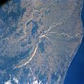
Satellite view of the Mahanadi river delta
-
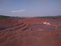
An iron ore mine in Keonjhar district
-
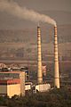
Rourkela Steel Plant
-

Biju Patnaik Airport, Bhubaneswar
-
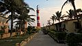
Gopalpur Port
-
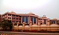
East Coast Railway headquarters, Bhubaneswar
-

Tribal people of Koraput, Odisha
-
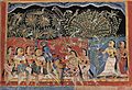
A painting of Gita Govinda
-

A signboard in English and Odia
-
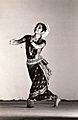
Sharmila Biswas performing Odissi dance
-

Barabati Stadium in Cuttack
-
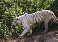
A white tiger in the Nandankanan Zoo
-
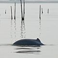
Irrawaddy dolphins found in Chilika
-
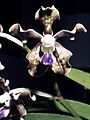
Vanda tessellata, an orchid found in Odisha
-
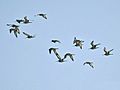
Birds at Chilika Lake
-
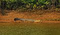
A crocodile in Bhitarkanika National Park
-
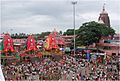
The Rath Yatra in Jagannath Temple, Puri
-
Maa Tarini Temple, Ghatgaon
-
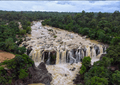
Gundichaghagi waterfall Keonjhar during monsoons


See also
 In Spanish: Odisha para niños
