Okeechobee Waterway facts for kids
The Okeechobee Waterway is a man-made water path that stretches across Florida. It connects the Gulf of Mexico on the west coast, near Fort Myers, to the Atlantic Ocean on the east coast, near Stuart. This waterway allows boats and barges to travel right through the state instead of going all the way around the southern tip of Florida.
The waterway is not very deep, so it's mainly used by barges and private boats. These vessels can be up to 50 feet wide and 250 feet long. They also need to draw less than 10 feet of water, meaning they can't go deeper than 10 feet into the water. This is because some parts of the waterway, especially the special water elevators called locks, are only about 10 feet deep.
The Okeechobee Waterway system includes the Caloosahatchee River to the west of Lake Okeechobee and the St. Lucie Canal (C-44) to the east. It actually goes right through Lake Okeechobee itself!
You can find a map of the Okeechobee Waterway by clicking here. Interestingly, the northern edge of this canal marks the official southern boundary of the Eastern Continental Divide. This is a line that separates where rainwater flows: north of the line, water flows towards the Atlantic Ocean or Gulf of Mexico via northern rivers, and south of the line, it flows towards the Everglades or southern parts of Florida.


Contents
Building the Waterway
The Okeechobee Waterway was completed in 1937. Its main goal was to create a direct water path across Florida. This saved boats a long trip around the southern end of the state.
Who Manages the Waterway?
The Okeechobee Waterway and Lake Okeechobee are part of a big system that manages water in Florida. This system is called the Central and Southern Florida Flood Control Project. It covers a huge area, about 16,000 square miles! This area starts south of Orlando and goes all the way down through the Kissimmee River Basin to the Everglades National Park and Florida Bay.
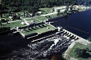
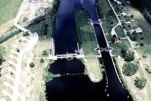
The U.S. Army Corps of Engineers helps manage this waterway. They are in charge of five important locks and dams along the Okeechobee Waterway.
What are Locks and Dams?
Locks are like water elevators for boats. They help boats move between different water levels. Dams are barriers that control the flow of water and help manage water levels.
St. Lucie Lock and Dam
The St. Lucie lock was built in 1941 to help boats navigate and to control floods. A connecting structure called a spillway was added in 1944. This spillway helps manage the water level in Lake Okeechobee by controlling how much water flows through the St. Lucie Canal.
Port Mayaca Lock and Dam
The Port Mayaca Lock and Dam was built in 1977. It helps boats travel and allows the water levels in Lake Okeechobee to be raised. It also helps control the effects of higher lake levels along the St. Lucie Canal.
Ortona Lock and Dam
The Ortona Lock and Dam were built in 1937 for navigation. In 1934, Captain James B. Cox helped dredge, or clear out, the locks. He also worked on the Herbert Hoover Dike, which is a large levee around Lake Okeechobee.
Moore Haven Lock and Dam
The Moore Haven Lock and Dam were built in 1935. They are used for both navigation and flood control.
W.P. Franklin Lock and Dam
The W.P. Franklin Lock and Dam were built in 1965. Their purposes include controlling floods, managing water levels, preventing saltwater from getting into freshwater, and helping boats navigate.
 | John T. Biggers |
 | Thomas Blackshear |
 | Mark Bradford |
 | Beverly Buchanan |

