Old Stone Fort (Tennessee) facts for kids
Quick facts for kids |
|
|
Old Stone Fort
|
|
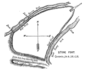
Map of the fort from Joseph Jones's Explorations of the Aboriginal Remains of Tennessee (1876)
|
|
| Location | 732 Stone Fort Drive |
|---|---|
| Nearest city | Manchester, Tennessee |
| Built | 0-499 A.D. |
| Website | Old Stone Fort |
| NRHP reference No. | 73001757 |
| Added to NRHP | 1973 |
The Old Stone Fort is an amazing ancient structure built by Native Americans long ago. You can find it in Coffee County, Tennessee, in the southeastern part of the United States. Experts believe it was built between the years 80 and 550 AD. This time period is known as the Middle Woodland period.
This fort is special because it's the most complex hilltop enclosure found in the South. It was probably used for important ceremonies, not just for protection. Today, the Old Stone Fort is part of the Old Stone Fort State Archaeological Park. This is one of only two state archaeological parks in Tennessee. The site is also recognized on the National Register of Historic Places.
Contents
Where is the Old Stone Fort Located?
The Old Stone Fort sits on a piece of land shaped like a finger. This land is surrounded by two rivers: the Duck River and the Little Duck River. The Duck River forms the northwest side, and the Little Duck River forms the southeast side. A bend in the Little Duck River also makes up the southern edge.
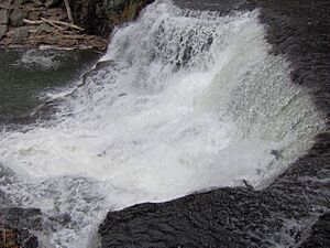
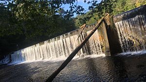
The area inside the fort's walls covers about 50 acres (200,000 square meters). Both the Duck and Little Duck rivers flow over a rocky shelf. This creates beautiful waterfalls and fast-moving water in the gorges around the fort. These powerful rivers were used to run mills in the 1800s.
The Old Stone Fort is entirely within Coffee County, just west of Manchester, Tennessee. The state park covers 876 acres (3.5 square kilometers). The Tennessee Department of Environment and Conservation manages this important historical site.
What Does the Old Stone Fort Look Like?
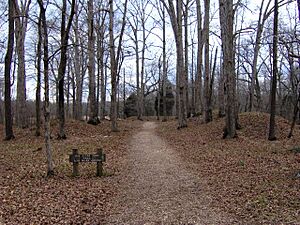
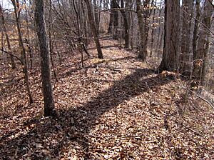
The walls of the Old Stone Fort are made of stone and earth. They are usually about 4 to 6 feet (1.2 to 1.8 meters) high. Originally, they had layers of stacked rocks on the inside and outside. Gravel and dirt filled the space between these rock layers. Over many years, the dirt has spread, making the walls look like gentle mounds today.
The walls have three main parts. Two sections run along the Duck and Little Duck Rivers. A third section follows the southern edge of the land. The river-side walls curve inward, getting closer to each other at the northeast part of the area. They stop just before meeting, leaving a small opening for an entrance.
At this entrance, there are two ancient "pedestal" mounds. One is 35 feet (11 meters) wide, and the other is 48 feet (15 meters) wide. These mounds are on either side of the entrance. The entrance then leads through a 120-foot (37-meter) L-shaped path into the fort's center.
The walls along the Duck River are about 1,394 feet (425 meters) long. The walls along the Little Duck River are about 1,094 feet (333 meters) long. The southern walls are mostly straight and are 2,116 feet (645 meters) long. Some parts of the fort's edge were left open. This is because they overlooked very steep cliffs created by the rivers. The rivers themselves acted as a natural defense in these spots.
There's also a large ditch, sometimes called a "moat," that runs along the southern wall. This ditch is actually a natural old river channel. We don't know if the ancient builders kept it clear on purpose.
The Old Stone Fort Through History
When European explorers and traders first came to this area in the mid-1700s, many trails crossed the land. One important trail passed right by the Old Stone Fort. This made the fort a key landmark for early travelers in Middle Tennessee.
During the Cherokee–American wars, a group of soldiers led by Major James Ore camped inside the Old Stone Fort. This was on their way to fight the Chickamauga towns. The fort was also important to the first people who lived in Coffee County. The county's first court met at the "Old Stone Fort Tavern" in 1836.
The powerful Duck River made the fort's location great for mills. In 1823, Samuel Murray built a rope factory there. Later, in 1852, W.S. Whitman built a paper mill. During the Civil War, Whitman even built a factory to make gunpowder for the Confederacy. Union soldiers destroyed it in 1863.
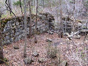
In 1879, the Stone Fort Paper Company built a large mill near Big Falls. This mill made paper for newspapers across the Southeast until the early 1900s. You can still see the mill's old foundations today from the Old Stone Fort Loop Trail.
The Chumbley family eventually owned the land with the Old Stone Fort. They wanted to protect it and turned down many offers to buy the land. In 1966, the State of Tennessee bought 400 acres (1.6 square kilometers) from the Chumbley family. This land became the heart of Old Stone Fort State Archaeological Park. The Old Stone Fort was officially added to the National Register of Historic Places in 1973.
Who Built the Old Stone Fort and Why?
Who Were the Builders?
For a long time, the Old Stone Fort was a mystery. People had many ideas about who built it. Some thought Buccaneers from Spain built it after a shipwreck. Others wondered if Vikings had built stone structures in North America, including this one.
The first serious study of the fort was done by Joseph Jones in 1876. He found several ancient artifacts. Later, in 1928, Tennessee State Archaeologist P.E. Cox also studied the fort.
In 1966, after the state bought the fort, the University of Tennessee began a big investigation. They dug trenches and did a lot of research. They finally figured out that Native Americans from the Middle Woodland period were the builders. Charles Faulkner, a team member, explained why:
- They used radiocarbon dating on charcoal found in the walls. This showed the fort was built between 30 and 430 AD.
- The fort's design and location are like other structures built by Middle Woodland cultures. These include the Hopewell people in Ohio and the builders of Pinson Mounds in West Tennessee.
- Between 1966 and 1971, five Middle Woodland villages were found near the fort. One large village was just 3 miles (4.8 kilometers) downstream.
The University of Tennessee team believes the fort was built slowly over several hundred years. Two different local Middle Woodland groups, the McFarland and the Owl Hollow cultures, likely worked on it. The McFarland culture started in the 1st century AD, and the Owl Hollow culture finished it.
What Was the Fort Used For?
For many years, people thought the fort was used for military defense. But the 1966 excavations showed it was more likely used for religious or ceremonial events. Charles Faulkner gave these reasons:
- Defensive forts are usually built quickly when there's danger. But the Old Stone Fort was built slowly over centuries.
- The walls are not tall enough for good defense. Also, there was no sign of a wooden fence (palisade) that would have helped protect it.
- The area inside the walls is very large. It would have taken a huge fighting force to defend it, more than a typical Middle Woodland group would have had.
- Very few everyday items were found inside the walls during the excavations. This suggests the area was kept clean and not lived in all the time.
The ditch along the southwestern edge was once thought to be man-made. However, researchers now believe it's a natural dry riverbed.
The Old Stone Fort Museum
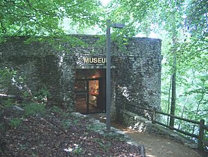
The Old Stone Fort Museum is located near the park's entrance. It was built by Tennessee State Parks. Inside, you can learn about the different ideas of who built the fort. You'll also see information about the archaeological digs and the history of early Native Americans. The museum has a small theater, a gift shop, and an observation deck. From the deck, you can see the Old Stone Fort, the rivers, and the beautiful Blue Hole Falls.
See also
 | Calvin Brent |
 | Walter T. Bailey |
 | Martha Cassell Thompson |
 | Alberta Jeannette Cassell |


