Pinson Mounds facts for kids
Quick facts for kids Pinson Mounds State Archaeological Park |
|
|---|---|
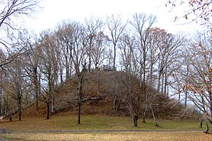
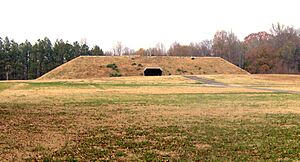
Sauls' Mound (Mound 9) at the park
|
|
| Type | Tennessee State Park |
| Location | Pinson, Tennessee |
| Area | 1,200 acres (4.9 km2) |
|
Pinson Mounds
|
|
| Location | Madison County, Tennessee |
| Built | 0-499 AD |
| Website | Pinson Mounds State Park |
| NRHP reference No. | 66000727 |
| Significant dates | |
| Added to NRHP | October 15, 1966 |
| Designated NHL | January 29, 1964 |
The Pinson Mounds are a fascinating place in Madison County, Tennessee. It's a huge area with many ancient earth mounds built by Native American people long ago. These mounds were created during the Middle Woodland period, which was about 1,500 to 2,000 years ago (around 1-500 AD).
This amazing complex has 17 mounds, a large earthen wall shaped like a geometric figure, and places where people used to live. It's the biggest group of Middle Woodland mounds in the entire United States! One of the mounds, called Sauls' Mound, is 72 feet (22 m) tall. It's the second-tallest ancient mound still standing in the U.S.
Today, the Pinson Mounds are protected as the Pinson Mounds State Archaeological Park. This park is a special place where you can learn about the past. It's also a National Historic Landmark, meaning it's very important to the history of the country.
Contents
Exploring the Pinson Mounds Site
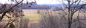
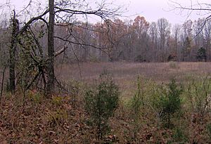
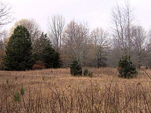
The Pinson Mounds are located on high ground next to the South Fork of the Forked Deer River. This river has wet, swampy areas nearby. The land around the mounds is very diverse. You can find oak forests on the higher parts, cypress trees in the wet lowlands, and beech forests on the slopes. The soil here is known for having good quality clay.
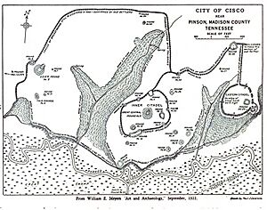
The whole area of the mounds can be thought of in three main parts. There's the Inner section in the middle, which includes Sauls' Mound. Then there's the Western section, also called Ozier. Finally, there's the Eastern section, which has the large geometric enclosure. A small stream called Hudson Branch separates the Inner and Western sections. Both the Eastern and Western sections are about 1,500 meters away from the Inner section.
Pinson Mounds State Archaeological Park is managed by the Tennessee Department of Environment and Conservation. It's about 2.5 miles east of the town of Pinson, Tennessee and 10 miles southeast of Jackson, Tennessee.
Amazing Ancient Structures
The Pinson Mounds complex covers about 400 acres (1.6 km2). Archaeologists have found at least 30 mounds here. At least 17 of these were built by ancient people. The mounds vary a lot in size, from the huge 72-foot Sauls' Mound to small bumps that are hard to see. Most of these mounds were likely built between 100 and 300 AD. This is based on radiocarbon dating and the many tools and pottery pieces found from that time.
Let's look at some of the most important features at Pinson Mounds:
The Inner Complex Mounds
- Sauls' Mound (Mound 9): This is the biggest mound and sits right in the middle of the complex. It's named after John Sauls, who owned the land before it became a park. Sauls' Mound is the second-tallest ancient mound in the U.S. It's shaped like a rectangle, and its corners point towards the four main directions (north, south, east, west). People think it was used for special ceremonies. Today, visitors can climb to the top and enjoy the view from a platform. It measures about 112 by 91 meters at its base and is 22 meters tall.
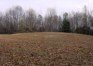
- Mound 10: This mound is just east of Sauls' Mound. It was probably a platform mound used for ceremonies. It measures about 61 by 40 meters at its base and is 1.3 meters tall.
- Mound 11 Sector: Located north of Sauls' Mound, this area was a natural hill. It's believed people lived here during the Middle Woodland period.
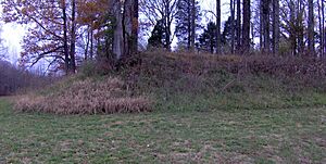
- Mound 12: This mound is southwest of Sauls' Mound. It was a burial mound, built on top of an even older living area. It measures about 23 by 17 meters at its base and is 1.3 meters tall.
- Mound 14 Sector: This area, also southwest of Sauls' Mound, was a place where people lived later, during the late Woodland and early Mississippian times.
The Eastern Section Mounds
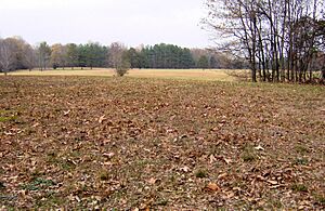
- The Eastern Citadel: This is a large, circular earthen wall located about 1,500 meters east of Sauls' Mound. It was named by William Myer in the early 1900s. Even though it's called a "citadel," archaeologists think it was mostly used for ceremonies, not for defense. The walls form a nearly perfect circle, about 366 meters across. They are about 1.5 meters tall on average.
- Mound 29: This is a rectangular platform mound on the eastern edge of the Eastern Citadel. It lines up with Sauls' Mound in the direction where the sun rises during the equinox (when day and night are equal). It measures about 49 by 52 meters at its base and is 3.5 meters tall.
- Mound 28: This rectangular platform mound is about 1,500 meters northeast of Sauls' Mound. It almost lines up with Sauls' Mound in the direction of the summer solstice sunrise (the longest day of the year). It measures about 62 by 65 meters at its base and is 4 meters tall.
The Western (Ozier) Section Mounds
- The Ozier Mound (Mound 5): This is a rectangular platform mound with a ramp facing northeast. At 33 feet tall, it's the second-largest mound in the entire complex. It measures about 80 meters across and is 10 meters tall.
- The Twin Mounds (Mound 6): These are two cone-shaped mounds located south of the Ozier Mound. They were used as burial mounds. Their base is about 30 by 50 meters.
- Mound 31: This is another burial mound, also south of the Ozier Mound. Its base is about 40 by 60 meters.
- The Cochran Area: This site is west of the Ozier Mound. It's believed to have been a temporary living area. It covers about 5,000 square meters.
Pinson Mounds in Recent History
After the Chickasaw people moved from West Tennessee in 1818, a man named Joel Pinson came to survey the land. He "discovered" the mound complex in 1820, and it was named after him. For a while, not many people paid attention to the mounds. But in the late 1800s, a journalist from Jackson, Tennessee, named J.G. Cisco, started writing about them. His articles caught the attention of the Smithsonian Institution.
In 1916, the Smithsonian sent an archaeologist named William E. Myer to study the site. Myer believed that the entire complex was built with a careful plan. He even created a map of the site. Later, in 1947, the Tennessee Division of Forestry bought the Western section of the Pinson site.
Archaeological Discoveries
In 1961, archaeologists Fred Fisher and Charles McNutt from the University of Tennessee began the first big excavation at Pinson Mounds. They dug in the Mound 14 Sector and found the remains of a house. It was about 21 by 18 feet and had a central fireplace and storage pits. By using radiocarbon dating on charcoal and looking at the many artifacts, they figured out that the Pinson Mounds were built during the Middle Woodland period (around 1-500 AD).
More excavations happened in 1963 with archaeologists Dan Morse and Richard Polhemus. They found what they thought was an oval-shaped house, a large fireplace, and various trash pits. They also agreed that most of the mounds were built during the Middle Woodland period. In 1965, the state bought the land from the Williams and Saul families. It was added to the National Register of Historic Places that same year.
In the 1970s, John Broster from the Tennessee Division of Archaeology did a lot of research in the Western section and the Mound 12 Sector. He found a human cremation pit and signs that people lived at Mound 12 even earlier. Broster's team also found many unique artifacts in the Cochran area. This suggests that Pinson Mounds might have been a place where special items were made for burials, or even a trading center for the region.
In the 1980s, Robert Mainfort discovered six tombs in the Twin Mounds. One tomb held the remains of eight young women wearing headdresses with copper decorations. Another tomb had four older men, one of whom was buried with two round rattles that had abstract designs. Mainfort also found a single burial in Mound 31 and evidence of food offerings at the bottom of the mounds.
Before new park buildings were constructed, more digging happened. This uncovered a possible living area at Mound 11 and many items from the 1800s. In the late 1990s, four more mounds were confirmed to be ancient, bringing the total to 17.
Why Were the Pinson Mounds Built?
The Native Americans of the Middle Woodland period most likely built the Pinson Mounds for religious ceremonies. We don't know all their reasons for sure. The Ozier Mound, for example, has no burials. Its flat top and ramp suggest it was used as a ceremonial platform. It's one of the oldest such mounds in the Eastern Woodlands. At least three other mounds (6, 12, and 31) contain burials or cremations. Archaeologists haven't found many everyday items like arrowheads or pottery pieces. This suggests that people didn't live at Pinson Mounds all the time.
Some clues suggest that the way the Pinson Mounds are laid out might be connected to the stars and the sun. This could show how the people understood the universe, much like at other ancient mound sites such as Cahokia. For example, the corners of Sauls' Mound point exactly to the four main directions. The Eastern and Western sections are also about the same distance (1,500 meters) from the Inner complex. Mound 29 in the Eastern section lines up with Sauls' Mound in the direction of the equinox sunrise. Mound 28 almost lines up with Sauls' Mound in the direction of the summer solstice sunrise.
Pinson Mounds State Archaeological Park Today
The park's museum is built to look like a platform mound. Inside, you can see artifacts found during the excavations at Pinson Mounds. There are also other ancient items from the region. The museum also houses the West Tennessee Regional Archaeology offices and a library focused on archaeology.
The park has about 6 miles of walking trails. These trails let you explore the mounds and other interesting features. South of Sauls' Mound, there's a boardwalk where you can look out over the South Fork of the Forked Deer River and its wetlands. Every September, the park hosts "Archaeofest," a special event that celebrates the ancient people who built these amazing mounds.
See also
 | Anna J. Cooper |
 | Mary McLeod Bethune |
 | Lillie Mae Bradford |


