
Olmito, Texas facts for kids
Quick facts for kids
Olmito, Texas
|
|
|---|---|

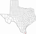
Location of Olmito, Texas
|
|
 |
|
| Country | United States |
| State | Texas |
| County | Cameron |
| Area | |
| • Total | 0.7 sq mi (1.9 km2) |
| • Land | 0.7 sq mi (1.7 km2) |
| • Water | 0.08 sq mi (0.2 km2) |
| Elevation | 30 ft (9 m) |
| Population
(2020)
|
|
| • Total | 1,021 |
| • Density | 1,390/sq mi (537/km2) |
| Time zone | UTC-6 (Central (CST)) |
| • Summer (DST) | UTC-5 (CDT) |
| ZIP code |
78575
|
| Area code(s) | 956 |
| FIPS code | 48-53964 |
| GNIS feature ID | 1375292 |
Olmito is a small community in Cameron County, Texas, United States. It's known as a census-designated place (CDP). This means it's an area that looks like a town but isn't officially a city with its own local government.
The name Olmito comes from Spanish and means "little elm." In 2020, about 1,021 people lived there. Olmito is also famous for calling itself the "mesquite capital of the world." Mesquite is a type of tree common in the area.
Contents
Where is Olmito Located?
Olmito is found in the southern part of Cameron County, Texas. It's located at coordinates 26.019655 degrees North and -97.534690 degrees West.
A major highway, Interstate 69E, runs along the eastern side of Olmito. This highway connects Olmito to other nearby towns. For example, it's about 10 miles (16 km) northwest to San Benito and 9 miles (14 km) south to Brownsville.
Land and Water Around Olmito
The community covers a total area of about 1.9 square kilometers (0.73 square miles). Most of this area, about 1.7 square kilometers (0.66 square miles), is land. The rest, about 0.2 square kilometers (0.077 square miles), is water.
You can find Olmito Lake in the northern part of the community. Also, the Resaca del Rancho Viejo, which is an old channel of the Rio Grande river, forms the western edge of Olmito.
Who Lives in Olmito?
| Historical population | |||
|---|---|---|---|
| Census | Pop. | %± | |
| 2000 | 1,198 | — | |
| 2010 | 1,210 | 1.0% | |
| 2020 | 1,021 | −15.6% | |
| U.S. Decennial Census 1850–1900 1910 1920 1930 1940 1950 1960 1970 1980 1990 2000 2010 2020 |
|||
Olmito was first counted as a census-designated place in the year 2000. The population has changed over the years. In 2000, there were 1,198 people, which grew slightly to 1,210 in 2010. By 2020, the population was 1,021 people.
Most people living in Olmito are of Hispanic or Latino background. In 2020, about 94.61% of the population identified as Hispanic or Latino.
Education in Olmito
Students in Olmito attend schools that are part of the Los Fresnos Consolidated Independent School District. This district provides public education for the area.
In addition to the local schools, the South Texas Independent School District also serves the community. This district operates special "magnet schools" that offer unique learning programs.
Olmito's Climate
The weather in Olmito is generally warm. Summers are hot and humid, meaning they feel sticky and wet. Winters are usually mild to cool, not extremely cold.
This type of weather is called a humid subtropical climate. On climate maps, you might see it labeled as "Cfa."
Images for kids
-
Location of Olmito, Texas
-
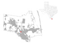
Map of Cameron County showing Olmito
See also
 In Spanish: Olmito (Texas) para niños
