Ongley Island facts for kids

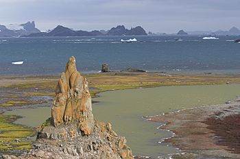
Ongley Island (in the background) from Barrientos Island, Aitcho Islands
|
|
 |
|
| Geography | |
|---|---|
| Location | Antarctica |
| Coordinates | 62°25′48″S 59°53′14.6″W / 62.43000°S 59.887389°W |
| Archipelago | South Shetland Islands |
| Area | 0.44 km2 (0.17 sq mi) |
| Length | 1.35 km (0.839 mi) |
| Width | 0.47 km (0.292 mi) |
| Administration | |
| Administered under the Antarctic Treaty System | |
| Demographics | |
| Population | Uninhabited |
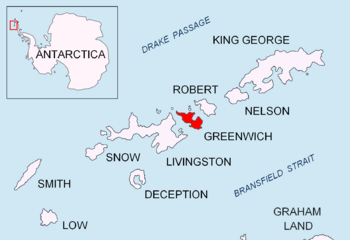
Ongley Island is a tough, rocky island located off the northern coast of Greenwich Island. Both islands are part of the South Shetland Islands in Antarctica. This island is about 1.35 kilometers (0.84 miles) long from west to northwest. It is also about 470 meters (514 yards) wide. The total area of Ongley Island is around 44 hectares (109 acres).
In the early 1800s, people who hunted seals visited this area. The island was named after L.T. Ongley in 1935. He was a cartographer, which means he was a mapmaker, for the Admiralty Hydrographic Department.
Where is Ongley Island?
Ongley Island is located at coordinates 62°25′48″S 59°53′14.6″W / 62.43000°S 59.887389°W. It sits about 3.7 kilometers (2.3 miles) west of Dee Island. It is also 1.73 kilometers (1.07 miles) north-east of Aprilov Point on Greenwich Island.
Other nearby points include Miletich Point on Greenwich Island, which is 2.74 kilometers (1.7 miles) to the northeast. Kabile Island is 2.52 kilometers (1.57 miles) to the east-northeast. Romeo Island is about 5.3 kilometers (3.3 miles) south-east. Finally, Stoker Island is 3.7 kilometers (2.3 miles) to the southwest.
Different countries have mapped this area over the years. These include Britain in 1935 and 1968, Argentina in 1957, Chile in 1971, and Bulgaria in 2005 and 2009.
Maps of the Area
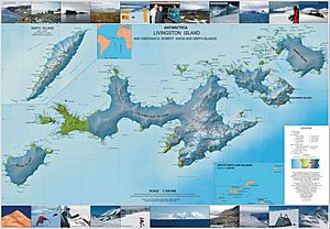
You can find Ongley Island on detailed maps of the region. One such map is:
- L.L. Ivanov et al. Antarctica: Livingston Island and Greenwich Island, South Shetland Islands. This is a topographic map with a scale of 1:100000. It was created by the Antarctic Place-names Commission of Bulgaria in 2005.
 | Laphonza Butler |
 | Daisy Bates |
 | Elizabeth Piper Ensley |


