Opeongo Lake facts for kids
Quick facts for kids Opeongo Lake |
|
|---|---|
 |
|
| Location | Nipissing District, Ontario |
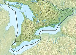
| Coordinates | 45°42′43″N 78°22′16″W / 45.71194°N 78.37111°W |
| Etymology | Algonquian opeauwingauk meaning "sandy narrows" |
| Part of | Saint Lawrence River drainage basin |
| Primary outflows | Opeongo River |
| Basin countries | Canada |
| Surface area | 58 km2 (22 sq mi) |
| Average depth | 14.6 m (48 ft) |
| Max. depth | 49.4 m (162 ft) |
| Surface elevation | 403 m (1,322 ft) |
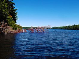
Opeongo Lake is a large lake located in Nipissing District, Ontario, Canada. It is the biggest lake within Algonquin Provincial Park. The Opeongo River starts from this lake. The name "Opeongo" comes from an Algonquian word meaning "sandy narrows."
Contents
About Opeongo Lake
Opeongo Lake has a unique Y-shape with three main parts: the North, East, and South Arms. These arms are connected by narrow sections of water. The lake covers an area of about 58 square kilometers (22 square miles). Its average depth is 14.6 meters (48 feet), and its deepest point reaches 49.4 meters (162 feet).
The main river flowing out of Opeongo Lake is the Opeongo River. It starts from Annie Bay on the East Arm. The flow of water is managed by the Opeongo Lake Dam. This river eventually joins the Madawaska River, which then flows into the Ottawa River.
Visiting Opeongo Lake
Opeongo Lake is a popular spot for outdoor adventures. At Sproule Bay, located at the south end of the South Arm, you can find a store with camping supplies. This area is also Algonquin Park access point 11. The Harkness Laboratory of Fisheries Research is also located here. All these places are easy to reach from Ontario Highway 60.
Because it's so accessible, many people start their canoe trips into the park's wilderness from Opeongo Lake. It's a great starting point for exploring the park's interior.
History of the Lake Area
Opeongo Lake was once planned as the end point for the Opeongo Line. This was one of several roads built to help people settle in this part of Ontario. The lake was also the final stop for the Whitney and Opeongo Railway. This railway was used for logging operations until the 1920s. Today, parts of the old railway route are now part of Ontario Highway 60. The access road connecting the lake to Highway 60 also follows some of this historic path.
Rivers Flowing into Opeongo Lake
Many smaller streams and creeks flow into Opeongo Lake. Here are some of them, listed clockwise from Sproule Bay on the South Arm:
- Costello Creek
- Sproule Creek
- Von Creek
- Graham Creek
- Hailstorm Creek
- Happy Isle Creek
- Wright Creek
- Cameron Creek
 | Dorothy Vaughan |
 | Charles Henry Turner |
 | Hildrus Poindexter |
 | Henry Cecil McBay |


