Ortiz Mountains facts for kids
Quick facts for kids Ortiz Mountains |
|
|---|---|

Ortiz Mountains
|
|
| Highest point | |
| Peak | Placer Peak |
| Elevation | 8,897 ft (2,712 m) |
| Dimensions | |
| Length | 17 mi (27 km) N-S |
| Width | 8 mi (13 km) E-W |
| Geography | |
| Country | United States |
| State | New Mexico |
| Region | Santa Fe County |
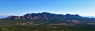
The Ortiz Mountains are a mountain range located in northern New Mexico, United States. They are found in Santa Fe County. These mountains are northeast of the Sandia Mountains. They are also directly north of the San Pedro Mountains. The Ortiz range includes several peaks. The tallest is Placer Peak, which is 8,858 feet high. Other peaks are Lone Mountain (7,310 feet) and Cedar Mountain (7,041 feet). The foothills are called Los Lomas de la Bolsa.
Contents
How the Ortiz Mountains Formed
The Ortiz Mountains are on the east side of the Rio Grande Rift. This "rift" is a large crack in the Earth's crust. To their west are the Santa Domingo and Hagan Basins. The Sandia uplift is to the southwest. The Espanola and Estancia Basins are to the east. These mountains also help separate the water flow. They form a boundary between the Rio Grande and the Pecos River.
The Ortiz Mountains are part of a larger area. This area is called the Ortiz porphyry belt. It is found in Santa Fe County. The mountains are made of special rocks. These are called igneous rocks. They formed from hot, melted rock deep underground. This happened about 30 to 40 million years ago. Other parts of this belt include South Mountain and the San Pedro Mountains. The Cerrillos Hills are also part of it. Later, more melted rock pushed up. This created large rock bodies called stocks. It also made thin, flat rock sheets called dikes. These rocks often contain valuable metals.
History of Gold Mining
People started looking for gold in the Ortiz Mountains a long time ago. The early Spanish settlers used to mine for gold here. The first big gold mining started in 1821. The Ortiz Mine, an underground mine, opened in 1822. By 1832, miners found several gold-rich veins. A "vein" is a crack in a rock filled with minerals.
The Ortiz Mountains had the first gold lode mine in the West. A "lode" mine digs into solid rock to find gold veins. New Mexico's first railroad was also built here. It helped move the gold. A famous inventor, Thomas Edison, even helped. He designed a special mill to separate the gold. But after World War I, mining became too expensive. The gold ore was not very rich. There was also not enough water. Because of this, the last mines closed down.
In 1973, a company called Consolidated Gold Fields started mining again. They opened a large pit at Cunningham Hill. This was the same place the Ortiz Mine had worked. They used a method called "heap and leach." This method uses chemicals to get gold from crushed rock. They collected about 250,000 ounces of gold. The mine closed in 1986. Later, in 1989, other companies explored the area. They dug a new tunnel, or adit, into Carache Canyon. But they stopped due to rules, lawsuits, and lower gold prices.
Nature and Environment
The Ortiz Mountains get about twelve inches of rain each year. At the lowest parts of the mountains, you will find Artemisia shrubs. These areas are called "sagebrush steppe." As you go higher up, the plants change. You will see piñon-juniper woodlands. These are forests with small pine trees and juniper trees.
Ortiz Mountains Educational Preserve
The Ortiz Mountains Educational Preserve (OMEP) opened in 2003. This preserve is a special place for learning about nature. It covers 1,350 acres of land. It was created after a legal agreement. Santa Fe County owns the preserve. The Santa Fe Botanical Garden helps manage it. It is a great place to explore and learn about the local environment.
 | Kyle Baker |
 | Joseph Yoakum |
 | Laura Wheeler Waring |
 | Henry Ossawa Tanner |

