Oswego, Montana facts for kids
Quick facts for kids
Oswego, Montana
|
|
|---|---|

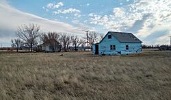
Abandoned house in Owsego Montana
|
|
| Country | United States |
| State | Montana |
| County | Valley |
| Elevation | 2,028 ft (618 m) |
| Time zone | UTC-7 (Mountain (MST)) |
| • Summer (DST) | UTC-6 (MDT) |
| GNIS feature ID | 774988 |
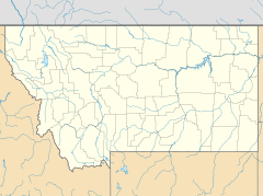
Oswego is a small, unincorporated community in Valley County, Montana, United States. This means it's a settlement without its own local government. You can find it along U.S. Route 2, between the towns of Frazer and Wolf Point. Oswego is also part of the Fort Peck Indian Reservation.
Contents
What's the Story of Oswego?
Oswego was first settled in the 1890s. Early settlers named the village after their hometown, Oswego, New York. A post office served the community from 1896 until 1971.
The Great Fire of 1971
On September 11, 1971, a terrible prairie fire swept through northeastern Montana. This fire destroyed most of Oswego. Only four homes were left untouched. All 75 residents had to leave their homes. After the fire, about 40 people returned to rebuild their lives in Oswego.
Getting Around Oswego
Oswego is located right on U.S. Route 2. This is a major highway that runs through the northern part of Montana.
Train Travel Near Oswego
The Amtrak Empire Builder train line passes through Oswego. This train travels between cities like Seattle and Portland on the west coast, all the way to Chicago. However, the train does not stop in Oswego. The closest train station is in Wolf Point, which is about 12 miles (19 km) to the east.
 | Selma Burke |
 | Pauline Powell Burns |
 | Frederick J. Brown |
 | Robert Blackburn |


