Otoe, Nebraska facts for kids
Quick facts for kids
Otoe, Nebraska
|
|
|---|---|
|
Village
|
|

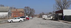
Downtown Otoe
|
|

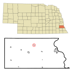
Location of Otoe, Nebraska
|
|
| Country | United States |
| State | Nebraska |
| County | Otoe |
| Area | |
| • Total | 0.16 sq mi (0.41 km2) |
| • Land | 0.16 sq mi (0.41 km2) |
| • Water | 0.00 sq mi (0.00 km2) |
| Elevation | 1,132 ft (345 m) |
| Population
(2020)
|
|
| • Total | 161 |
| • Density | 1,012.58/sq mi (390.18/km2) |
| Time zone | UTC-6 (Central (CST)) |
| • Summer (DST) | UTC-5 (CDT) |
| ZIP code |
68417
|
| Area code(s) | 402 |
| FIPS code | 31-37630 |
| GNIS feature ID | 2399595 |
Otoe is a small village located in north central Otoe County, Nebraska, United States. In 2020, a total of 161 people lived there. It is a quiet place with an interesting past.
Contents
History of Otoe
The village of Otoe was started in 1880. It was built along the planned route of the Missouri Pacific Railroad. This railroad would connect Kansas City to Omaha. The town was first called Berlin. Many of its first residents were German Lutherans.
In 1896, the town grew to 200 people. At this point, it officially became an "incorporated" village. This means it formed its own local government. In 1913, a tornado hit Otoe. It destroyed most of the businesses, but the town rebuilt itself.
Name Change During World War I
When the United States joined World War I, people felt strongly against Germany. This feeling spread to towns with German names, like Berlin. In 1918, a series of fires destroyed a block of the town's main street. Some people thought these fires were caused by those against Germany.
In October 1918, the town changed its name to Otoe. This happened just before the war ended. The area around the town, called Berlin Precinct, kept its original name.
Changes Over Time
Passenger train service to Otoe stopped in 1932. Even with this change, the town kept growing. In 1940, Otoe reached its largest population ever, with 298 people.
After World War II, the number of people living in Otoe started to go down. The high school in Otoe closed in 1958. In the 1960s, the railroad line that ran through Otoe was no longer used.
Geography of Otoe
Otoe is a small village. According to the United States Census Bureau, the village covers about 0.16 square miles (0.41 square kilometers). All of this area is land, with no water.
Population Information
| Historical population | |||
|---|---|---|---|
| Census | Pop. | %± | |
| 1900 | 150 | — | |
| 1910 | 196 | 30.7% | |
| 1920 | 261 | 33.2% | |
| 1930 | 263 | 0.8% | |
| 1940 | 298 | 13.3% | |
| 1950 | 230 | −22.8% | |
| 1960 | 225 | −2.2% | |
| 1970 | 204 | −9.3% | |
| 1980 | 197 | −3.4% | |
| 1990 | 196 | −0.5% | |
| 2000 | 217 | 10.7% | |
| 2010 | 171 | −21.2% | |
| 2020 | 161 | −5.8% | |
| U.S. Decennial Census 2012 Estimate |
|||
Otoe's Population in 2010
The census of 2010 counted 171 people living in Otoe. There were 67 households and 45 families. The population density was about 1068.8 people per square mile. This means many people lived in a small area.
Most of the people in Otoe were White (95.3%). A small number were Native American or from other races. About 2.3% of the population were Hispanic or Latino.
About 28.4% of households had children under 18 living with them. Many households (44.8%) were married couples living together. The average household had 2.55 people. The average family had 3.13 people.
The median age in the village was 36.6 years old. This means half the people were younger and half were older. About 25.1% of residents were under 18. About 18.1% were 65 years old or older. More males lived in Otoe (55.6%) than females (44.4%).
See also
 In Spanish: Otoe (Nebraska) para niños
 | Dorothy Vaughan |
 | Charles Henry Turner |
 | Hildrus Poindexter |
 | Henry Cecil McBay |

