Ouahigouya facts for kids
Quick facts for kids
Ouahigouya
|
|
|---|---|
 |
|
| Country | |
| Region | Nord Region |
| Province | Yatenga Province |
| Founded | 1757 |
| Elevation | 315 m (1,033 ft) |
| Population
(2019 census)
|
|
| • Total | 124,587 |
| Time zone | UTC+0 (GMT) |
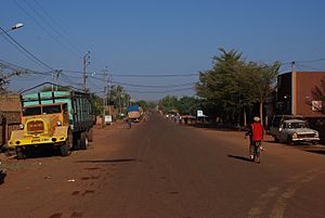
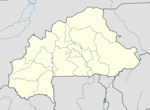
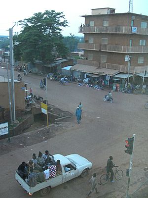
Ouahigouya is a lively city in northern Burkina Faso, a country in West Africa. It's about 182 kilometers (113 miles) northwest of Ouagadougou, the capital city of Burkina Faso. Ouahigouya is the main city of the Yatenga Province and also the biggest town in the Nord Region. With a population of about 124,587 people in 2019, it's the fourth largest city in the country.
The city has a stadium where sports events take place. There is also a special hospital for children, which helps babies being born and cares for kids who are very sick. You can find a post office with internet access and a bank branch in Ouahigouya.
Contents
History of Ouahigouya
Ouahigouya was founded in 1757. It became the capital of Yatenga, which was one of the important Mossi Kingdoms. The name "Ouahigouya" itself means "come and prostrate yourselves." This shows its historical importance as a royal city.
In 1985, during a conflict known as the Christmas War, the city's marketplace was bombed by forces from Mali. This sad event resulted in the deaths of almost 100 people.
Economy and Daily Life
The economy of Ouahigouya mostly depends on farming. However, there are also some businesses and local craft industries.
Farming and Food
Two dams located just north and west of the city help with farming. They provide water for irrigation, which allows people to grow vegetables like tomatoes, carrots, onions, and especially potatoes. However, the region and the city still rely heavily on rainfall. The well-being of the people largely depends on how much rain falls. The main foods grown and eaten here are millet and sorghum, just like in many surrounding areas.
Crafts and Trade
The small craft industry in Ouahigouya mainly focuses on making things from leather and tanning animal hides. There isn't much large-scale industry in the region. What little industry exists is mostly about finding gold, which is done by a big company.
For trade, Ouahigouya benefits from being close to the country's capital, Ouagadougou. There's an asphalt road connecting the two cities, which makes it easy to bring manufactured products from the capital to Ouahigouya and sell them to local people.
Interesting Places to Visit
If you visit Ouahigouya, there are a few interesting spots. You can see the Naaba Kango's tomb, which is a historical burial site. There's also the Yatenga Naba's compound, which is the traditional home of the local leader. The city also has an artificial lake, which is a nice place to see.
Geography and Climate
Ouahigouya is located in a region with a hot semi-arid climate. This means it's generally hot and dry, but it does get some rain.
Weather Patterns
The weather in Ouahigouya can get very hot, especially from March to May, with temperatures sometimes reaching over 40 degrees Celsius (104 degrees Fahrenheit). The coolest months are December and January. Most of the rain falls between June and September, with August being the wettest month. The rest of the year is very dry.
| Climate data for Ouahigouya (1991–2020, extremes 1920–present) | |||||||||||||
|---|---|---|---|---|---|---|---|---|---|---|---|---|---|
| Month | Jan | Feb | Mar | Apr | May | Jun | Jul | Aug | Sep | Oct | Nov | Dec | Year |
| Record high °C (°F) | 40.0 (104.0) |
42.5 (108.5) |
44.3 (111.7) |
45.5 (113.9) |
48.8 (119.8) |
48.0 (118.4) |
40.8 (105.4) |
38.6 (101.5) |
41.3 (106.3) |
41.8 (107.2) |
40.6 (105.1) |
43.6 (110.5) |
48.8 (119.8) |
| Mean daily maximum °C (°F) | 32.3 (90.1) |
35.6 (96.1) |
39.0 (102.2) |
40.8 (105.4) |
40.0 (104.0) |
37.0 (98.6) |
33.7 (92.7) |
31.8 (89.2) |
33.5 (92.3) |
37.0 (98.6) |
36.8 (98.2) |
33.6 (92.5) |
35.9 (96.6) |
| Daily mean °C (°F) | 24.6 (76.3) |
27.7 (81.9) |
31.5 (88.7) |
33.9 (93.0) |
33.5 (92.3) |
31.1 (88.0) |
28.3 (82.9) |
26.8 (80.2) |
27.8 (82.0) |
29.9 (85.8) |
28.6 (83.5) |
25.6 (78.1) |
29.1 (84.4) |
| Mean daily minimum °C (°F) | 17.7 (63.9) |
20.4 (68.7) |
24.4 (75.9) |
27.5 (81.5) |
28.0 (82.4) |
26.0 (78.8) |
23.9 (75.0) |
23.0 (73.4) |
23.4 (74.1) |
24.1 (75.4) |
21.3 (70.3) |
18.4 (65.1) |
23.2 (73.7) |
| Record low °C (°F) | 8.5 (47.3) |
11.2 (52.2) |
13.1 (55.6) |
13.5 (56.3) |
17.0 (62.6) |
15.7 (60.3) |
17.9 (64.2) |
18.6 (65.5) |
18.1 (64.6) |
16.2 (61.2) |
11.2 (52.2) |
10.0 (50.0) |
8.5 (47.3) |
| Average precipitation mm (inches) | 0.1 (0.00) |
0.1 (0.00) |
1.3 (0.05) |
7.1 (0.28) |
39.6 (1.56) |
107.0 (4.21) |
170.4 (6.71) |
238.9 (9.41) |
130.4 (5.13) |
38.8 (1.53) |
1.1 (0.04) |
0.7 (0.03) |
734.8 (28.93) |
| Average precipitation days (≥ 1.0 mm) | 0.0 | 0.1 | 0.2 | 1.1 | 3.6 | 7.1 | 10.9 | 13.1 | 9.1 | 3.5 | 0.1 | 0.0 | 48.8 |
| Average relative humidity (%) | 26 | 22 | 26 | 35 | 52 | 64 | 73 | 80 | 77 | 62 | 40 | 29 | 49 |
| Mean monthly sunshine hours | 276.5 | 259.1 | 266.3 | 249.4 | 265.9 | 246.6 | 246.5 | 226.4 | 246.1 | 280.2 | 285.0 | 284.7 | 3,132.7 |
| Source 1: World Meteorological Organization, Meteo Climat (record highs and lows) | |||||||||||||
| Source 2: Deutscher Wetterdienst (humidity, 1951–1967) | |||||||||||||
Sister Cities
Ouahigouya has one sister city. This means it has a special friendship connection with another city in a different country:
See also
 In Spanish: Ouahigouya para niños
 | Delilah Pierce |
 | Gordon Parks |
 | Augusta Savage |
 | Charles Ethan Porter |


