Owey Island facts for kids
|
Native name:
Uaigh
|
|
|---|---|
 |
|
| Geography | |
| Location | Atlantic Ocean |
| Coordinates | 55°03′17″N 8°27′03″W / 55.0547°N 8.4508°W |
| Area | 1.214 km2 (0.469 sq mi) |
| Highest elevation | 102 m (335 ft) |
| Highest point | Moylemore |
| Administration | |
|
Ireland
|
|
| Province | Ulster |
| County | Donegal |
| Demographics | |
| Population | 2 (2021) |
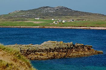
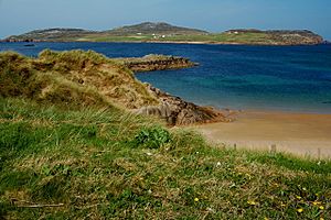
Owey Island (Irish: Uaigh, meaning Cave) is a small island located off the coast of west County Donegal, Ireland. Its name in Irish, Uaigh, means "Cave."
Exploring Owey Island's Landscape
Owey Island covers about 1.2 square kilometers (or 300 acres). It sits close to the Donegal coast, near a place called Kincasslagh. The island's highest point is a hill named Moylemore, which reaches 102 meters high.
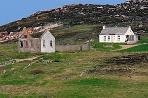
Most of the island's buildings are found on its southern side. The northern part is very rocky and often hit by strong winds. There is no public electricity or water supply on Owey Island.
Island Life: Past and Present
| Historical population | |||||||||||||||||||||||||||||||||||||||||||||||||||||||||||||||||||||||||||||||||||
|---|---|---|---|---|---|---|---|---|---|---|---|---|---|---|---|---|---|---|---|---|---|---|---|---|---|---|---|---|---|---|---|---|---|---|---|---|---|---|---|---|---|---|---|---|---|---|---|---|---|---|---|---|---|---|---|---|---|---|---|---|---|---|---|---|---|---|---|---|---|---|---|---|---|---|---|---|---|---|---|---|---|---|---|
|
|
|
|||||||||||||||||||||||||||||||||||||||||||||||||||||||||||||||||||||||||||||||||
| Source: | |||||||||||||||||||||||||||||||||||||||||||||||||||||||||||||||||||||||||||||||||||
The table above shows how the number of people living on Owey Island has changed over time. The information comes from old records and the Census of Ireland.
Owey Island had people living there all year round until the mid-1970s. After that, it became a place where people mostly stayed part-time, especially during the summer. Many of these part-time residents own old cottages. These homes were passed down from their ancestors who used to live on the island permanently.
Owey Island's History

In the past, life on Owey Island was simple but good for over 100 people. The waters around the island had lots of fish. The land was fertile because people used seaweed to help grow vegetables.
Islanders used turf (dried peat) to heat their homes. Some even used it to heat equipment for making drinks like single malt and other liquors.
Owey Island once had its own post office and a school. The school closed in 1971, but its remains can still be seen. It had only one teacher who taught children of all primary school ages. For secondary school, children had to travel to the mainland.
 | Stephanie Wilson |
 | Charles Bolden |
 | Ronald McNair |
 | Frederick D. Gregory |


