Owyhee Airport facts for kids
Quick facts for kids
Owyhee Airport
|
|||||||||||
|---|---|---|---|---|---|---|---|---|---|---|---|
| Summary | |||||||||||
| Airport type | Public | ||||||||||
| Owner | Shoshone-Paiute Tribes | ||||||||||
| Serves | Owyhee, Nevada | ||||||||||
| Elevation AMSL | 5,377 ft / 1,639 m | ||||||||||
| Coordinates | 41°57′13″N 116°10′55″W / 41.95361°N 116.18194°W | ||||||||||
| Map | |||||||||||
| Runway | |||||||||||
|
|||||||||||
| Statistics (2012) | |||||||||||
|
|||||||||||
|
Source: Federal Aviation Administration
|
|||||||||||
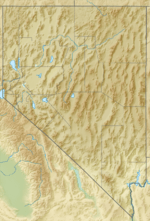
Owyhee Airport (FAA LID: 1ØU) is a small public airport in Nevada, United States. It is located about 4 miles (6.4 km) west of the town of Owyhee. This airport is special because it is owned by the Shoshone-Paiute Tribes. It sits within the Duck Valley Indian Reservation.
The airport is mainly used for general aviation. This means it's for private planes, not big passenger jets.
Airport History
This airport was built around 1942 by the United States Army Air Forces. Back then, it was called Owyhee Flight Strip. It was used as an emergency landing spot for military planes during training flights.
After World War II ended, the airport was closed. It was then given to the local government to use.
Airport Features
Owyhee Airport covers an area of 135 acres (55 hectares). It is located 5,377 feet (1,639 meters) above sea level.
The airport has one runway. It is called 5/23 and has an asphalt surface. The runway is 4,700 feet (1,433 meters) long and 60 feet (18 meters) wide.
In the year ending June 30, 2012, the airport had 50 aircraft operations. This means about 4 planes took off or landed there each month. These were all general aviation flights.
 | Victor J. Glover |
 | Yvonne Cagle |
 | Jeanette Epps |
 | Bernard A. Harris Jr. |


