Paallavvik facts for kids
 |
|
| Geography | |
|---|---|
| Location | Davis Strait |
| Coordinates | 67°06′17″N 062°37′20″W / 67.10472°N 62.62222°W |
| Archipelago | Canadian Arctic Archipelago |
| Administration | |
|
Canada
|
|
| Territory | Nunavut |
| Region | Qikiqtaaluk |
| Demographics | |
| Population | Uninhabited |
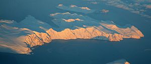
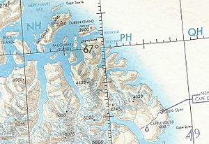
Paallavvik (which means ᐹᓪᓚᕝᕕᒃ in Inuktitut syllabics) used to be called Padloping Island. It is an island in Nunavut, Canada, where no one lives. You can find it in Davis Strait's Merchants Bay, right off the eastern coast of Baffin Island.
A smaller island called Aggijjat is about 7 km (4.3 mi) to the east. To the west, you'll find Auyuittuq National Park.
Contents
Island Size and Location
Paallavvik is a long island, measuring about 4 to 6 km (2.5 to 3.7 mi) in length. It is also quite narrow, only about 1 to 2 km (0.62 to 1.24 mi) wide.
A Look Back: Paallavvik's Past
Paallavvik was once home to an Inuit community. During World War II, it played a small but interesting role.
World War II Airfield Plans
In July 1941, a team from the United States Army Air Forces (USAAF) explored Baffin Island. They were looking for a good spot to build an airport. Captain Elliott Roosevelt led this team. He chose the southern part of Paallavvik as the best place for an airstrip. His plan was to build a 4,000-foot (1,200 m) long runway there.
A team of ten people, including radio and weather experts, arrived on Paallavvik on October 16, 1941. They started sending out regular weather reports. A local Inuk guide named "Vee-Vee" helped the team.
The Crimson Route Project
Paallavvik was meant to be the third stop on an air route called the "Crimson East" air ferry route. This route was planned to help planes fly across the Atlantic Ocean. The station on Paallavvik was given the secret code name "Delight."
However, building a regular landing strip on the island turned out to be too difficult. Instead, they created a 6,000 by 250 ft (1,829 by 76 m) runway made of ice. This ice runway could be used from December to June. Ski-equipped planes started using it in February 1942. But the larger "Crimson" project was stopped in 1943, so the runway was never used for its main purpose. Weather reporting continued throughout the war.
Post-War Operations
After the war, in 1947, the Canadian government decided to take over the weather station from the United States. This transfer was planned for 1949–1950. However, there weren't enough Canadian staff ready. So, the United States agreed to keep running the station until 1951.
In 1953, the Royal Canadian Navy took charge of the station. They called it weather station VFU8. But by 1956, operations on Paallavvik were stopped completely.
Weather data from the original Padloping station was collected from November 1, 1941, to December 31, 1956. Another nearby site, Padloping Site 40, reported weather from December 1, 1955, to February 28, 1958.
Current Status
Today, Paallavvik is listed as a contaminated site. This means the land has some pollution from its past use. The government plans to clean up the site in the future.
 | Aaron Henry |
 | T. R. M. Howard |
 | Jesse Jackson |


