Palisades del Rey, California facts for kids
Quick facts for kids
Palisades del Rey
Surfridge
|
|
|---|---|
|
Former settlement
|
|

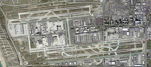
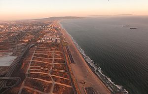
Abandoned streets of Palisades del Rey, visible to the left of Los Angeles International Airport
|
|
| Country | United States |
| State | California |
| County | Los Angeles County |
| City | Los Angeles |
| Elevation | 135 ft (41 m) |
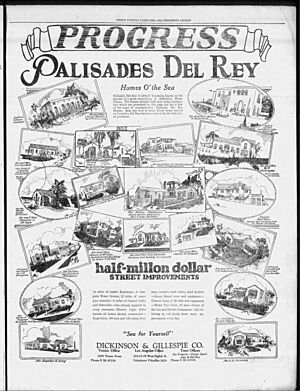
Palisades del Rey was a neighborhood created in 1921. Its name means "Palisades of the King" in Spanish. This area later became part of the Playa del Rey district in Los Angeles County, California. It was located about 135 feet (41 meters) above sea level. Many homes here were custom-built, often as beach houses. Some famous Hollywood actors and producers, like Cecil B. DeMille, owned homes in this area.
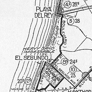
A southern part of Playa del Rey became known as Surfridge. This area was south of the current Playa del Rey and north of El Segundo. It was right next to Los Angeles International Airport (LAX) on its west side. Surfridge was bordered by LAX to the east, Waterview and Napoleon streets to the north, Imperial Highway to the south, and Vista del Mar to the west. The beach next to it is Dockweiler State Beach.
How Surfridge Was Built
Surfridge was developed in the 1920s and 1930s. It was planned as a special place for wealthy people to relax. In 1925, the developers held a contest to name the neighborhood. Someone won $1,000 for suggesting "Surfridge." The Los Angeles Times newspaper said the name was chosen because it was short, sounded nice, and was easy to say. Most importantly, it told the story of this new "wonder city."
Salespeople set up tents on the sand dunes to sell land plots. You could buy a plot for $50 down and then pay $20 each month for 36 months. There were rules about how houses could be built. Their outside walls had to be made of stucco, brick, or stone. Wooden structures were not allowed. Building slowed down when the Great Depression started. But in the early 1930s, more wealthy people began buying plots to build large homes.
The Airport's Impact
Mines Field, a small airport, opened east of Surfridge in 1928. It became a popular spot for residents to watch air shows. After World War II, more and more commercial flights flew into Los Angeles. This meant more planes flew low over Surfridge. Many residents got used to the noise from propeller planes. However, the new jet engines were much louder and harder to ignore.
One business executive, Duke Dukesherer, wrote about Surfridge's history. He said that before the late 1950s, you just had to speak a bit louder to have a conversation. But after the jets arrived, you had to stop talking completely when they took off.
In the 1960s and 1970s, the City of Los Angeles bought the land in Surfridge. They used a process called eminent domain. This means the government can buy private property for public use, even if the owner doesn't want to sell. The city needed the land for airport expansion and to deal with the loud jet noise. Homeowners were forced to sell their properties. Some homeowners sued the city and stayed in their houses for a few years. But eventually, all the houses were either moved or torn down.
A Special Nature Preserve
Today, the Surfridge neighborhood is surrounded by chain-link fences. You can still see the old streets through the fences and from the air. The area is now a protected home for the endangered El Segundo blue butterfly. This means it's a safe place for these rare butterflies to live.
In 2019, several rare burrowing owls were seen nesting in the preserve. California gnatcatchers also live among the restored sand dunes and coastal sage scrub. These birds thrive there despite the noise from the nearby airport.
The only part of the old neighborhood that people can still visit is Vista Del Mar Park. It's a small park with a playground and picnic area on Vista Del Mar Boulevard. The City of Los Angeles takes care of this park.
 | Bessie Coleman |
 | Spann Watson |
 | Jill E. Brown |
 | Sherman W. White |


