
Palo Alto, Pennsylvania facts for kids
Quick facts for kids
Palo Alto, Pennsylvania
|
|
|---|---|
|
Borough
|
|

War Memorial in Palo Alto.
|
|

Location of Palo Alto in Schuylkill County, Pennsylvania.
|
|

Palo Alto, Pennsylvania
Location in Pennsylvania

Palo Alto, Pennsylvania
Location in the United States
|
|
| Country | United States |
| State | Pennsylvania |
| County | Schuylkill |
| Settled | 1844 |
| Incorporated | 1854 |
| Government | |
| • Type | Borough Council |
| Area | |
| • Total | 1.04 sq mi (2.70 km2) |
| • Land | 1.04 sq mi (2.70 km2) |
| • Water | 0.00 sq mi (0.00 km2) |
| Population
(2020)
|
|
| • Total | 970 |
| • Density | 929.12/sq mi (358.63/km2) |
| Time zone | UTC-5 (Eastern (EST)) |
| • Summer (DST) | UTC-4 (EDT) |
| Zip code |
17901
|
| Area code(s) | 570 |
| FIPS code | 42-57752 |
| Website | http://www.paloaltopa.com/ |
Palo Alto is a small town, also called a borough, in Schuylkill County, Pennsylvania, United States. The main street in town is called Bacon Street.
This borough is located along the south bank of the Schuylkill River. Palo Alto has its own fire department. However, it shares its zip code, phone services, and school district with the nearby city of Pottsville.
In 2020, about 971 people lived in Palo Alto.
Contents
History of Palo Alto
Early Days and Growth
Before the mid-1870s, the area where Palo Alto now stands was mostly covered in thick forests. In the early 1800s, there was just a log cabin and a small wooden blacksmith's shop here.
As more people moved to the region, the Philadelphia and Reading Railroad and the Schuylkill Navigation Company (which later became the Schuylkill Canal) started having stops in this area. Because of this, John G. Hewes mapped out and planned the town of Palo Alto between late 1844 and early 1845.
More workers came to build and operate the canal and railroad. Mining companies also hired many miners to work in the coal mines across Schuylkill County. This led to new stores and businesses opening to serve the growing population of Palo Alto.
A public school was built in the eastern part of town during this time of growth.
Becoming a Borough
Palo Alto officially became a borough in 1854. Historians believe it might have been named because of the "very high timber" that grew on the mountain above it. Another idea is that it was named after the Battle of Palo Alto. This was the first big battle of the Mexican-American War, which happened near what is now Brownsville, Texas.
The first elected leaders of the borough included Burgess Waters S. Chillson and clerk William M. Stellwagon. The first borough council members were William Bensinger, Allen Enison, John Griner, Jacob Lime, David Riley, and William Stellwagon.
Soon after, a second public school opened in the western part of the borough. Both schools were two-room buildings made of stone.
Industry and Services
Between 1854 and 1855, William Harris built and started a large factory called a rolling mill. This factory made railroad iron. Later, Benjamin Haywood bought this factory and built a second one in 1863. Together, these two factories were known as the Palo Alto Rolling Mill.
The Philadelphia and Reading Railroad was a major customer of the rolling mill. They also had a roundhouse and repair shop about a mile west of the factories.
By 1856, Palo Alto had a reliable water system. Water was supplied by the Pottsville Water Company.
In 1866, community leaders built a Methodist Episcopal church on Union Street. It cost about $1,300 to build.
The borough's first post office opened in 1870 but closed in 1873. After that, mail service came from a post office in Pottsville.
In 1878, borough leaders built a new, two-story public school in the middle of town. This school had four classrooms, mountain spring water, and steam heat. It taught multiple grades, while the two older schools focused on teaching younger children. Around 300 students attended school each year during this time.
Geography
Palo Alto is located at 40°41′16″N 76°10′16″W / 40.687881°N 76.171194°W.
The United States Census Bureau says the borough covers about 1.1 square miles (2.7 square kilometers) of land. There is no water area within the borough limits.
Population and People
| Historical population | |||
|---|---|---|---|
| Census | Pop. | %± | |
| 1860 | 1,108 | — | |
| 1870 | 1,740 | 57.0% | |
| 1880 | 1,588 | −8.7% | |
| 1890 | 1,424 | −10.3% | |
| 1900 | 1,707 | 19.9% | |
| 1910 | 1,873 | 9.7% | |
| 1920 | 1,667 | −11.0% | |
| 1930 | 1,908 | 14.5% | |
| 1940 | 1,934 | 1.4% | |
| 1950 | 1,767 | −8.6% | |
| 1960 | 1,445 | −18.2% | |
| 1970 | 1,428 | −1.2% | |
| 1980 | 1,321 | −7.5% | |
| 1990 | 1,192 | −9.8% | |
| 2000 | 1,052 | −11.7% | |
| 2010 | 1,032 | −1.9% | |
| 2020 | 971 | −5.9% | |
| 2021 (est.) | 971 | −5.9% | |
| Sources: | |||
In 2000, there were 1,052 people living in Palo Alto. These people lived in 444 households, and 306 of these were families.
The population density was about 996 people per square mile (385 people per square kilometer). There were 478 housing units in the borough.
Most of the people living in Palo Alto were White (98.86%). A small number were African American, Asian, or from two or more races.
About 25.7% of households had children under 18 living with them. Many households (55.2%) were married couples living together. About 14.0% of households had someone living alone who was 65 years old or older.
The average household had 2.37 people, and the average family had 2.88 people.
The population was spread out by age. About 18.7% were under 18 years old. About 20.8% were 65 years or older. The average age was 42 years.
Notable Person
- Eddie Delker, a baseball infielder, was from Palo Alto.
Gallery
-
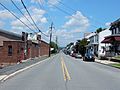
Bacon Street.
-
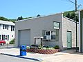
Palo Alto Borough Hall.
-
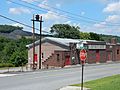
Citizens Fire Co.
-
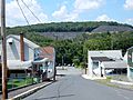
View from Charles Street.
-
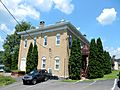
House on Fox Street.


See also
 In Spanish: Palo Alto (Pensilvania) para niños
