Panguipulli Lake facts for kids
Quick facts for kids Panguipulli LakeLago Panguipulli |
|
|---|---|
 |
|
| Location | Panguipulli Commune, Valdivia Province, Los Ríos Region, Chile |
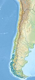
| Coordinates | 39°41′39″S 72°14′30″W / 39.69417°S 72.24167°W |
| Type | Glacial, moraine-dammed, ribbon |
| Primary inflows | Llanquihue River, Pullinque River |
| Primary outflows | Enco River |
| Basin countries | Chile |
| Max. length | 29.78 km (18.50 mi) |
| Max. width | 14.81 km (9.20 mi) |
| Surface area | 116 km2 (45 sq mi) |
| Shore length1 | around 105 km (65 mi) |
| Surface elevation | around 130 m (430 ft) |
| Islands | Gabriela Island |
| Settlements | Panguipulli, Choshuenco |
| 1 Shore length is not a well-defined measure. | |
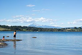
Panguipulli Lake (pronounced PANG-gee-POO-yee) is a beautiful lake located in southern Chile. It is one of the famous "Seven Lakes" found in the Panguipulli area. This lake was formed by ancient glaciers and is surrounded by the tall Andes mountains. The town of Panguipulli sits on its western side. The lake's water flows out through the Enco River, which then goes south to Riñihue Lake.
Contents
About Panguipulli Lake
Panguipulli Lake is a large and important natural feature in the Los Ríos Region of Chile. Its name comes from the Mapuche language, meaning "spirit of the puma" or "hill of pumas." The lake is a popular spot for both locals and tourists.
How Panguipulli Lake Formed
Panguipulli Lake is known as a glacial lake. This means it was created by huge sheets of ice called glaciers.
- Thousands of years ago, massive glaciers moved slowly through the valleys.
- As they moved, these glaciers carved out deep hollows in the land.
- When the climate warmed, the glaciers melted.
- The meltwater filled these deep hollows, forming lakes.
Moraine-Dammed and Ribbon Lake
Panguipulli Lake is also a moraine-dammed lake.
- As glaciers move, they pick up rocks, dirt, and other debris.
- When a glacier melts or stops moving, it leaves behind piles of this material. These piles are called moraines.
- Sometimes, a moraine acts like a natural dam, blocking a valley and allowing water to collect behind it, forming a lake.
It is also a ribbon lake.
- A ribbon lake is a long, narrow lake.
- They often form in valleys that were carved out by glaciers.
- Panguipulli Lake's shape, being long and narrow, shows its glacial past.
Location and Surroundings
Panguipulli Lake is nestled within the Andes mountain range. This means it has stunning views of tall peaks and green forests all around.
- The lake is almost completely surrounded by mountains.
- The only side not blocked by mountains is the west, where the town of Panguipulli is located.
- The lake is a key part of the local environment and provides a home for various plants and animals.
Water Flow and Connections
The lake is part of a larger water system.
- Water flows into Panguipulli Lake from rivers like the Llanquihue River and the Pullinque River.
- The lake's water then flows out through the Enco River.
- This river connects Panguipulli Lake to other lakes in the region, like Riñihue Lake. This connection is important for the whole ecosystem.
Cities and Islands
The main town on the lake's shore is Panguipulli. This town is a center for tourism and local activities. Another town near the lake is Choshuenco. The lake also has a small island called Gabriela Island.
See also
 In Spanish: Lago Panguipulli para niños
 | Laphonza Butler |
 | Daisy Bates |
 | Elizabeth Piper Ensley |


